Points of Interest

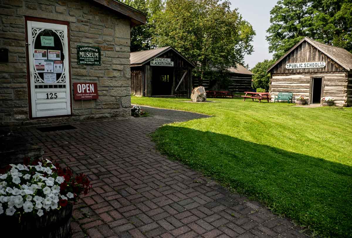
The Assiginack Museum. Expositor file photo.

South Baymouth

Little School House Museum – Informs about the community’s early fishing days through displays and artifacts and features the Island’s only remaining one-room school that has been preserved intact.

Ferry Dock – Besides being the loading and unloading point for the Chi-Cheemaun (which makes four return trips a day during the tourist season and two round trips daily during spring and fall), the ferry dock is a nice place to relax by the port.

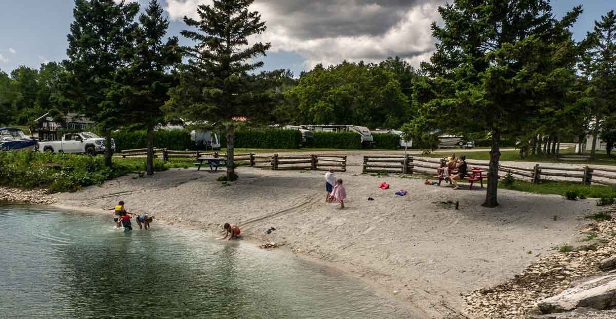
John Budd Memorial Park – A pleasant park with a nearby swimming beach appropriate for children.

Tehkummah

Blue Jay Creek Fish Culture Station – Operated by the Ministry of Natural Resources and Forestry, the station rears young lake trout for release in the waters of Manitoulin and the North Shore.

Fairview United Church – Built as a Methodist Church in 1897, this wood-frame church is surrounded by the gravestones of early members of the community.

Michael’s Bay Municipal Park – Located off the Government Road southwest of Tehkummah village, the park is ideal for picnics, swimming and fishing. The Manitou River and Blue Jay Creek both flow into Michael’s Bay.

Wiikwemkoong Unceded Territory

Wikwemikong Health Centre – Uniquely combining the science of Western medicine with traditional healing methods, the health centre is also worth a visit if only for its splendid design. The nearby Hub centre provides children’s services: nursery school, day care, toy library and resource centre.

The Historic Ruins – Large dormitory for Jesuit clergy that burned in the early 1950s located beside Holy Cross Mission Church. A perimeter of solid stone walls, two feet thick and three stories high (minus the roof), are all that remain of the building. Often a venue for Debajemjig storytellers summer offerings.

Bebamikawe Memorial Trail – Manitoulin’s newest trail and outdoor fitness park is located at Wikwemikong. Trailhead is at the end of Beach Road in Wikwemikong. The trail is 14 km of easy to intermediate trails, spectacular lookouts and educational signage. The Outdoor Fitness Park section of the trail is a double track, granular surfaced trail with five fitness stations equipped with outdoor fitness equipment so that trail users can take advantage of resistance training in a scenic natural environment. For information about the trail, contact (705) 859-3477.

Manitowaning

Assiginack Museum – Originally built as a lock-up in the 1850s, the museum contains a range of artifacts from the lives of early settlers in the area and is home to an impressive and expanding collection of antique glassware, porcelain and pottery. The museum grounds feature a schoolhouse, blacksmith shop and barn.

St. Paul’s Anglican Church – The oldest Anglican parish church in Northern Ontario was consecrated in 1849 and still stands serenely on the edge of the downtown, overlooking the expansive waters of Manitowaning Bay.

S.S. Norisle Heritage Park – Located at the Manitowaning waterfront. Home to a nineteenth century grist mill and the Burns Wharf Theatre building. Park includes docks, boat launch, change rooms and a great sand beach. Resting in permanent dockage is the S.S. Norisle, the last passenger steamship to be built in Canada after WWII. Go to www.norisle.com.
Lighthouse – Located behind St. Paul’s Church and overlooking Manitowaning Bay, this operational lighthouse was built in 1885.

De-ba-jeh-mu-jig Creation Centre – Home of De-ba-jeh-mu-jig storytellers and the Kathleen Reynolds Mastin Gallery, in downtown Manitowaning. The theatre has taken over the old Mastin’s Store and amplified it to the tune of 14,000 square feet of space dedicated to theatre (and often other visual arts). Besides a massive black box rehearsal studio with a sprung floor, the two-level complex includes a carpentry shop, a costume shop, space for an actors’ green room and a great deal more. It’s well worth a visit. There are continuous activities there and usually an art installation in the Kathleen Reynolds Mastin Gallery. The old stone-fronted Mastin’s store provides the entrance. You can call (705)859-2204 or consult www.debaj.ca for more information, or just come in.

Sheguiandah

The Centennial Museum of Sheguiandah – The museum projects the life and times of the pioneers who settled here after the Manitoulin Treaty of 1862. Also displayed are artifacts from the prehistoric quarry, as well as the wreckage of a mail plane which was associated with President Roosevelt’s 1943 wartime visit to the area. Each summer the museum curator presents a busy agenda of art exhibitions, workshops and lectures. New installation is an interactive interpretive centre featuring the 9,500 year history of human activities in the community. A replica mill complete with a water wheel, is a feature on Bass Creek.

Hiking And Walks – An available tour map tells the story of nineteenth century Sheguiandah. Also, there are maps to guide you through village landmarks.

Fish Viewing Platform – Spring and fall, depending on the fish species, there is a platform especially available at Bass Creek from where to watch fish fighting their way up river to spawn. This is the joint effort of the Little Current Fish and Game Club and Manitoulin Streams.

Providence Bay

Manitoulin District Cenotaph And Memorial Gardens – Four distinct monuments; the Manitoulin District Cenotaph, the Merchant Marines Memorial, the Youth in Partnership with Veterans Memorial and the Women’s Memorial stand in this tranquil memorial garden located on Hwy 551/542 between Mindemoya and Providence Bay/Spring Bay. These monuments serve to remind us of the contributions and sacrifices made for the causes of peace and freedom by the men and women of Manitoulin during the twentieth century. The Cenotaph’s flags are those of Canada’s Second World War allies.

Discovery Centre – Located at the foot of the boardwalk just off the downtown. Snack bar and change rooms, the building houses an interpretive centre, which has a fascinating mixture of biological, historical and fossil displays, as well as a snack bar, ice cream parlour and washrooms.

Boardwalk – Spanning the Mindemoya River and running for a considerable length of the beach, this wheelchair-accessible boardwalk is worth a stroll.

Town Square – A new and colourful downtown focus for this town.

Mindemoya

Pioneer Park – Access Pioneer Park off Hwy 551 through a covered footbridge and visit the reconstructed pioneer log home, barn and hiking trails.

St. Francis Of Assisi Anglican Church – Built in 1933 of local stone in the ancient Norman style of early European churches. The church contains a number of interesting and rare artifacts.

Little Current

Heritage Swing Bridge – Constructed in 1913 for rail traffic only, the bridge rested in the open position to allow for the frequent passage of coal freighters through the North Channel. Today the railway is gone, and the 980 tonne bridge provides a link for automobile traffic between Manitoulin and the mainland, excepting 15 minutes on the hour, when it now swings for the Channel’s plentiful cruise boat traffic. The unique swing bridge has been designated an Ontario Heritage Bridge.

Manitoulin Welcome Centre – The first building on your right after crossing the bridge onto Manitoulin, this aptly-situated building is home to the Island’s best selection of information on what to see and where to stay during your visit.

Low Island And Sisson Park – Within walking distance of downtown, Low Island is home to Little Current’s best beach as well as a walking trail, playground, picnic area, change rooms, softball, volleyball and soccer grounds, skateboard park, a splash pad, a pump track for bikers and vie de parcours-style workout equipment.

Farmers’ Market – Find the market downtown on Water St. first thing Saturday morning.

McLean’s Mountain Lookout – Located just outside Little Current, the lookout on McLean’s Mountain provides one of the most spectacular views of the North and Wabuno Channels with the LaCloche Mountains on the horizon. The lookout includes picnic tables, barbecues and washrooms.

Aundeck Omni Kaning

Four Directions Complex – State of the art community centre, gym and library in the heart of the village

Birch Island

St. Gabriel Lalemant Roman Catholic Church – This beautiful church was built in 1940 of area stone  and cedar.

Dreamer’s Rock – Accessible only with permission, this is a place where youth would come and dream of their destiny following a fasting time.

Roosevelt Monument – The monument commemorating U.S. President F.D.Roosevelt’s wartime (1943) fishing trip to nearby McGregor Bay is at the main intersection of Birch Island.

M’Chigeeng

Ojibwe Cultural Foundation – A mixture of gallery (displaying the work of local artists who work in a variety of media), educational, resource and meeting space. The Foundation also includes a traditional healing lodge, elders room and gift shop.

Lillian’s Museum – A wonderful permanent collection of First Nation art and crafts, especially porcupine quill work, augmented by education videos on aspects of First Nation culture. It features a unique quill box museum.

Immaculate Conception Church – An architecturally interesting Roman Catholic Church which incorporates elements of native tradition in both design and content.

Kagawong

Bridal Veil Falls – The falls and river gorge are one of Manitoulin’s premier attractions. For the safest parking and most convenient access to both the falls and the trail system, park at the Kagawong Park Centre in lower Kagawong or near the river mouth in the vicinity of the Old Mill.

Vendors Market – A very busy market, every Wednesday 10 am to 3 pm during July and August, across from the Old Mill Heritage Centre.

The Billings Connections Trail – 32 heritage plaques and seven public sculptures located throughout the township, including on the river systems trails and in the hamlet of Kagawong. The plaques and sculptures are the result of a Canada 150mCelebration project. They provide information on township history and speak to the theme of municipal/community participation in Truth and Reconciliation.

Anglican Church – St. John the Evangelist Anglican Church, also known as the “Sailors” or “Boat” church is on the Kagawong waterfront, and features a pulpit fashioned from the bow of a pleasure craft wrecked off Maple Point with tragic loss of life.

Old Mill Heritage Centre – Located in the Old Mill (former pulp mill) building on the waterfront in Kagawong. The museum features local history and hosts special annual exhibits. The post office is an original structure, and features artifacts and information relating to early communication and transportation on Manitoulin Island. Featured in this building is also the home of Edwards Art Studios.

Beaches – The Kagawong beach is located in the heart of the village and is a wonderful kid-friendly sand beach. Another more expansive beach, Maple Ridge Sandy Beach, is approximately 2km around the bay from the village.

Old Church On The Hill – A gem of an entertainment centre located in a former church building that is the oldest structure in the municipality.

Gore Bay
Street Market – Every Friday, from 9 am to 1 pm daily. July and August, the main street becomes a busy pedestrian-only street market.

Gore Bay Boardwalk – An interesting stroll through and across the very bottom of Gore Bay.  The interesting boardwalk leaves from Smith Park (an open field waterfront recreation area) adjacent to a basketball court/skateboard park. Walk the other way and you’ll find the tennis courts.

Noble Trail – Begins at Bay and Water streets intersection, climbs the scenic East Bluff to park lookout.

Gore Bay Museum – High above the downtown and adjacent to the courthouse complex. Unique exhibits and a busy gallery that anually features local artists. An extension of the museum is on the waterfront beside the boat harbour; the Harbour Gallery features artists, gallery space in a superb setting.

Harold Noble Memorial Park – Up on the East Bluff, this park and picnic area offers a panoramic view of the harbour and surrounding countryside.

Harbour Centre Gallery – At west end of waterfront. The Harbour Centre Gallery is occupied by many local artisans whose work if for sale in their shops. William Purvis Marine Museum upstairs.

Gordon/Barrie Island

Janet Head Lighthouse – Located at Janet Head at the end of Lighthouse Road, this Georgian-style lighthouse was built in 1879 and contains a fascinating history of maritime life, local development, and tragedy. Visit for a guided tour available a few afternoons each week in July and August.

Manitoulin Golf – On Golf Course Rd. off Highway 542. Nine scenic holes, club and cart rentals. Restaurant and bar.

Gore Bay-Manitoulin Airport – Following the Second World War, the Federal Department of Transport decided to establish an airport on Manitoulin to provide radio and weather information and an emergency landing centre.  Since its completion in 1947, the airport has remained a vital asset for the area.

Beaches – Enjoy both of Gordon’s sandy beaches located at Tobacco Lake and Julia Bay.  Use the children’s area at Tobacco Lake or practice your diving on the raft at Julia Bay.  Visit the Salmon Bay Park on Goosecap Crescent on Barrie Island for a peaceful picnic spot overlooking Lake Huron.  While you’re there, use the nearby boat launch to take a tour of the waters – the same can be done close to the Julia Bay beach.

Sheshegwaning

This proud community features Nimkee’s Trail and the Nishan Lodge.

Zhiibaahaasing First Nation

See the world’s largest Peace Pipe, Dream Catcher and Pow Wow Drum located in the center of the community in the park, all welcome.
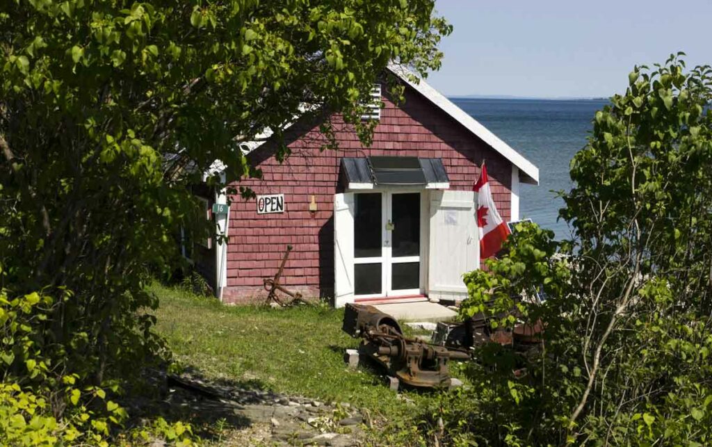
The Meldrum Bay Net Shed Museum. Expositor file photo.

Meldrum Bay

Net Shed Museum – Located in a building once used by fisherman to repair and store their nets, the museum is a tribute to the area’s marine heritage.

St. Andrew’s United Church and Community Hall – A well-kept church which has served the area for over 70 years is flanked by the nearby hall, site of numerous local events.

Grab an Explore Manitoulin Visitors’ Map and enjoy our many local beaches 

Meldrum Bay boasts a gorgeous new beach to go along with the updated campground.

by Isobel Harry

Manitoulin is chock full of beaches both on the ‘big water’ Lake Huron side or in the plethora of inland lakes that dot the countryside. Here are just a few to sample on your Manitoulin holiday.

Providence Bay

The horseshoe crescent of golden sand beach in Providence Bay on the south coast is one of the Island’s top natural attractions, rated the “best” and the “longest” in Northern Ontario, stretching as far as the eye can see to the east and west of the wide bay. In the hot summer months, brightly coloured umbrellas shade the prostrate bodies that have travelled from near and far just to collapse here in the warm embrace of the sands, a kind of communal ritual that involves exhaling and sighing deeply upon arrival.

A family gathers round a blanket and a picnic basket, little kids squeal in wild abandon as they run in and out of the shallow waves, a solitary walker and dog amble the length of the curving arc of the ancient strand. One can imagine similar lakeside scenes when hundreds of Odawa lived and fished here in the 1600s, naming it G’Chiaazhwiyiing, or Sand Beach in English, according to historian Shelley Pearen, or Mindimoiesibing, Old Woman River.

A beachgoer is only a few steps from any of the village’s accommodations and places to eat. 

At the beach, the Interpretive Centre hosts Huron Island Time, serving roti, patties and over 20 flavours of Farquhar’s ice cream among local art, clothing and gifts. Throughout the summer, their Sunset Music Series on the boardwalk presents local musicians and talented guests versed in country, folk, jazz and ‘50s and ‘60s rock. Check them out on Facebook.

A sliver of the famous beach at Providence Bay.

The view from here is magnificent: the immensity of sky and water stretching toward the seemingly infinite horizon is breathtaking. On the far left shore can be spotted the red roof of the marina, tiny from this perspective, and, still far in the distance, the beginnings of the beach on the east side and the mouth of the Mindemoya River where it joins Lake Huron. 

On the right, or west, side of the bay, the beach goes on and on until it is but a tiny speck at the tip of Simcoe Point.

The beach is diverse: at this end, it’s sandy and a little more secluded; returning to the centre of the horseshoe beach, this is where the action is. The equipment in the generously outfitted playground gives kids a good workout; just behind is a parking area and a shady little park with picnic tables; here also is the Interpretive Centre, with washrooms. The village centre and its amenities are just a block away.

It’s heavenly down on the beach—the sand and water, sun and sky shimmering like a mirage, like a dream of a perfect summer’s day. 

Lake Mindemoya

In Central Manitoulin, Lake Mindemoya’s long history as a vacation destination may be appreciated on a tour around the lake, a drive or bicycle ride on the little roads that contour the water on the east and west sides. 

Lined on the eastern shore with old-time rental operations, a golf course, cottages and homes fronted by docks with deckchairs, this side of the lake has the quiet air of a well-loved, long established community.

There are several spots along here to swim, launch a boat and have a picnic. Driving or biking south on Hwy 551 toward the town of Mindemoya, turn right on Hill Road, down to the evocatively-named Ketchankookem Trail at the waterfront. 

Pleasant grassy park areas back the beaches around the lake, strips of fine sand that serve as personal welcome mats into the nice-and-warm shallow waters ahead. Young and old picnic at tables and on blankets, launch a boat, take a dip or just hang out, gazing across the water to Treasure Island, the storied isle of legends. 

Treasure Island, or Mindemoya Island, is seen from almost anywhere around the lake; the shape resembles a prostrate human form with arms resting outstretched over the water. An old Anishinaabe legend tells of Nanabush, the infamous Trickster, who stumbled while carrying his grandmother over his shoulder, causing her to fly through the air to the middle of the lake where she landed on her hands and knees. Mindemoya (Mndimooyenh), the old woman of the lake, remains here ever since. 

Still on Ketchankookem Trail, the road will join up with Lakeshore Road, another lovely lane to wander, and Highways 542/551; follow 551 along the south shore of the lake, stopping at still another small, quiet picnic area then proceeding west until the turn on the right to Monument Road.

Monument Road is a Bike Route—as are all the roads around the lake—and a little piece of rural heaven: split rail fences sprout among flat limestone pavements, a few homes and cottages peep through the forest cover, cyclists and walkers, children and dogs meander as the road winds gently around the west side of Lake Mindemoya and another public beach, with picnic tables on a strip of lawn, benches, parking and portable toilets. A few hundred yards up the beach is a new boat launch. 

Low Island Park

At the far northeast tip of the town of Little Current in the Town of Northeastern Manitoulin and the Islands (NEMI), overlooking the North Channel of Lake Huron and the LaCloche mountains on the far shore, a great summer getaway awaits.

The splash pad located at Low Island Park is fun for all ages.

Got kids? Bring them here to swim at the beach, get drenched in the waterspouts of the splash pad, run around the lawns and tucker themselves right out on the playground slides as you keep an eye out, all the while relaxing at one of the many picnic tables in Low Island Park. 

The sprawling municipal green space and beach accommodate lots of recreational activities for all ages, with fields for ball and soccer, a skateboard park, a dock for launching canoes, kayaks and oneself into the water, a pavilion with washrooms and change rooms, walking trails, historical sites, all in a lush setting of big trees shading the aforementioned numerous picnic spots.

Julia Bay

Just past Gore Bay, stay on Hwy 540, headed for Gordon/Barrie Island. The highway becomes Hwy 540A as it curves westward; turn right (east) here to find Julia Bay beach.

The beach at Julia Bay.

Just past the Gore Bay airport, down a hill, around a curve lies Julia Bay and its alluring arc of sand. Julia Bay Beach offers a sandy, gradually sloping lake bottom and floating dock for sunning and jumping from. The view over the bay is grand; there’s a small gazebo at water’s edge, benches, a picnic table with sail awning, a big Manitoulin Cycling Routes map marked with the Barrie Island route and room to stretch out on the sand or the lawn.

It is generally quiet here but can fill up on those hot afternoons; out on the dock a young lad dives over and over into the cool, calm water then comes in to hop on his bike to head home.

Manitowaning

The beach in the village of Manitowaning, nestled on the southwestern side of Manitowaning Bay in the eastern Township of Assiginack, is a sprawling expanse of sand on a picturesque coastline that is steeped in history. All around this immense bay, over to the peninsula of Wiikwemkoong Unceded Territory in the east, resonate the stories of the determining treaties, signed on these shores by the Anishinaabek and the British Crown almost 200 years ago, of the legends of an underwater ‘den of the Great Spirit,’ or ‘Manitowaning’ in Ojibwe.

To visit the town of Manitowaning is a multifaceted cultural experience that brings to life the story of settlement in this area. Preceding or following a trip to the beach, a stop in at the Assiginack Museum on Arthur Street and a look around interesting landmarks will paint a complex and fascinating historical panorama. 

Drive, walk or bike down Queen Street toward the water and Bay Street, where stand the imposing frame structures of the Manitoulin Roller Mills (one of the finest examples remaining in Ontario) and the Burns’ Wharf warehouse (both built in the 1880s), sided by the Norisle, a steam-powered ferry built in 1946 that carried passengers and cars between Tobermory and South Baymouth until 1974, when the Chi-Cheemaun began her tenure of that run.

We’ve reached the Manitowaning Heritage Park and Marina, and the beach, richly deserved after touring through time. There’s ample parking and a bike rack and the beach is spacious and sandy; all along the beach locals from Wiikwemkoong, Manitowaning and further afield chat at several picnic tables; a long dock sees swan dives and cannonballs expertly executed off the boards; kids dig a hole atop a big hill of sand. On the far side is a sandy playground and a gazebo with more picnic tables, and by that side of the dock is a cordoned-off section of water for shallow bathers. 

Misery Bay

Have you had any misery on Manitoulin this summer? If not (it’s not that easy, being miserable here), no worries, we’re all about a well-rounded vacation, mini-break or staycation, so jump aboard the train (that’s a figure of speech, there’s no train) to Misery Bay Provincial Park. No, you won’t be miserable, and yes, there’s a beach.

The story of the name goes something like this: Back in the dawn of time (or, in the 1880s), two men in a boat in the bay called out to settlers cutting marsh grass in the hot sun on the shore, “What bay is this?” An overheated wag in the work party shouted back, “Misery!” and the name stuck. 

About 30 kilometres west of Gore Bay on Hwy 540, Misery Bay Provincial Park is a natural marvel: a 1,100-hectare tract of undisturbed, protected land with over 15 kilometres of well-marked and maintained trails on four distinct routes. Misery Bay Provincial Park is classified as a nature reserve by Ontario Parks to protect “at the highest level” the alvars, wetlands, upland forests and animal and plant species at risk that are found here.

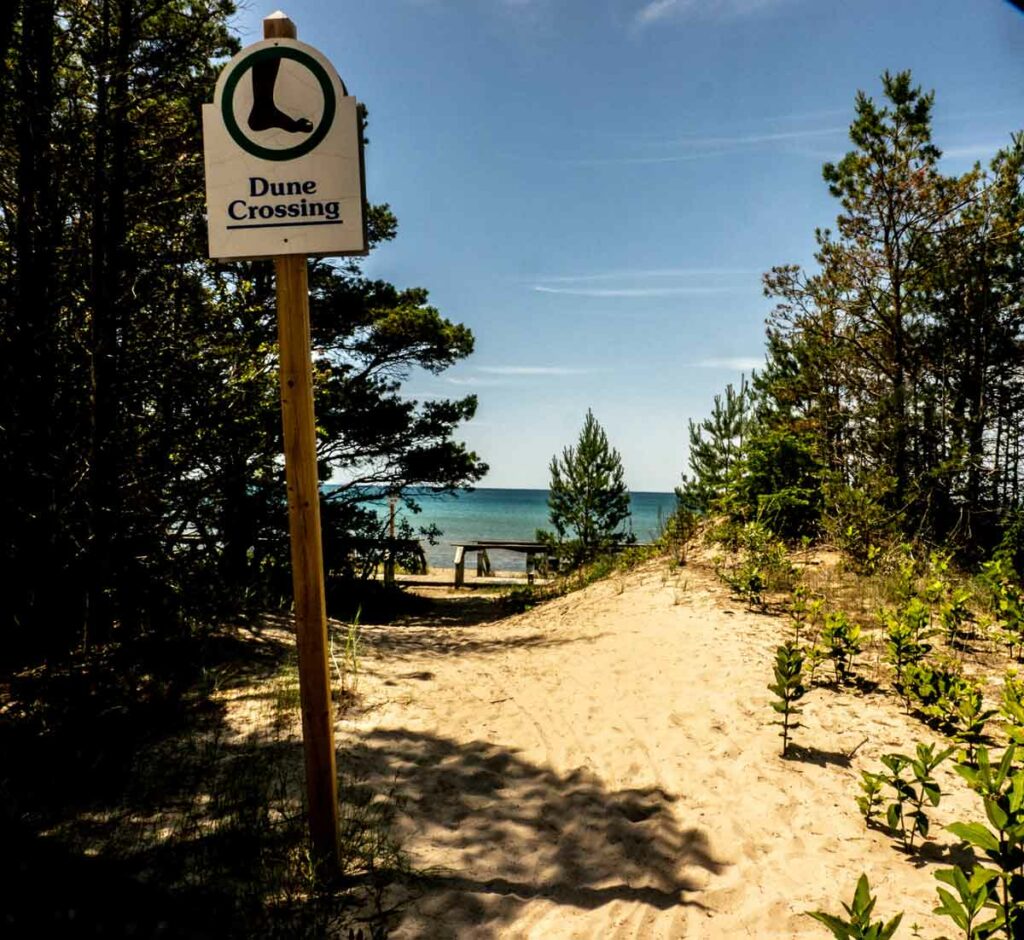
Take the 3.3 km Alvar Coast Trail to the beach in Misery Bay, a ‘moderate’ trail to hike, well-marked with red directional arrows. (The trail carries on along the coastline and loops back, a total of about eight km, but just to go to the beach and back is much shorter.) The slope down to the water is gently gradual, the path sometimes firm sand, sometimes flat, limestone alvars, sometimes pine-needle-strewn, always clearly discernible as it weaves through thick stands of trees. 

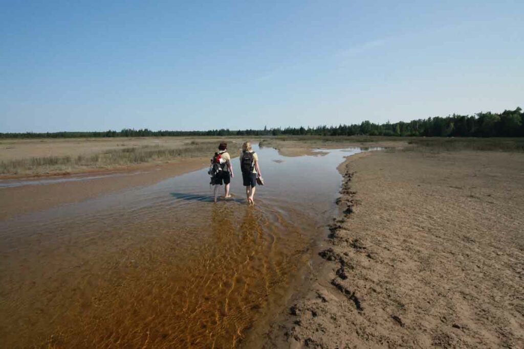
Part of the extensive beaches at Misery Bay Provincial Nature Park.

Given the stunning geological environment in which the park is situated, it stands to reason that the beach will not be just your usual beach (never a bad thing in itself, of course), but also a geological wonder. And it’s a 20-minute walk, adding another healthy dimension to the beach experience; for this reason, a pair of shoes slightly sturdier than flip-flops is recommended for the trail. As on any hike, water and snacks are de rigueur.

This beach is indeed different; arriving on the shore of Misery Bay is a bit like stumbling into a movie set in primeval times. Water levels have receded since last summer’s high levels submerged all of the beach, but are still not as low as in recent years, when the now-lake-bottom became visible, alvars stretching out as far as the eye could see. 

You’d have to go out farther to actually swim, but everyone here seems content to explore the unusual terrain and to stretch out on the huge flat rock bed a few inches above the water; adults and kids linger and splash around the edges, sitting and standing in amazement. 

The park is for day use only; no camping is allowed. Day use fees are in effect only on Friday, Saturday and Sunday. There is no charge for day use from Monday to Thursday until September. 

The washrooms are open seven days a week.

So, what are you waiting for? Grab your towel and hit the beach! For more beach adventures (and you’ve got options!), be sure to pick up a copy of the handy Explore Manitoulin tearaway visitor’s map found just about everywhere!

Pleasures of Providence Bay: The Mutchmor’s new-fangled take on art and crafts takes off

By Isobel Harry, This is Manitoulin April 2021

The pleasures of a picturesque small village—a swoon-worthy crescent of palest-sand beach, evening strolls and serenades on the boardwalk, fish and chips, ice cream, Russian pancakes, fine dining … Aaahhh, Providence Bay in summer—the perfect Island getaway from your Island getaway, should you need one.

Providence Bay’s enduring attractions also include its nearly 150-year-old annual agricultural fair in August, a popular marina and a June bluegrass festival under the stars; vintage tourist cottages and tent and trailer parks, motel and lakeview B&B are always booked solid. In more recent history, new businesses have merged seamlessly into the country village vibe, adding much to the economic viability and lasting appeal of this tiny Island treasure. 

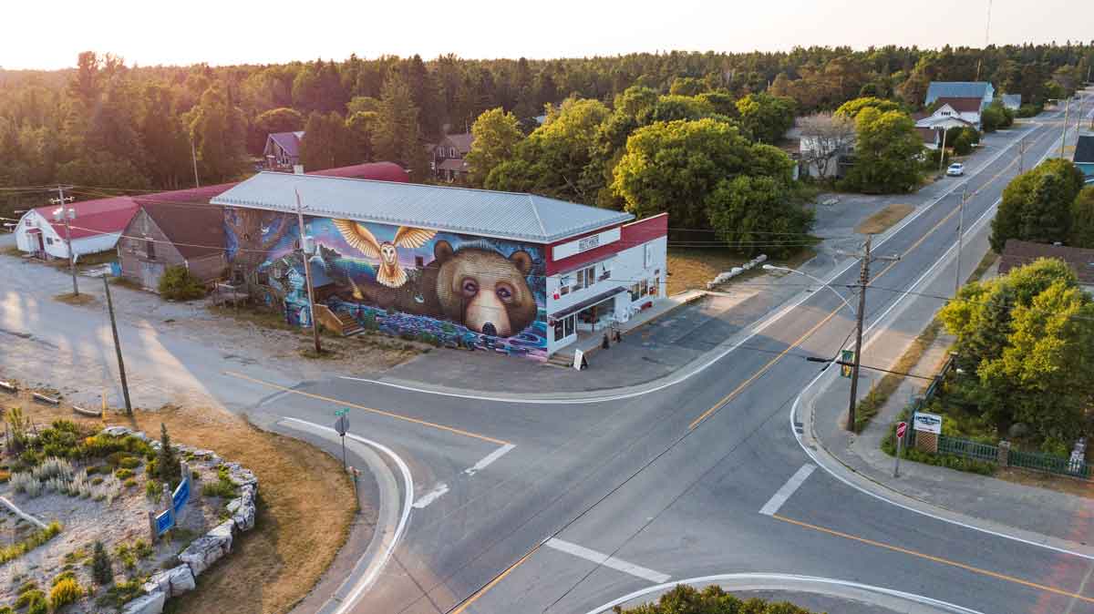
At the centre of the village and steps to the beach, the 10,000 square-foot Mutchmor building can’t be missed: a vividly coloured mural covers the entire south-facing wall of the original furniture store and the McDermid hardware store that operated here since the 1930s.

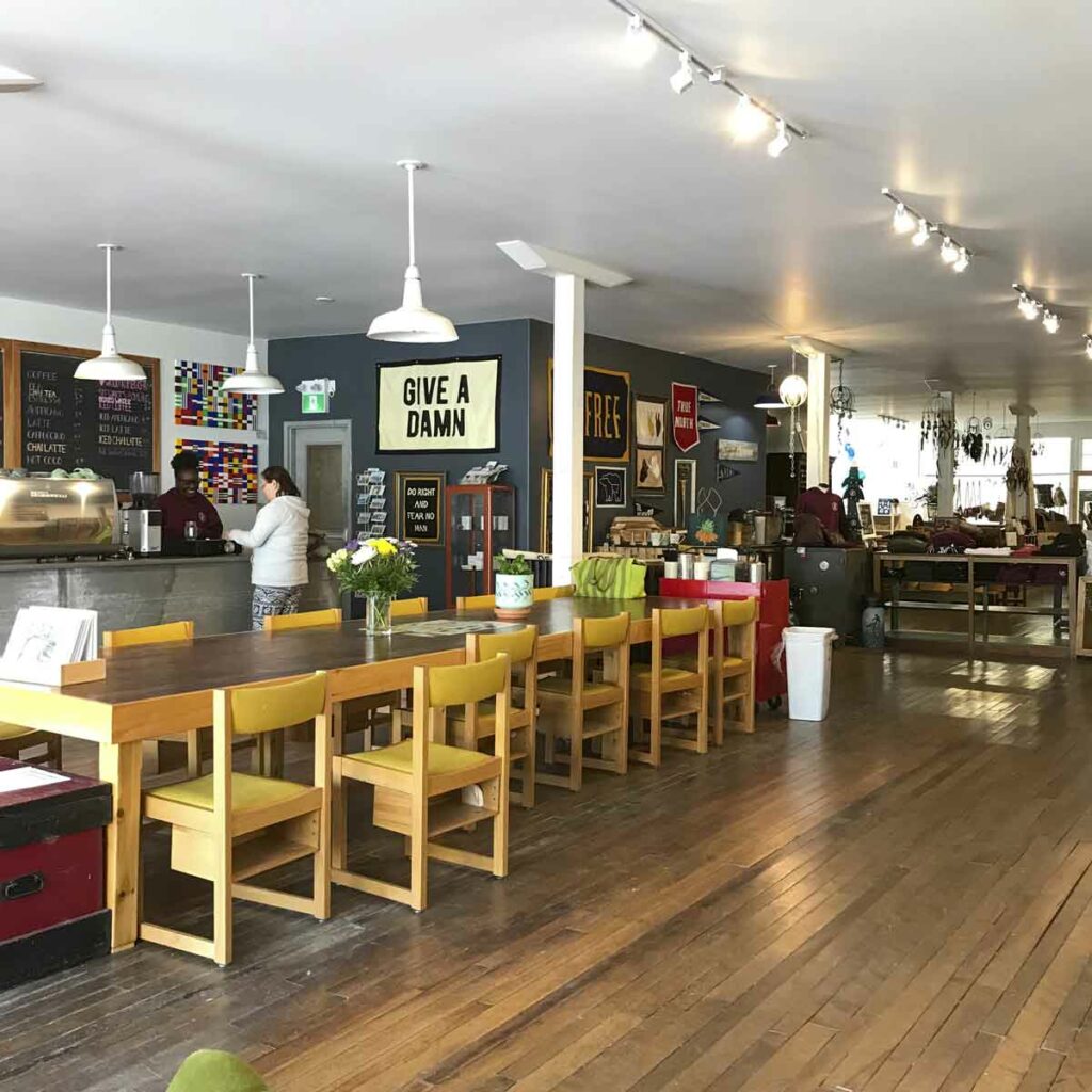
In 2016, young entrepreneurs Matthew Garniss (who was already operating Lake Huron Fish and Chips up the street) and spouse Bridget Sarpong, imagining a combination of café, gallery and gift shop in the cavernous space, took the leap of faith required to purchase the building. Now, the renovated space, renamed after an early lumber entrepreneur in Prov (as the village is known to locals), is the bustling setting for the welcoming Peace Café with its communal table and benches, sofas and armchairs amid the sprawling bazaar of thoughtfully-chosen wares that takes up three quarters of the main floor, and a long gallery wall of art in front of which to enjoy your espresso.

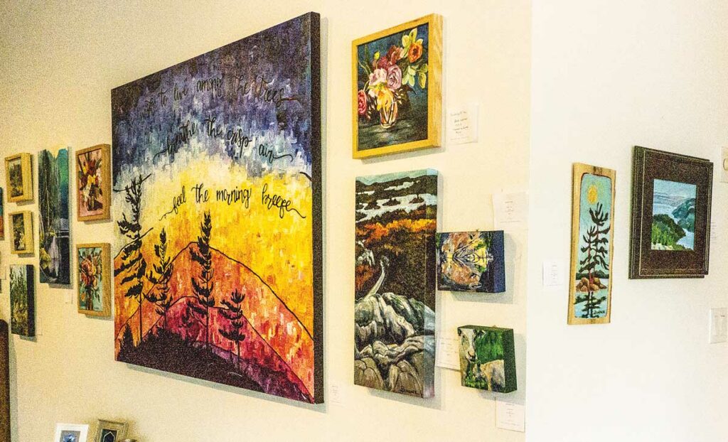
The Mutchmor’s long gallery walls. Photo by Isobel Harry.

“We wanted to be half-city, half-country, to expose people to broader communities,” says Matthew of their urban concept transplanted to this, well, much less urban outpost. “We’re a blend of rural and town, offering things you might see where you live, but many you would not see normally. We buy things that we love and that sell. For the vendors, the rent is not high, we can play around a bit every year with what works.” 

Last season, the gallery featured Julieanne Steedman (Sudbury area and Manitoulin) and Beth Lindner (McGregor Bay), both artists of vibrant northern landscapes that visitors loved and bought. “The art we show at the Mutchmor is approachable and affordable. Bridget and I have picked up art in Marrakesh, in Ghana, Tibetan pieces—we want to show our excitement here about art from all over. The gallery, in the main space, will show one or two artists, or a group, each season,” adds Matthew.

We stroll through the market space, appreciating summer local Rick McKenzie’s photos on canvas, pottery mugs by Greg Voisin (Hamilton), the “functional and sculptural” pottery of daughter and mother Antje Hettmann and the hand-wrought jewelry of Ursula Hettmann (Manitoulin). Bridget and Matthew designed the t-shirts with retro fictional logos proclaiming ‘Camp Prov,’ ‘Prov Bay Pinecones’ and ‘Cold Lake Swim Club,’ much to the liking of the many who snapped them up last summer. There are photos by Vladimir Kabelik (Oakville), witty plexiglass pieces by Kazys Tamasauskas and photos by Jim Ryce (Toronto), soaps, leather bags, cushions, linen and screenprinted clothing, large dreamcatchers called ‘Aga Orbs,’ and an alcove off the main space devoted to Matthew’s dad’s vintage assortment of books, records and collectables. 

Artful and eclectic, like Providence Bay itself.

Mutchmor Lofts, Gallery & Peace Café
Open May to October
Tel: 705-377-4703
www.themutchmor.com

Picturesque Prov: Much More to Love than Sun, Sand and Surf

The iconic 1930s McDermid’s hardware store in the centre of the village of Providence Bay was converted to the Mutchmor in 2016. A vibrantly-coloured mural covers the south wall, facing the newly refurbished village square. Photo by Chris Hurd (@churdphoto)

By Isobel Harry, This is Manitoulin April 2020

There’s an invigorating breeze, a fresh new wave rolling onto Manitoulin’s shores, a bit of a rural Renaissance, if you will. Feel it in many of the Island’s small, historical towns and villages as more artists, artisans, growers, creative innovators and entrepreneurs – passionate about being a part of and contributing to Manitoulin’s vital communities – launch original initiatives born of creative new approaches to living and working here.

As in many small villages on the Island, Providence Bay was feeling the effects of the tectonic shift from a farm-based economy – the closing of stores and services that once had anchored a community, the dearth of jobs, the exodus of young people – the very effects that are proving to be the driver of a new economy based on inventive ideas about Providence Bay enduring appeal as a popular tourist destination.

Always a well-loved getaway, Providence Bay has it all, starting with the North’s longest sand beach, a magnet for its crescent moon of pale gold sand, a marina buzzing with fisher folk in quest of the abundant large salmon, a renowned agricultural fair that has been “showing the fancy work and prize livestock” of this vibrant community for 137 years, a renowned bluegrass festival and, new last summer, a farmers’ market on Saturday mornings. Campgrounds (such as the large and well-liked Providence Bay Tent and Trailer Park) and cottages do a roaring business, old-fashioned wooden rental cabins ringing the bay, many in operation since the 1930s and ‘40s. 

By the time McDermid’s iconic hardware store closed in 2010, the gas station was shuttered and the centre of Providence Bay lost its main commercial amenities, the changes that would transform Providence Bay had already been afoot for a while.

Twelve years ago, when erin-blythe reddie (no caps please) moved here, local consensus seemed to be that “the hamlet was dying,” she says. “But some things have to leave for something else to happen. I saw Prov as a phoenix rising.” She bought a house off the main street and set up ‘Naturally … it’s a Working Studio’ to produce her ‘naturescapes,’ paint with watercolours, weave textiles, including Japanese Sashiko pieces, and sew contemporary art quilts. “And I’m an artist in the garden in summer!” she adds, producing a bounty of food, some of which is enjoyed by guests of her rental loft who, like her, appreciate Prov “as a nature-based creative place to be.

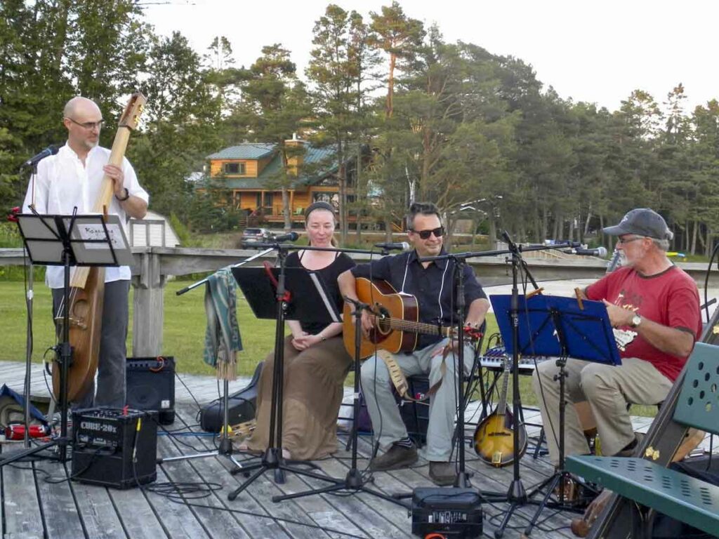
At Huron Island Time, a diverse music program on the boardwalk includes local musicians, such as the Kagawong Folk Roots Collective (pictured), 
and touring acts. Photo by Isobel Harry
At Huron Island Time, a diverse music program on the boardwalk includes local musicians, such as the Kagawong Folk Roots Collective (pictured), and touring acts. Photo by Isobel Harry.

“There are more and more pockets of imaginative and resourceful people cropping up,’ says erin-blythe. “Networks are strong and very fluid; you can find kinship all over the Island.  Infused with this creativity, a community keeps building and getting stronger.” 

The library – with Sally Miller at the helm – the post office and the community centre are revitalized as gathering spots; the newly re-designed village square is now a restful park that Mary-Jo Gordon, in consultation with the community, saw through to fruition. As the Huron Sands Motel is refurbished by new owners Inessa Taibert and Vera Kuminov Mamoutov, they run their diner year-round and stock small convenience items; the 1898 School House Restaurant, operated by spouses Heather and chef Greg Niven, has been serving up fine dining since 1995. 

The Interpretive Centre on the beach has been given new life by Lance Baptiste, a former resident of Ottawa who came to Canada from Guyana with his parents when he was nine. The music industry professional ended up in Providence Bay “as a result of a series of happy accidents,” he says. In 2016, his partner found a job on the Island and a home in Providence Bay for the family, two blocks from the Interpretive Centre – and the ice cream bar within was available for lease! From the kitchen of his newly-purchased beachside venue, Huron Island Time, Lance soon was offering Guyanese specialities – roti, dhalpuri, and Jamaican-style jerk chicken. As for music on the boardwalk, he says, “I want eclectic, to marry professional touring musicians with local musicians, to bring more new experiences for people to enjoy.”

For this season, Lance has invited a cellist, a Trinidadian calypsonian, an “amazing” percussionist and a ‘cavaquinho’ (a small Portuguese guitar) player to join local performers in serenading visitors to the lakeshore. 

A passion for Prov was ignited in Matthew Garniss by his parents, United Church minister Martin Garniss and Lynda Garniss, a nurse, who bought a home on the Mindemoya River after a camping trip here in 2003. Matthew came to visit after his second year at Ryerson University and promptly found a job at Greg Niven’s Huron Fish and Chips for the summer. 

After a post-graduation stint in the printing industry in BC, Matthew started to think about being his own boss, and in 2010, he returned to Providence Bay and bought the fish and chips shop. 

The Peace Cafe inside The Mutchmor is a great place to relax and enjoy the ambiance of this charming artistic space. Photo by Isobel Harry.

He isn’t running “your usual fast food place,” says Matthew, who “wanted to keep staff around, encourage and mentor them so they feel a part of the business. Some of the little kids who visited with their parents every year worked in the shop when they grew up,” he says, “and local kids have gone off to college after working here in the summer and are now looking to come back to the Island with their new skills. It’s more than just ‘exchange money for food.’” 

In 2012, casting about for opportunities to showcase the arts, he put in an offer on the old McDermid hardware store; it was turned down. Finally, in 2016, Matthew and partner Bridget Sarpong bought the building and began to realize their concept of a cafe, gallery and gift shop in the large, open space they named the Mutchmor (after the namesake side street, named for a community pioneer family of that name). Bridget’s Peace Cafe is at its heart while a large artisans’ bazaar fills the high-ceilinged recesses with stalls and nooks and crannies filled with locally-made and international finds. “We wanted half country and half city, a more stylized experience,” says Matthew. On the second floor are the four Mutchmor Lofts, airy rentals with views of the lake and the main street. 

Looming large in countless souvenir photos is the vivid mural that takes up the entire south wall of the Mutchmor. Painted in 2018 by Toronto multi-disciplinary artists, husband and wife Bruno Smoky and Shalak Attack, and Fiya Bruxa – it’s like a billboard announcing all the bold, new creative responses to the timeless inspiration that are places like Providence Bay on Manitoulin Island.