Points of Interest

The Assiginack Museum. Expositor file photo.

South Baymouth

Little School House Museum – Informs about the community’s early fishing days through displays and artifacts and features the Island’s only remaining one-room school that has been preserved intact.

Ferry Dock – Besides being the loading and unloading point for the Chi-Cheemaun (which makes four return trips a day during the tourist season and two round trips daily during spring and fall), the ferry dock is a nice place to relax by the port.

John Budd Memorial Park – A pleasant park with a nearby swimming beach appropriate for children.

Tehkummah

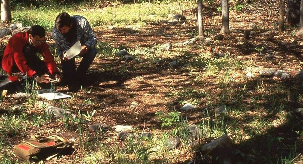
Blue Jay Creek Fish Culture Station – Operated by the Ministry of Natural Resources and Forestry, the station rears young lake trout for release in the waters of Manitoulin and the North Shore.

Fairview United Church – Built as a Methodist Church in 1897, this wood-frame church is surrounded by the gravestones of early members of the community.

Michael’s Bay Municipal Park – Located off the Government Road southwest of Tehkummah village, the park is ideal for picnics, swimming and fishing. The Manitou River and Blue Jay Creek both flow into Michael’s Bay.

Wiikwemkoong Unceded Territory

Wikwemikong Health Centre – Uniquely combining the science of Western medicine with traditional healing methods, the health centre is also worth a visit if only for its splendid design. The nearby Hub centre provides children’s services: nursery school, day care, toy library and resource centre.

The Historic Ruins – Large dormitory for Jesuit clergy that burned in the early 1950s located beside Holy Cross Mission Church. A perimeter of solid stone walls, two feet thick and three stories high (minus the roof), are all that remain of the building. Often a venue for Debajemjig storytellers summer offerings.

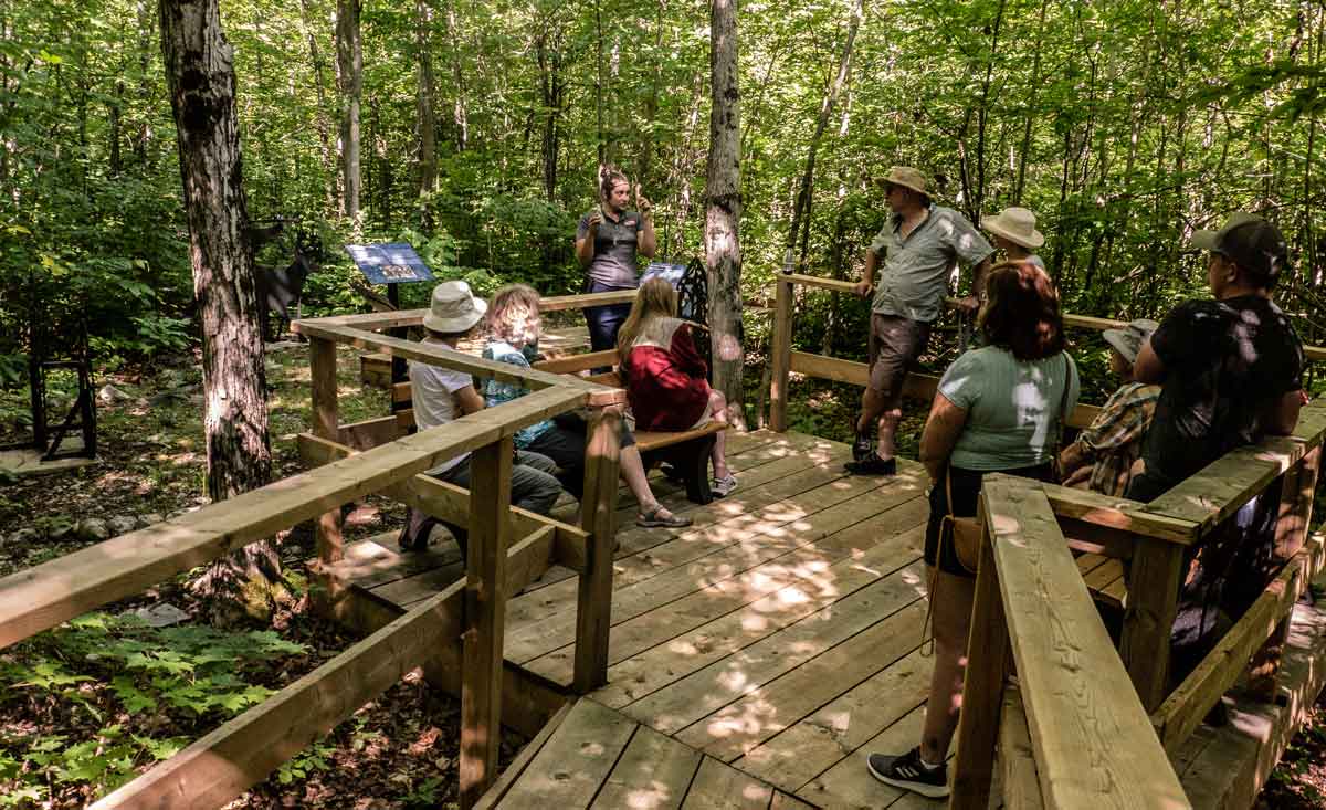
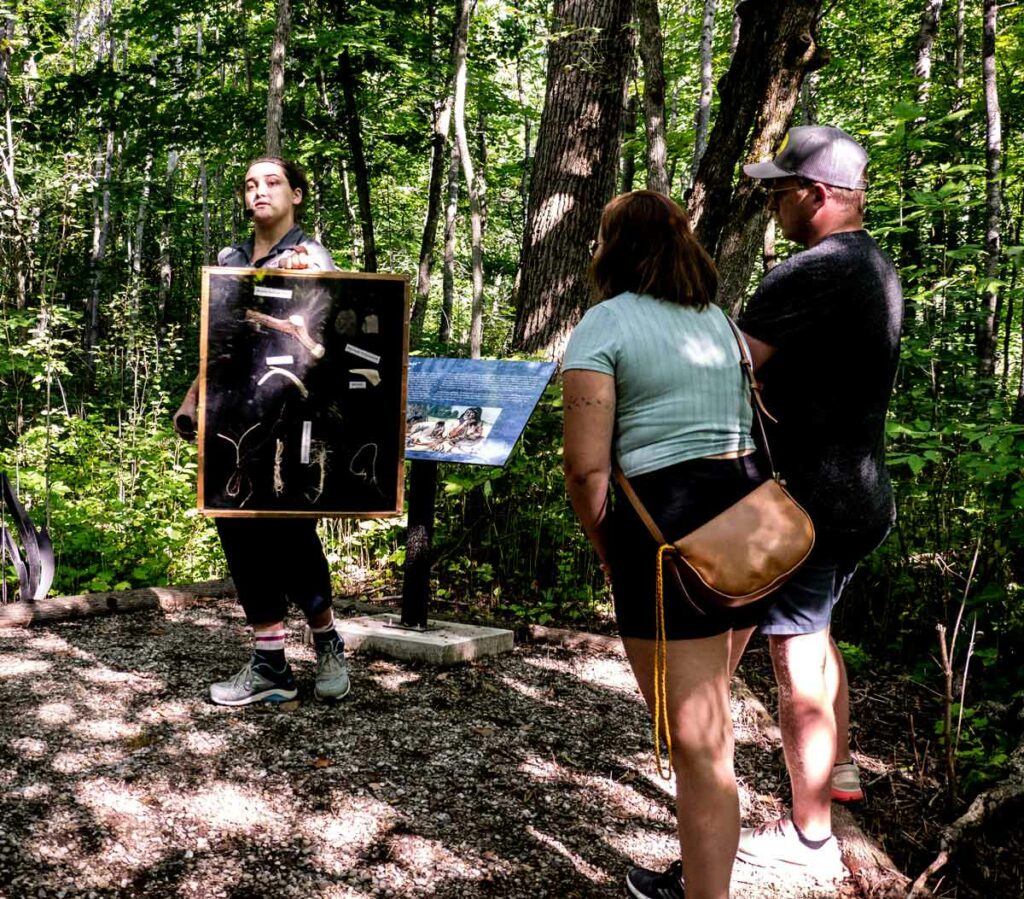
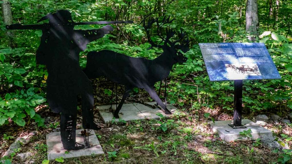
Bebamikawe Memorial Trail – Manitoulin’s newest trail and outdoor fitness park is located at Wikwemikong. Trailhead is at the end of Beach Road in Wikwemikong. The trail is 14 km of easy to intermediate trails, spectacular lookouts and educational signage. The Outdoor Fitness Park section of the trail is a double track, granular surfaced trail with five fitness stations equipped with outdoor fitness equipment so that trail users can take advantage of resistance training in a scenic natural environment. For information about the trail, contact (705) 859-3477.

Manitowaning

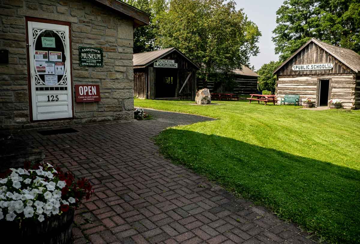
Assiginack Museum – Originally built as a lock-up in the 1850s, the museum contains a range of artifacts from the lives of early settlers in the area and is home to an impressive and expanding collection of antique glassware, porcelain and pottery. The museum grounds feature a schoolhouse, blacksmith shop and barn.

St. Paul’s Anglican Church – The oldest Anglican parish church in Northern Ontario was consecrated in 1849 and still stands serenely on the edge of the downtown, overlooking the expansive waters of Manitowaning Bay.

S.S. Norisle Heritage Park – Located at the Manitowaning waterfront. Home to a nineteenth century grist mill and the Burns Wharf Theatre building. Park includes docks, boat launch, change rooms and a great sand beach. Resting in permanent dockage is the S.S. Norisle, the last passenger steamship to be built in Canada after WWII. Go to www.norisle.com.
Lighthouse – Located behind St. Paul’s Church and overlooking Manitowaning Bay, this operational lighthouse was built in 1885.

De-ba-jeh-mu-jig Creation Centre – Home of De-ba-jeh-mu-jig storytellers and the Kathleen Reynolds Mastin Gallery, in downtown Manitowaning. The theatre has taken over the old Mastin’s Store and amplified it to the tune of 14,000 square feet of space dedicated to theatre (and often other visual arts). Besides a massive black box rehearsal studio with a sprung floor, the two-level complex includes a carpentry shop, a costume shop, space for an actors’ green room and a great deal more. It’s well worth a visit. There are continuous activities there and usually an art installation in the Kathleen Reynolds Mastin Gallery. The old stone-fronted Mastin’s store provides the entrance. You can call (705)859-2204 or consult www.debaj.ca for more information, or just come in.
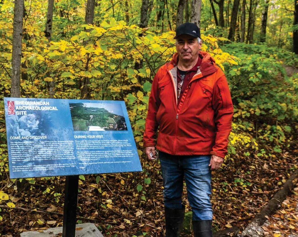
Sheguiandah

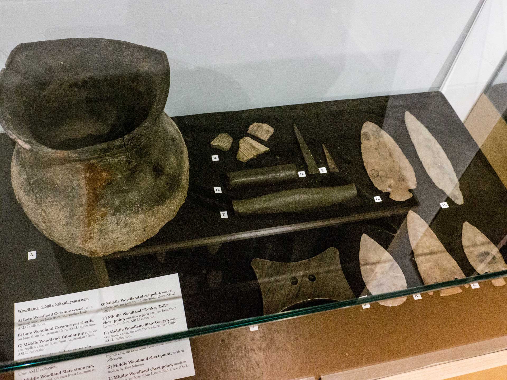
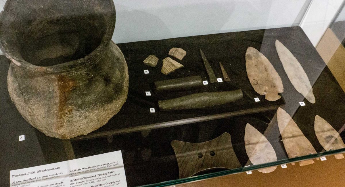
The Centennial Museum of Sheguiandah – The museum projects the life and times of the pioneers who settled here after the Manitoulin Treaty of 1862. Also displayed are artifacts from the prehistoric quarry, as well as the wreckage of a mail plane which was associated with President Roosevelt’s 1943 wartime visit to the area. Each summer the museum curator presents a busy agenda of art exhibitions, workshops and lectures. New installation is an interactive interpretive centre featuring the 9,500 year history of human activities in the community. A replica mill complete with a water wheel, is a feature on Bass Creek.

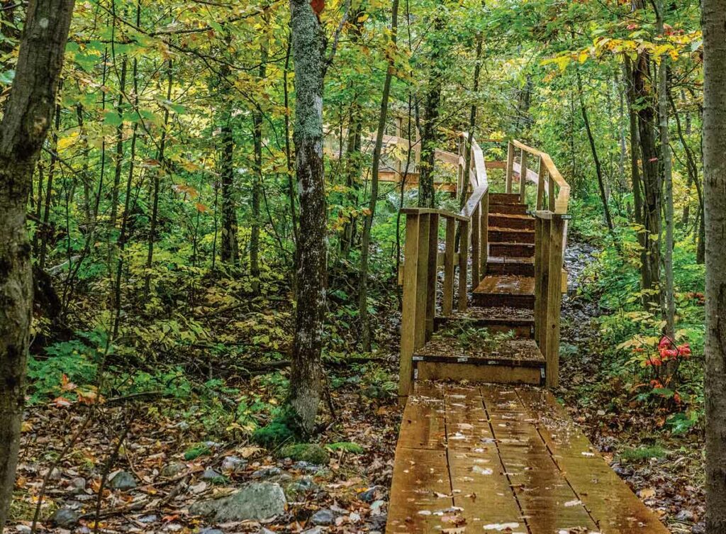
Hiking And Walks – An available tour map tells the story of nineteenth century Sheguiandah. Also, there are maps to guide you through village landmarks.

Fish Viewing Platform – Spring and fall, depending on the fish species, there is a platform especially available at Bass Creek from where to watch fish fighting their way up river to spawn. This is the joint effort of the Little Current Fish and Game Club and Manitoulin Streams.

Providence Bay

Manitoulin District Cenotaph And Memorial Gardens – Four distinct monuments; the Manitoulin District Cenotaph, the Merchant Marines Memorial, the Youth in Partnership with Veterans Memorial and the Women’s Memorial stand in this tranquil memorial garden located on Hwy 551/542 between Mindemoya and Providence Bay/Spring Bay. These monuments serve to remind us of the contributions and sacrifices made for the causes of peace and freedom by the men and women of Manitoulin during the twentieth century. The Cenotaph’s flags are those of Canada’s Second World War allies.

Discovery Centre – Located at the foot of the boardwalk just off the downtown. Snack bar and change rooms, the building houses an interpretive centre, which has a fascinating mixture of biological, historical and fossil displays, as well as a snack bar, ice cream parlour and washrooms.

Boardwalk – Spanning the Mindemoya River and running for a considerable length of the beach, this wheelchair-accessible boardwalk is worth a stroll.

Town Square – A new and colourful downtown focus for this town.

Mindemoya

Pioneer Park – Access Pioneer Park off Hwy 551 through a covered footbridge and visit the reconstructed pioneer log home, barn and hiking trails.

St. Francis Of Assisi Anglican Church – Built in 1933 of local stone in the ancient Norman style of early European churches. The church contains a number of interesting and rare artifacts.

Little Current

Heritage Swing Bridge – Constructed in 1913 for rail traffic only, the bridge rested in the open position to allow for the frequent passage of coal freighters through the North Channel. Today the railway is gone, and the 980 tonne bridge provides a link for automobile traffic between Manitoulin and the mainland, excepting 15 minutes on the hour, when it now swings for the Channel’s plentiful cruise boat traffic. The unique swing bridge has been designated an Ontario Heritage Bridge.

Manitoulin Welcome Centre – The first building on your right after crossing the bridge onto Manitoulin, this aptly-situated building is home to the Island’s best selection of information on what to see and where to stay during your visit.

Low Island And Sisson Park – Within walking distance of downtown, Low Island is home to Little Current’s best beach as well as a walking trail, playground, picnic area, change rooms, softball, volleyball and soccer grounds, skateboard park, a splash pad, a pump track for bikers and vie de parcours-style workout equipment.

Farmers’ Market – Find the market downtown on Water St. first thing Saturday morning.

McLean’s Mountain Lookout – Located just outside Little Current, the lookout on McLean’s Mountain provides one of the most spectacular views of the North and Wabuno Channels with the LaCloche Mountains on the horizon. The lookout includes picnic tables, barbecues and washrooms.

Aundeck Omni Kaning

Four Directions Complex – State of the art community centre, gym and library in the heart of the village

Birch Island

St. Gabriel Lalemant Roman Catholic Church – This beautiful church was built in 1940 of area stone  and cedar.

Dreamer’s Rock – Accessible only with permission, this is a place where youth would come and dream of their destiny following a fasting time.

Roosevelt Monument – The monument commemorating U.S. President F.D.Roosevelt’s wartime (1943) fishing trip to nearby McGregor Bay is at the main intersection of Birch Island.

M’Chigeeng

Ojibwe Cultural Foundation – A mixture of gallery (displaying the work of local artists who work in a variety of media), educational, resource and meeting space. The Foundation also includes a traditional healing lodge, elders room and gift shop.

Lillian’s Museum – A wonderful permanent collection of First Nation art and crafts, especially porcupine quill work, augmented by education videos on aspects of First Nation culture. It features a unique quill box museum.

Immaculate Conception Church – An architecturally interesting Roman Catholic Church which incorporates elements of native tradition in both design and content.

Kagawong

Bridal Veil Falls – The falls and river gorge are one of Manitoulin’s premier attractions. For the safest parking and most convenient access to both the falls and the trail system, park at the Kagawong Park Centre in lower Kagawong or near the river mouth in the vicinity of the Old Mill.

Vendors Market – A very busy market, every Wednesday 10 am to 3 pm during July and August, across from the Old Mill Heritage Centre.

The Billings Connections Trail – 32 heritage plaques and seven public sculptures located throughout the township, including on the river systems trails and in the hamlet of Kagawong. The plaques and sculptures are the result of a Canada 150mCelebration project. They provide information on township history and speak to the theme of municipal/community participation in Truth and Reconciliation.

Anglican Church – St. John the Evangelist Anglican Church, also known as the “Sailors” or “Boat” church is on the Kagawong waterfront, and features a pulpit fashioned from the bow of a pleasure craft wrecked off Maple Point with tragic loss of life.

Old Mill Heritage Centre – Located in the Old Mill (former pulp mill) building on the waterfront in Kagawong. The museum features local history and hosts special annual exhibits. The post office is an original structure, and features artifacts and information relating to early communication and transportation on Manitoulin Island. Featured in this building is also the home of Edwards Art Studios.

Beaches – The Kagawong beach is located in the heart of the village and is a wonderful kid-friendly sand beach. Another more expansive beach, Maple Ridge Sandy Beach, is approximately 2km around the bay from the village.

Old Church On The Hill – A gem of an entertainment centre located in a former church building that is the oldest structure in the municipality.

Gore Bay
Street Market – Every Friday, from 9 am to 1 pm daily. July and August, the main street becomes a busy pedestrian-only street market.

Gore Bay Boardwalk – An interesting stroll through and across the very bottom of Gore Bay.  The interesting boardwalk leaves from Smith Park (an open field waterfront recreation area) adjacent to a basketball court/skateboard park. Walk the other way and you’ll find the tennis courts.

Noble Trail – Begins at Bay and Water streets intersection, climbs the scenic East Bluff to park lookout.

Gore Bay Museum – High above the downtown and adjacent to the courthouse complex. Unique exhibits and a busy gallery that anually features local artists. An extension of the museum is on the waterfront beside the boat harbour; the Harbour Gallery features artists, gallery space in a superb setting.

Harold Noble Memorial Park – Up on the East Bluff, this park and picnic area offers a panoramic view of the harbour and surrounding countryside.

Harbour Centre Gallery – At west end of waterfront. The Harbour Centre Gallery is occupied by many local artisans whose work if for sale in their shops. William Purvis Marine Museum upstairs.

Gordon/Barrie Island

Janet Head Lighthouse – Located at Janet Head at the end of Lighthouse Road, this Georgian-style lighthouse was built in 1879 and contains a fascinating history of maritime life, local development, and tragedy. Visit for a guided tour available a few afternoons each week in July and August.

Manitoulin Golf – On Golf Course Rd. off Highway 542. Nine scenic holes, club and cart rentals. Restaurant and bar.

Gore Bay-Manitoulin Airport – Following the Second World War, the Federal Department of Transport decided to establish an airport on Manitoulin to provide radio and weather information and an emergency landing centre.  Since its completion in 1947, the airport has remained a vital asset for the area.

Beaches – Enjoy both of Gordon’s sandy beaches located at Tobacco Lake and Julia Bay.  Use the children’s area at Tobacco Lake or practice your diving on the raft at Julia Bay.  Visit the Salmon Bay Park on Goosecap Crescent on Barrie Island for a peaceful picnic spot overlooking Lake Huron.  While you’re there, use the nearby boat launch to take a tour of the waters – the same can be done close to the Julia Bay beach.

Sheshegwaning

This proud community features Nimkee’s Trail and the Nishan Lodge.

Zhiibaahaasing First Nation

See the world’s largest Peace Pipe, Dream Catcher and Pow Wow Drum located in the center of the community in the park, all welcome.

The Meldrum Bay Net Shed Museum. Expositor file photo.

Meldrum Bay

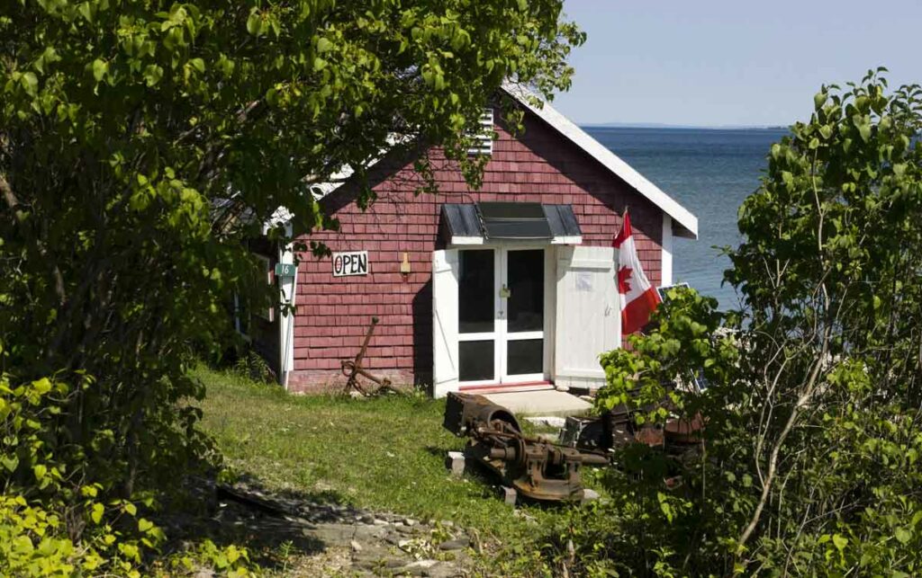
Net Shed Museum – Located in a building once used by fisherman to repair and store their nets, the museum is a tribute to the area’s marine heritage.

St. Andrew’s United Church and Community Hall – A well-kept church which has served the area for over 70 years is flanked by the nearby hall, site of numerous local events.

Sheguiandah Archaeological Site: Time travel up this hill to 10,000 years ago

During a tour, participants walk along wooden boardwalks and relax on benches and decks while taking in fascinating information offered by the tour guide. Photo by Isobel Harry.

by Isobel Harry

Taking a guided tour through the Sheguiandah Archaeological Site is unlike any other Manitoulin Island experience. To climb the newly opened boardwalk up the small hill on the edge of the pretty village of Sheguiandah south of Little Current is to enter an enchanted forest enclosing thousands of years of geological and cultural history. 

The uncovering of this prehistoric place began just over seventy years ago, in 1951, when Thomas E. Lee, an archaeologist with the National Museum of Canada, found ancient stone implements in a farm field near here. Lifting his eyes upward to this very hill – so the legend goes – he spotted something shiny glinting in the sun at the top. 

After ascending the knoll, Lee and his team realized they had come across a small part of the region’s two-billion-year-old Precambrian geological formation. Also known as the Canadian Shield and rare amongst Manitoulin’s younger rock formations, the glittering object Lee had seen was a knob of the original white quartzite bedrock poking out of the earth that had been laid down around it in successive layers over millions of years. Upon beginning their archaeological digs, they found dug pits and artifacts of the Island’s first inhabitants, Indigenous peoples drawn here by the hard and durable stone’s great utility in quarrying tools and spears. 

Tour guide Olivia Fetterly (left) discusses some of the artifacts found by archaeologists during early excavations of the site in Seguiandah. Photo by Isobel Harry.

In 1954, the hill, quarry and habitation area that encompass the village of Sheguiandah were designated a National Historic Site of Canada. But after Lee’s initial excavations, the site lay dormant for over forty years.

Then in 1991, geo-archaeologist Patrick Julig of Sudbury’s Laurentian University, Peter Storck of the Royal Ontario Museum’s anthropology department and a team of specialists re-opened the quarry site to re-examination. Julig and Storck’s new analyses dated the site at 9,500 carbon-dated years after the last Ice Age, or about 11,000 calendar years ago.

Since relocating to Sheguiandah with his wife, Helen, in 2002, Dr. Julig has continued his involvement with the adjacent Centennial Museum of Sheguiandah, designing an interactive display of maps, descriptive details and archeological artifacts and realizing a long-held dream of guided tours at the site.  Finally, after extensive work aimed at ensuring that the fragile site remains undisturbed even as it is visited by the public – it is protected from any encroachment by the Ontario Heritage Act and the National Historic Site designation – and after postponements caused by the pandemic, tours began last summer.

According to the Canadian Register of Historic Places, “The heritage value of the remains found in Sheguiandah resides in a series of successive cultural occupations of early inhabitants in what is now Ontario, beginning circa 11,000 B.C.E. with the Paleo-Indian Period during the recession of glacial Lake Algonquin. 

“The site also contains artifacts from the Archaic Period (1000-500 B.C.E.) as well as Point Peninsula Culture stone tools associated with the Middle Woodland Period (0 – 500 C.E.).” 

Now, for the first time, site tours offer the exhilarating opportunity to experience these ‘successive cultural occupations’ and geological eras one after the other, led by an experienced guide on a walk back in time. 

From the present day entrance on Lake Huron’s Sheguiandah Bay, our guide, Olivia Fetterly, a knowledgeable graduate of Nipissing University in biology and fine art, stops at regular intervals to describe the beach levels corresponding to the different periods as we go up the hill. Along the leafy route descriptive plaques and evocative iron sculptures denote the activities that took place here, offering an exceptional ‘living lesson’ in the prehistory of Manitoulin Island as we walk.

The natural landforms are a geological record of the ancient glacial lake waters receding through time as the glaciers melted – remaining at one level for millennia, carving a step, or beach, into the ridge – down to the modern water level of Lake Huron that we know today. Similarly, as we go up the Sheguiandah Site hill, each new beach level is higher and older geologically than the last, ending with the oldest part of the site at the top, where Thomas Lee had first spotted the quartzite protuberance from the field below.

From the edge of the bay to the trailhead, just a few hundred yards up a low rise, we have already gone back in time two thousand years, to the first ancient raised beach terrace on this walk (or the last, and earliest, if you count back from the top level), the 2,000 year-old Algoma water level. Here lived nomadic people known in anthropology as ‘Middle Woodland,’ tribes that traded copper goods, shells and flint tools, made pottery pipes and vessels, wove baskets and worked hides. 

“The people kept coming back here to work the site,” Dr Julig has said. “They first arrived to work the quartzite at the top and, as more and more land became exposed as the water lowered over thousands of years, succeeding groups of nomadic people arrived to quarry and live here for brief periods.” 

Our guide ensures an immersive experience by showing a range of fossils, bones and tools that were found here, and by pausing to point out some of the plants that were used for food, such as acorns and wild leeks, medicines, like chaga mushrooms, and for tools like axe handles and ropes. 

Positioned along the trail are evocative iron sculptures depicting scenes of prehistoric life and descriptive signs of the geological formations to be found in the Archaeological Site. 
Photo by Isobel Harry.
Positioned along the trail are evocative iron sculptures depicting scenes of prehistoric life and descriptive signs of the geological formations to be found in the Archaeological Site. Photo by Isobel Harry.

We continue our gentle ascent along the boardwalk, punctuated by some steps and resting on benches on the decks, captivated by our guide’s stories of early peoples and accompanying fascinating geological facts. Upward we go, noting the change in vegetation, from spruce forests to pine, followed by hardwood forests and into the hillside quarrying area where pits were dug into the quartzite bedrock. We learn about the carbon-dating process and why Thomas Lee’s estimates of time periods for the site differed from later, now standard, opinions.

Having risen up beyond the Nipissing Bluff beach level (5,500-6,000 years old) that is associated with the Archaic-era peoples, past the Mystic Ridge ‘storm beach’ that dates to 450 million years ago, we see lines of quartzite rocks in what is known as the Habitation Area, marking Thomas Lee’s excavations. In the area of the Korah Bluff, we enter the Paleo-Indian era at the top of the hill, in the time of the first Indigenous inhabitants of the Americas, about 11,000 years ago. 

We’ve gazed down into large pits where the quartzite that is still seen here in big and small chunks first began to be quarried. We’ve imagined the encampments of the hunters by the earliest lakes, building fires for cooking and warmth and chipping stone into spear points and knife blades. We remembered there were caribou on the Island eons ago, and birch bark canoes filled with copper and clay goods for trading over the water. And now we’re at the top of the ancient hill that has yielded so much mystery and history for thousands of years, fixing our eyes in wonder on the quartzite at our feet and toward the Georgian Bay far off in the distance.

Once we trek back down to the site entrance, we’ve only been a couple of hours on the trail, but our prehistoric reverie is destined to last much longer. Because, luckily, we hold the beautifully crafted field guide given to participants at the end of the tour to remind us that we did not just imagine this magical place.   

Tours must be booked ahead at https://shegsite.com or by visiting the Centennial  Museum of Sheguiandah, 10862 Highway 6, Sheguiandah.  

Tel: 705-368-2367 

Open May to October

Finding fulfilment paddling every lake on Manitoulin. Join ‘The Attempt’ with your own Island paddling expedition this summer

by Warren Schlote, This is Manitoulin April 2021

You might need a few trips to Manitoulin Island if you want to match the ambition of Islanders Kristin Bickell and Nat Hastings, two long-time friends who have made it their mission to paddle the circumference of every inland lake on Manitoulin, but even a day trip around one of the glimmering waterways might offer enough beauty to satisfy your quest for an adventure on a more manageable scale.

“We’re both people who are up for a challenge; we have a hard time saying ‘no’ to things. It’s just a way to challenge ourselves to stay active on the water and continue to explore Manitoulin,” said Ms. Hastings. “Right now, with what’s been going on with COVID-19, it’s even more of a reason to stay put and explore in our own backyard.”

This isn’t the first canoe-bound adventure for Ms. Bickell and Ms. Hastings. The two successfully circumnavigated the whole Island in a canoe over 13 days during the summer of 2019. Trying to cross off all the inland lakes seemed like the next natural progression.

Last year brought mixed results—they had great times on the smaller water but could not reach as many lakes as they first hoped. This was a teachable moment for them about making extensive plans rather than ‘winging it,’ as they shared with This is Manitoulin, noting they are planning a more structured approach for this year.

Whenever heading out on an outdoor adventure, it’s important to remember that there are always plenty of factors beyond one’s control, from weather to fatigue to an unexpected emergency.

The first step in planning a successful paddling trip is making sure you have the right amount and type of gear, starting with safety essentials. These include wearing properly fitting and up-to-code life jackets, making sure your boat is in good repair and that you have the right paddles to get the job done. An emergency kit is a must-have, which will feature a rope, whistle and waterproof flashlight, ideally within a small bucket-like container that can double as a bailing device if needed.

You’re free to add more items as you see fit, such as a compass, but it’s also important to make sure you don’t overpack and have too much gear to manage effectively.

Once your kit is ready, it’s time to plan out your ideal voyage. When selecting a lake, it’s probably best for beginner and mid-level paddlers to avoid the big water of Lake Huron and even some of the larger inland lakes like Lake Manitou, unless you know the area. These waters can be unpredictable and treacherous so starting with an easily accessible spot is generally a good plan.

A stop at a tiny beach on Manitoulin’s rugged Lake Huron shoreline. Photo by Warren Schlote

“Mother Nature is boss and she reminded us of that many times. The Island’s shorelines are rugged, the surrounding water is intimidatingly big, and the smallest amount of weather out there can make for challenging paddling conditions,” said the paddling duo, stressing the importance of knowing your comfort zone and adventuring within your limits. 

Bass Lake in Sheguiandah can be a pleasant paddle for new and experienced boaters alike. The duo behind ‘The Attempt’ journeyed its 8.4-kilometre shoreline as the first entry into their inland lake challenge last summer.

As Ms. Bickell and Ms. Hastings can attest, the scenery available on Manitoulin’s many lakes is varied and can offer years of new experiences while voyaging around more than 100 inland waterways.

“(The trip around Manitoulin) felt worth it all of the time. We got to see the Island in a way that was better than we could have ever imagined. It can be easy to forget that we live in one of the most beautiful places in the world and that all of this is within arm’s reach,” they said.

It’s always important to let others know of your plans just in case you should ever need assistance, whether they’re nearby or checking in from a distance. Besides, it never hurts to have someone to snap your next Instagram photo from the shore.

On the water you are guaranteed a sunset a day. Photo by Warren Schlote

The process of getting out on the water can seem intimidating for newer paddlers but thankfully, there are places on Manitoulin Island that can help you out. 

If you’re looking for a quick way to see the hotspots on Manitoulin with an expert leader, other organizations like Wikwemikong Tourism offer guided adventures (Wiikwemkoong.ca/tourism/tours; 705-859-3122) including day-trip paddling treks and multi-day adventures over longer distances.

If you don’t have your own canoe or kayak, call ahead to check on the availability of rentals as this summer season unfolds.

As for the two behind The Attempt, they have their eyes set on crossing more lakes off their 2021 to-do list. It’s a rejuvenating activity in what’s been an otherwise hectic year for the pair.

“I think both Nat and I would agree that taking care of yourself is so important. Paddling in this beautiful landscape and all lakes that we have can do wonders for your mental health and happiness in general,” Ms. Bickell said.

Ms. Hastings and Ms. Bickell plan to make this year more interactive, featuring immersive tripping videos, safety advice, helpful tips and, of course, more gorgeous photos from their treks on the water.

To keep up with the progress during The Attempt, follow their adventure on Facebook by searching for the official page, @TheAttemptManitoulin.

Sheguiandah Site: Travel back 10,000 years to the prehistoric quarry of Manitoulin Island’s first people

Photo by Isobel Harry.

By Isobel Harry, This is Manitoulin 2021

The morning of the long-awaited excursion is wet; rain, misting at first, turning into a soaker. Nevertheless we persist, unlocking the newly-installed metal gate off an unremarkable lane in the village of Sheguiandah and closing it behind us.

Ahead, a newly-built boardwalk and sets of stairs climb the gently rising escarpment until they vanish into the forest. We are entering the Sheguiandah National Historic Site of Canada, one of the oldest archaeological sites in the country, open this year for the first time ever to the public: Spring 2021.

The earth beneath our feet was laid down 450 million years ago, in successive layers over millennia, on top of what had come before, the two-billion-year-old quartzite bedrock of the Canadian Shield, or Precambrian Shield. On Manitoulin, quartzite is visible in only a few places, in high spots, usually, where the brilliant white rock was the only landform standing above the waters of glacial Lake Algonquin (ancient Lake Huron) over 10,000 years ago. As the waters receded at the end of the last Ice Age, sediment covered the rock below the water line, leaving exposed knobs of quartzite behind. It is then that the Island’s first inhabitants arrived here, moving north as the glaciers retreated and water levels fell, drawn by the glinting white stones’ great utility in quarrying for tools and spear points.

Dr. Patrick Julig picks up pieces of quartzite roughly chipped into usable tools thousands of years ago. Photo by Isobel Harry.

Guiding a sneak preview of the upcoming site tours (pending pandemic conditions) is Dr. Patrick Julig, the geo-archeologist of Sudbury’s Laurentian University who, in 1991, along with Dr. Peter Storck of the Royal Ontario Museum, re-opened the long-abandoned excavations first dug by Dr. Thomas Lee in the 1950s. The team analyzed thousands of found stone implements and geological samples and carbon-dated the site to 10,000 years B.C.E., or about 11,000 calendar years ago.

“The heritage value of the remains found in Sheguiandah,” reads the Canadian Register of Historic Places, “resides in a series of successive cultural occupations of early inhabitants in what is now Ontario, beginning circa 11,000 B.C.E. with the Paleo-Indian Period during the recession of glacial Lake Algonquin. The site also contains artifacts from the Archaic Period (1000-500 B.C.E.) as well as Point Peninsula Culture stone tools associated with the Middle Woodland Period (0 – 500 C.E.).” 

The Sheguiandah site offers the thrilling opportunity to experience these ‘successive cultural occupations,’ one after the other, on a guided tour. 

“We are walking back in time,” says Dr. Julig as we begin our ascent, describing our trek upward through a series of ancient beach terraces representing different cultural periods, based on the tools and other artifacts found here and on analyses of the earth’s layers. 

Earlier, during our orientation in the gazebo at the edge of Sheguiandah Bay, Dr. Julig pointed to the treed escarpment that lines the other (east) side of the bay to explain the beach levels corresponding to different eras that are clearly visible as “steps” in that ridge. The natural landform is a geological record of the ancient glacial lake waters receding through time – remaining at one level for thousands of years, carving a step, or beach, into the ridge – down to the modern water levels we know. Similarly, as we go up the Sheguiandah site hill, each new beach level is higher and older geologically than the last, ending with the oldest part of the site at the top. These older and successfully newer sites correspond to the historic access to the quartzite, from the water, as the ice sheet gradually melted and, over time, access was gained to lower and lower sites.

Dr. Patrick Julig is the geo-archeologist who, in 1991, along with colleague Dr. Peter Storck, carbon-dated the Sheguiandah quarry site to 11,000 calendar years ago. Dr. Julig was instrumental in designing the sensitive site for public access. Photo by Isobel Harry.

From the edge of the bay to the trailhead, just a few hundred yards up a low rise, we have already gone back in time 2,000 years, to the first ancient raised beach terrace on this walk (or the last, and earliest, if you count back from the oldest, top level), the 2,000-year-old Algoma water level. Here lived nomadic people known in anthropology as ‘Late Woodland,’ tribes that traded copper goods, shells and flint tools, made pottery pipes and vessels, baskets and worked hides. 

The beach levels are highlighted in a series of 12 explanatory plaques along the boardwalk, as are the corresponding periods of human activity, offering a rare ‘living lesson’ in the prehistory of Manitoulin Island as we walk. “The people kept coming back here to work the site,” says Dr. Julig. “They first arrived to work the quartzite at the top and as more and more land became exposed as the water lowered to the present-day levels over thousands of years, succeeding groups of nomadic people arrived to quarry and live here for brief periods.” 

Accompanying us is Heidi Ferguson, economic development officer for Northeastern Manitoulin and the Islands (NEMI), who has worked with the municipality, landowners, the Archaeology Division of the Ministry of Heritage, Sport, Tourism and Culture Industries and with some First Nations chiefs and Dr. Julig for several years on bringing the development of the site to fruition. Both Ms. Ferguson and Dr. Julig underline the importance of conservation in the planning, building and ongoing use of the site. “The site is very sensitive to disturbance,” says Dr. Julig. “We ask visitors to stay on the boardwalk, to protect the ancient artifacts.” 

“We continue preserving, studying and exhibiting collections of artifacts that tell the story of the Anishnabek and earlier Indigenous cultures that quarried, camped, fished, hunted, gathered and traded around Sheguiandah Bay,” Ms. Ferguson adds.

New steps and boardwalk weave through the forest on their ascent back in time. 
Photo by Isobel Harry.
New steps and boardwalk weave through the forest on their ascent back in time. Photo by Isobel Harry.

For history, geology, anthropology and archeology buffs, hikers, lifelong learners and kids, the Sheguiandah site is a magical place of wonder. The forest provides a leafy backdrop to contemplation and imagination as we rise through the millennia. We move up to the Nipissing beach terrace as Dr. Julig explains the ancient seasonal uses of certain plant species for medicines, dyes and foods including rare-for-Manitoulin blueberries found here in the more acidic soil around quartzite. This beach level, the archeologist says, dates to around 5,500 years ago, and evidence of people of the Archaic era—large quartzite bifaces (the beginnings of their distinctive notched spear points)—has been found near here. 

Upward we go, ever farther back in prehistory, reading about fossils found in the 450 million-year-old Mystic Ridge area, learning from Dr. Julig’s intimate knowledge of the site since the ‘90s and of the controversies surrounding the dating of the site since the 1950s. The relatively flat ‘Habitation Area’ is the site of the first excavations of Dr. Lee. Here, in these shallow rocky pits, the scientist found the knives and scrapers that would have been used in a camp or habitation area, animal bones, pigment of the ‘Late Paleoindian’ period, when humans first appeared in the archeological record in North America. 

By the time we reach the top, the immensity of what we’ve just experienced as we time-travelled up through this silent forest of ancient secrets is finally felt. We seem to exhale all at once, standing here on the fabled quartzite, eyes tracing the gently sloping landscape as it glides down to Sheguiandah Bay and the Modern Era.

The approximately one-hour-long guided tours can be booked in advance at the Centennial Museum of Sheguiandah or online.

An interactive exhibit with site artifacts may be viewed at the Museum. 

For updated information, visit www.shegsite.com

The Centennial Museum of Sheguiandah 
10862 Highway 6, Sheguiandah.  
Tel: 705-368-2367 
Open May to October.

Sheguiandah National Historic Site: Twice the Age of the Pyramids of Egypt

Sheguiandah National Historic Site:

Twice the Age of the Pyramids of Egypt

When Thomas E. Lee, an archaeologist with the National Museum of Canada, found ancient stone implements in an Island farm field in 1951, they led him and his team to a nearby ridge of quartzite, part of the Precambrian geological formation over two billion years old that was poking out of the top of the younger rocks.

At the top of a hill in Sheguiandah, a picturesque hamlet on Highway 6 south of Little Current, Lee uncovered a stunning archeological find: a large, prehistoric quarry filled with innumerable stone tools, spearheads and scrapers that Lee claimed proved the existence of the oldest recorded humans in the Americas, some 25,000 years ago. His findings, developed before the use of carbon-dating, contradicted the ‘standard’ view – that humans came to North America after the last Ice Age, about 10,000 years ago – and were not substantiated, fueling a decades-long controversy that is still debated today.

In 1954, the hill, quartzite quarry, and the habitation area that encompasses the village of Sheguiandah were designated a National Historic Site of Canada. For over forty years after Lee’s initial digs, the site lay dormant, the land privately owned and occasionally quarried in a different location.

“The heritage value of the remains found in Sheguiandah,” reads the Canadian Register of Historic Places, “resides in a series of successive cultural occupations of early inhabitants in what is now Ontario, beginning circa 11,000 B.C.E. with the Paleo-Indian Period during the recession of glacial Lake Algonquin.

“The site also contains artifacts from the Archaic Period (1000-500 B.C.E.) as well as Point Peninsula Culture stone tools associated with the Middle Woodland Period (0 – 500 C.E.).”

These were the findings of Patrick J. Julig of Laurentian University and Peter L. Storck of the Royal Ontario Museum who led a team of specialists to re-open the quarry site in 1991. They found strong evidence that the glacial till in which Lee had found artifacts and which dated the site to 25-30,000 years ago was in a fact a much younger beach of a receding glacial lake and the effects of wind and erosion in mixing the soil had caused some artifacts to be lodged in lower, older soil strata.  Julig and Storck dated the site at 9,500 carbon-dated years, after the last Ice Age, now the standard view among archaeologists.

A Geo-Archeologist, Patrick Julig has been a professor of Anthropology at Laurentian University in Sudbury since 1990, now part-time, and had been doing research on Manitoulin since 1985. He and his wife Helen bought a hobby farm in Sheguiandah in 2002, semi-retiring to the Island in 2005 – just up the road from the site of one of most exciting archeological finds of Dr. Julig’s long career.

“The new dig was a collaboration among local municipalities and First Nations; we were working with First Nations Chiefs from the beginning. The Chiefs of Sheguiandah and Aundeck Omni Kaning were involved in discussions about collaborative ventures for tourism; communication is ongoing. The First Nations did their own studies about a possible cultural or interpretive centre and there’s support from the major landowners and the Town of NEMI. Sheguiandah First Nation wants to honour their ancestors by allowing others to learn from the site.”

Also close to the archeological site on Highway 6 is the Centennial Museum of Sheguiandah, a small but significant repository of artifacts found in the nearby excavations, ancient fossils and settler implements and buildings, offering fascinating glimpses of life in this culturally diverse area from prehistory to modern days. Last fall the Museum unveiled an engaging interactive exhibit dedicated to the National Historic Site of Sheguiandah with the backing of the Town of NEMI and grants from the Northern Ontario Heritage Fund and Canadian Heritage’s Canada Cultural Spaces Fund. At last, an easy-to-navigate, fun way to learn the amazing history, geology and archeology of this important place.

Dr. Julig is chair of the Museum’s Advisory Committee and designed the content of the exhibit into the clearly delineated archaeological periods of the site that are represented by descriptive panels and accompanied by the artifacts of those periods found by Lee in the 1950s and by Julig and Storck in the 90s. Museum Curator Lisa Hallaert was keen on activities for kids, so there’s a sandbox ‘dig’ with a screen for sifting out ‘artifacts’ like shells, stones and beads and an iPad station with a custom-designed archeological game featuring Dr. Julig as a cartoon character.

Among the educational panels of photos, maps and absorbing information on the site’s history, Patrick Julig indicates a display case of artifacts from the Middle Woodland Period and points to a clay pipe. “You see that in this era, people started to smoke tobacco and they made clay pipes. The Middle Woodland is characterized by the making of pottery and copper beads. Before clay, containers were made of skin or birch bark.” A beautiful clay pot from a similar site is shown as an example of artisan work from 2,500 BCE.

“Each cultural period is an evolution into the next,” adds Dr. Julig. “Paleo-Indians used long, thin, pointy spear points for thrusting at game. The quartzite knoll in Sheguiandah was their tools workshop for centuries, and we have the evidence of their scrapers and spear points, and of heavier ‘cores’ used to chip into a spear point or to flake into scrapers or knives. The spear points of different periods also indicate different ways of throwing spears, and in the Archaic Period they were fast and accurate, using ‘atlatls’ (spear throwers) and spear points with notches.”

A welcome development of the Centennial Museum project to bring the site into the light of day is the plan to allow guided tours to the prehistoric quarry in future, pending funding and consultation with those involved. “We need a boardwalk first, and gravel paths,” says Patrick Julig. The site is fragile and vulnerable to disturbance and is protected from any encroachment by the Ontario Heritage Act and the National Historic Site designation.

To Patrick Julig, almost thirty years after the publication of his team’s findings, the Sheguiandah Archeological Site remains a place of awe: “Sheguiandah is twice the age of the Pyramids of Egypt and of Stonehenge. You can see the different ancient water levels that are clearly visible and indicate the distinctive eras, the 450 million-year-old Ordovician beach conglomerate called Mystic Ridge, the artifacts that have been lying around for thousands of years and the dug pits, now bogs, at the very top,” says the archeologist. “Because quartzite is more acidic than Manitoulin’s more usual alkaline soil, there are blueberries up there.”

Until it’s possible to tour the famous site, the Centennial Museum’s interactive exhibit will whet the appetite for the archeological wonder that is Sheguiandah.

The Centennial  Museum of Sheguiandah, 10862 Highway 6, Sheguiandah.  Tel: 705-368-2367 Open May to October.