Manitoulin Hiking Trails

Shutterstock.

Manitoulin has many hiking trails which take anywhere from a couple of hours to a full day, requiring various degrees of fitness. For the casual walker, there are nature trails and boardwalks in and around many of the towns. Brief descriptions follow.

Gordon’s Park

On Hwy 6, just north of Hwy 542, this private park offers a nature interpretive centre with three complimentary hiking trails through five different eco systems, (wetland, forest, meadow, pond, escarpment). The Interpretive Centre features mounted animal displays of bears, wolves, hawks and owls plus interpretive information on mushrooms, fossils, edible wilds, astronomy, birds, trees, wildflowers and animals. Picnic area, pool, mini putt, camping, tipi tenting, B&B and store. Observation deck, bird blind, Dark Sky Sanctuary and astronomy observatory. www.gordonspark.com

McLean’s Park
This verdant 100-acre park is located on New England Road, a sideroad off Hwy 6 mid-way between Manitowaning and South Baymouth. The park, about 3km along the New England Rd. features hiking trails based on ancient logging paths. Hardwood bush with some huge trees. The walk takes about 1.5 hours.

Cup and Saucer – Michigiwadinong Trails

Twenty km west of Little Current, with ample parking and trailhead off Highway 540, 3km past the Bidwell Road corner, is the well known Cup and Saucer trail. With its dramatic 70 metre cliffs and breathtaking views, up to 12km of hiking trails, and a 2km adventure trail, it is one of the most popular trails in Ontario. Anywhere from 1.5 to 4 hours. Spectacular views over both the North Channel and Lake Manitou.

Bridal Veil Falls

The Bridal Veil Falls trail system is located in Kagawong. Although there is access to the trail system at Bridal Veil Falls, which is adjacent to Hwy 540, there are much safer and roomier parking options in the lower hamlet of Kagawong, including at the Park Centre and in the vicinity of the river mouth as well as next to Dig and Doug’s Cedar Furniture. Park in lower Kagawong and enjoy the river trail system/falls on foot – you get the best of both worlds! The lower village includes other points of interest, and both the upper and lower village have unique shops. Note that the Bridal Veil Falls trail system is also part of the new Billings Connections Trail and includes access to several of the new public sculptures and heritage plaques installed as part of the Billings Canada 150 project.

Sheshegwaning – Nimkee’s Hiking Trail

North of Silver Water, off Hwy 540, the Sheshegwaning First Nation is developing a 20km trail, which can be enjoyed in several sections, some offering wonderful views of the North Channel. There are facilities for camping and picnicking. Trail maps are available at the Band Office or at the Gas/Convenience store at the trailhead. Allow 3 to 6 hours.
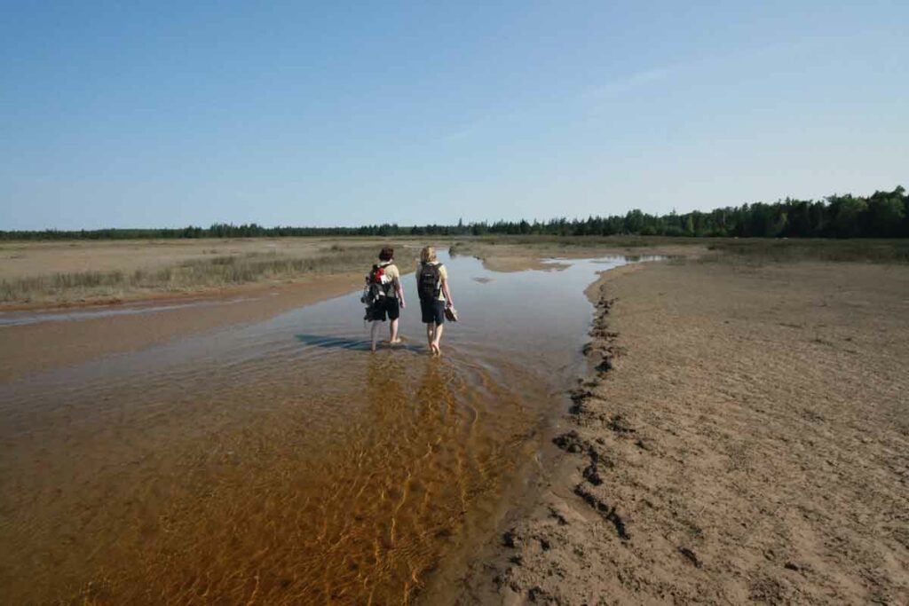
Misery Bay

Misery Bay Provincial Nature Reserve is a 860 hectare provincial park on the south shore of Manitoulin Island, a 10 minute drive west of Evansville. There is a trail network of eight trails totaling approximately 16 km (one way) and ranging in length from 0.2 km to 4.8 km (one way). The trails feature mixed woodland, old beach ridges, and rare alvars. There is a visitor centre/ interpretive centre to educate the public about this unique area. There is an easy loop of 4.1km from the visitor centre consisting of the Lakeshore and Wolf Den Trails. For more information visit www.manitoulin.com/misery-bay

Noble Nature Trail

The Noble Nature Trail is an easy to moderate trail that offers a 1.1km stroll east from its starting point at the intersection of Water and Bay Streets on the Gore Bay shoreline up to and along the East Bluff overlooking Gore Bay and the town. The Noble Nature Trail ends at the Harold Noble Memorial Park which offers a high vantage point that provides outstanding panoramic opportunities for that perfect photo of the Port of Gore Bay and its busy harbourfront.  

Gore Bay Boardwalk Trail

The Boardwalk Trail follows the town’s waterfront and connects with the Noble Nature Trail. It travels 1.2km along the shoreline west to Fish Point Park, where the Harbour Centre Gallery and Split Rail Brewery are in the neighbourhood. The Boardwalk Trail offers an easy and accessible route along the length of the town’s waterfront will bring you to the newly constructed breakwall, providing an opportunity to get further out into the bay. Picnic areas are available along this trail as is direct access to the many downtown businesses and services.

Heaven’s Gate Trail

This approx 50km trail runs from the Willisville turn-off on Hwy 6 through to Fort Lacloche on the Sagamok First Nation, south of Massey. The multi-day hike runs through the magnificent Lacloche Mountains with beautiful views of the North Channel and surrounding lakes. However it is not well marked or maintained and only recommended for very skilled hikers. Guided hiking and canoeing tours of the area, with a Native theme, are available from “Trails of The Eagle Clan,” 705-865-2526, or email mowl@vianet.ca

Wagg’s Wood

Right off one of Mindemoya’s main streets, Hwy 542, Wagg’s Woods is located almost directly across the street from the municipal office and library building. Features maple, basswood, birch and ash. Moss climbs the cliffs which are part of the Niagara Escarpment. Watch for 15 different species of fern. Allow 1 hour.

Bowerman trails in South Baymouth

While you’re waiting for the Chi-Cheemaun ferry, or after you disembark, this trail is a great diversion. Access points are off the small boat harbour parking lot and across from the boat launch (south of the ferry terminal building) and also off Green Street in the same area. The trails take you up limestone steps, through the bush and offer Lake Huron views. Allow 1 hour.

Bebamikawe Memorial Trail

Located at the end of Beach Road in Wiikwemkoong, this trail is 14 km of easy to intermediate trails, spectacular lookouts and educational signage. The Outdoor Fitness Park section of the trail is a double track, granular surfaced trail with five fitness stations equipped with outdoor fitness equipment so that trail users can take advantage of resistance training in a scenic natural environment. Call (705) 859-3477 for more information.

Point Grondine Park

A First Nation-owned and operated recreational park, Point Grondine has over 7,000 hectares of scenic natural wilderness landscape, old growth pine forest, stunning river vistas and eight interior lakes to explore. The trailhead is ideally situated off Killarney Highway 637 nestled between the Killarney and French River Provincial Parks; it is in the northern terminus of the Georgian Bay Coast Trail, a sustainable world-class hiking trail in the spectacular landscape of the UNESCO Georgian Bay Biosphere Reserve. The park is accessible through mandatory park permits that can be purchased online at www.GrondinePark.com or by calling 1 (705) 859-3477.

The Little Current Recreational Walking Trail

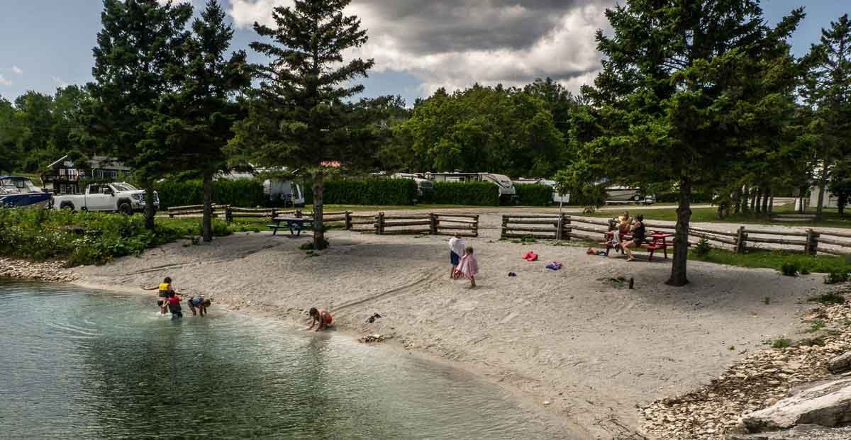
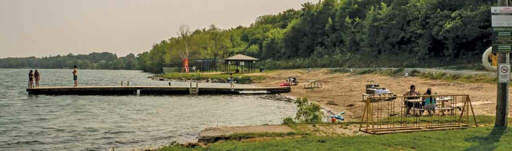
The trail is a 12 km path (approximately 2 to 4 hours) that includes minimal elevation changes, a compact surface, trail lighting on most sections, benches and directional signage. This beautiful trail loops around the entire town of Little Current and includes a picturesque stretch of roughly five kilometers that follows the North Channel, including along the town’s unique downtown waterfront. Along this stretch, you will find a series of mounted historic plaques describing the town’s rich marine heritage. Visit Low Island, at the western end of the downtown Water Street as the trail circles the perimeter of the town’s waterfront park (1 km) where, in addition to several of the descriptive plaques, you can enjoy a vie de parkours-style workout on the sets of workout equipment provided there in addition to playground equipment for children, a beautiful sand beach, soccer and baseball fields, shaded pavilions, washroom facilities and a water bottle filler station.

A favourite section of the trail can begin (or end) at Low Island Park with a park loop and then along the waterfront to the Welcome Centre and the swing bridge, and then return along the same route. You can also begin at the Welcome Centre where there is ample parking. The return trip is 3 km.

The Lewis Twin Peaks Hiking Trail

This trail is in Sheguiandah and is accessible from the west side of Hwy 6, just across from Paradise Motel. Approximately 2km in length and a relatively easy hike, the trail nevertheless provides two quite spectacular views of Bass Lake and the North Channel. The lookouts are on Quartzite outcrops. Allow 1 to 1.5 hours.

Grab an Explore Manitoulin Visitors’ Map and enjoy our many local beaches 

Meldrum Bay boasts a gorgeous new beach to go along with the updated campground.

by Isobel Harry

Manitoulin is chock full of beaches both on the ‘big water’ Lake Huron side or in the plethora of inland lakes that dot the countryside. Here are just a few to sample on your Manitoulin holiday.

Providence Bay

The horseshoe crescent of golden sand beach in Providence Bay on the south coast is one of the Island’s top natural attractions, rated the “best” and the “longest” in Northern Ontario, stretching as far as the eye can see to the east and west of the wide bay. In the hot summer months, brightly coloured umbrellas shade the prostrate bodies that have travelled from near and far just to collapse here in the warm embrace of the sands, a kind of communal ritual that involves exhaling and sighing deeply upon arrival.

A family gathers round a blanket and a picnic basket, little kids squeal in wild abandon as they run in and out of the shallow waves, a solitary walker and dog amble the length of the curving arc of the ancient strand. One can imagine similar lakeside scenes when hundreds of Odawa lived and fished here in the 1600s, naming it G’Chiaazhwiyiing, or Sand Beach in English, according to historian Shelley Pearen, or Mindimoiesibing, Old Woman River.

A beachgoer is only a few steps from any of the village’s accommodations and places to eat. 

At the beach, the Interpretive Centre hosts Huron Island Time, serving roti, patties and over 20 flavours of Farquhar’s ice cream among local art, clothing and gifts. Throughout the summer, their Sunset Music Series on the boardwalk presents local musicians and talented guests versed in country, folk, jazz and ‘50s and ‘60s rock. Check them out on Facebook.

A sliver of the famous beach at Providence Bay.

The view from here is magnificent: the immensity of sky and water stretching toward the seemingly infinite horizon is breathtaking. On the far left shore can be spotted the red roof of the marina, tiny from this perspective, and, still far in the distance, the beginnings of the beach on the east side and the mouth of the Mindemoya River where it joins Lake Huron. 

On the right, or west, side of the bay, the beach goes on and on until it is but a tiny speck at the tip of Simcoe Point.

The beach is diverse: at this end, it’s sandy and a little more secluded; returning to the centre of the horseshoe beach, this is where the action is. The equipment in the generously outfitted playground gives kids a good workout; just behind is a parking area and a shady little park with picnic tables; here also is the Interpretive Centre, with washrooms. The village centre and its amenities are just a block away.

It’s heavenly down on the beach—the sand and water, sun and sky shimmering like a mirage, like a dream of a perfect summer’s day. 

Lake Mindemoya

In Central Manitoulin, Lake Mindemoya’s long history as a vacation destination may be appreciated on a tour around the lake, a drive or bicycle ride on the little roads that contour the water on the east and west sides. 

Lined on the eastern shore with old-time rental operations, a golf course, cottages and homes fronted by docks with deckchairs, this side of the lake has the quiet air of a well-loved, long established community.

There are several spots along here to swim, launch a boat and have a picnic. Driving or biking south on Hwy 551 toward the town of Mindemoya, turn right on Hill Road, down to the evocatively-named Ketchankookem Trail at the waterfront. 

Pleasant grassy park areas back the beaches around the lake, strips of fine sand that serve as personal welcome mats into the nice-and-warm shallow waters ahead. Young and old picnic at tables and on blankets, launch a boat, take a dip or just hang out, gazing across the water to Treasure Island, the storied isle of legends. 

Treasure Island, or Mindemoya Island, is seen from almost anywhere around the lake; the shape resembles a prostrate human form with arms resting outstretched over the water. An old Anishinaabe legend tells of Nanabush, the infamous Trickster, who stumbled while carrying his grandmother over his shoulder, causing her to fly through the air to the middle of the lake where she landed on her hands and knees. Mindemoya (Mndimooyenh), the old woman of the lake, remains here ever since. 

Still on Ketchankookem Trail, the road will join up with Lakeshore Road, another lovely lane to wander, and Highways 542/551; follow 551 along the south shore of the lake, stopping at still another small, quiet picnic area then proceeding west until the turn on the right to Monument Road.

Monument Road is a Bike Route—as are all the roads around the lake—and a little piece of rural heaven: split rail fences sprout among flat limestone pavements, a few homes and cottages peep through the forest cover, cyclists and walkers, children and dogs meander as the road winds gently around the west side of Lake Mindemoya and another public beach, with picnic tables on a strip of lawn, benches, parking and portable toilets. A few hundred yards up the beach is a new boat launch. 

Low Island Park

At the far northeast tip of the town of Little Current in the Town of Northeastern Manitoulin and the Islands (NEMI), overlooking the North Channel of Lake Huron and the LaCloche mountains on the far shore, a great summer getaway awaits.

The splash pad located at Low Island Park is fun for all ages.

Got kids? Bring them here to swim at the beach, get drenched in the waterspouts of the splash pad, run around the lawns and tucker themselves right out on the playground slides as you keep an eye out, all the while relaxing at one of the many picnic tables in Low Island Park. 

The sprawling municipal green space and beach accommodate lots of recreational activities for all ages, with fields for ball and soccer, a skateboard park, a dock for launching canoes, kayaks and oneself into the water, a pavilion with washrooms and change rooms, walking trails, historical sites, all in a lush setting of big trees shading the aforementioned numerous picnic spots.

Julia Bay

Just past Gore Bay, stay on Hwy 540, headed for Gordon/Barrie Island. The highway becomes Hwy 540A as it curves westward; turn right (east) here to find Julia Bay beach.

The beach at Julia Bay.

Just past the Gore Bay airport, down a hill, around a curve lies Julia Bay and its alluring arc of sand. Julia Bay Beach offers a sandy, gradually sloping lake bottom and floating dock for sunning and jumping from. The view over the bay is grand; there’s a small gazebo at water’s edge, benches, a picnic table with sail awning, a big Manitoulin Cycling Routes map marked with the Barrie Island route and room to stretch out on the sand or the lawn.

It is generally quiet here but can fill up on those hot afternoons; out on the dock a young lad dives over and over into the cool, calm water then comes in to hop on his bike to head home.

Manitowaning

The beach in the village of Manitowaning, nestled on the southwestern side of Manitowaning Bay in the eastern Township of Assiginack, is a sprawling expanse of sand on a picturesque coastline that is steeped in history. All around this immense bay, over to the peninsula of Wiikwemkoong Unceded Territory in the east, resonate the stories of the determining treaties, signed on these shores by the Anishinaabek and the British Crown almost 200 years ago, of the legends of an underwater ‘den of the Great Spirit,’ or ‘Manitowaning’ in Ojibwe.

To visit the town of Manitowaning is a multifaceted cultural experience that brings to life the story of settlement in this area. Preceding or following a trip to the beach, a stop in at the Assiginack Museum on Arthur Street and a look around interesting landmarks will paint a complex and fascinating historical panorama. 

Drive, walk or bike down Queen Street toward the water and Bay Street, where stand the imposing frame structures of the Manitoulin Roller Mills (one of the finest examples remaining in Ontario) and the Burns’ Wharf warehouse (both built in the 1880s), sided by the Norisle, a steam-powered ferry built in 1946 that carried passengers and cars between Tobermory and South Baymouth until 1974, when the Chi-Cheemaun began her tenure of that run.

We’ve reached the Manitowaning Heritage Park and Marina, and the beach, richly deserved after touring through time. There’s ample parking and a bike rack and the beach is spacious and sandy; all along the beach locals from Wiikwemkoong, Manitowaning and further afield chat at several picnic tables; a long dock sees swan dives and cannonballs expertly executed off the boards; kids dig a hole atop a big hill of sand. On the far side is a sandy playground and a gazebo with more picnic tables, and by that side of the dock is a cordoned-off section of water for shallow bathers. 

Misery Bay

Have you had any misery on Manitoulin this summer? If not (it’s not that easy, being miserable here), no worries, we’re all about a well-rounded vacation, mini-break or staycation, so jump aboard the train (that’s a figure of speech, there’s no train) to Misery Bay Provincial Park. No, you won’t be miserable, and yes, there’s a beach.

The story of the name goes something like this: Back in the dawn of time (or, in the 1880s), two men in a boat in the bay called out to settlers cutting marsh grass in the hot sun on the shore, “What bay is this?” An overheated wag in the work party shouted back, “Misery!” and the name stuck. 

About 30 kilometres west of Gore Bay on Hwy 540, Misery Bay Provincial Park is a natural marvel: a 1,100-hectare tract of undisturbed, protected land with over 15 kilometres of well-marked and maintained trails on four distinct routes. Misery Bay Provincial Park is classified as a nature reserve by Ontario Parks to protect “at the highest level” the alvars, wetlands, upland forests and animal and plant species at risk that are found here.

Take the 3.3 km Alvar Coast Trail to the beach in Misery Bay, a ‘moderate’ trail to hike, well-marked with red directional arrows. (The trail carries on along the coastline and loops back, a total of about eight km, but just to go to the beach and back is much shorter.) The slope down to the water is gently gradual, the path sometimes firm sand, sometimes flat, limestone alvars, sometimes pine-needle-strewn, always clearly discernible as it weaves through thick stands of trees. 

Part of the extensive beaches at Misery Bay Provincial Nature Park.

Given the stunning geological environment in which the park is situated, it stands to reason that the beach will not be just your usual beach (never a bad thing in itself, of course), but also a geological wonder. And it’s a 20-minute walk, adding another healthy dimension to the beach experience; for this reason, a pair of shoes slightly sturdier than flip-flops is recommended for the trail. As on any hike, water and snacks are de rigueur.

This beach is indeed different; arriving on the shore of Misery Bay is a bit like stumbling into a movie set in primeval times. Water levels have receded since last summer’s high levels submerged all of the beach, but are still not as low as in recent years, when the now-lake-bottom became visible, alvars stretching out as far as the eye could see. 

You’d have to go out farther to actually swim, but everyone here seems content to explore the unusual terrain and to stretch out on the huge flat rock bed a few inches above the water; adults and kids linger and splash around the edges, sitting and standing in amazement. 

The park is for day use only; no camping is allowed. Day use fees are in effect only on Friday, Saturday and Sunday. There is no charge for day use from Monday to Thursday until September. 

The washrooms are open seven days a week.

So, what are you waiting for? Grab your towel and hit the beach! For more beach adventures (and you’ve got options!), be sure to pick up a copy of the handy Explore Manitoulin tearaway visitor’s map found just about everywhere!