Lake Manitou

Lake Manitou

Keen fishermen may find:

About 
Lake Manitou

LAKE MANITOU—The largest lake within a fresh water island in the world, with 90 miles of shoreline and depths of up to 162 feet, Lake Manitou is a sublime, nearly unfathomable sprawl of blue.

Perhaps this is why it is named “Manitou,” the Ojibwe word for a spirit or power being, in this case apparently referring to the greatest spirit of all, Kitche Manitou. But Manitou, for all its size, is not an ominous or forbidding lake. Over the years, its surface has been ably plied by everything from canoes and ferries to runabouts and personal watercraft and its exceptionally clear, clean waters offer a paradise for swimmers, anglers and scuba divers.

Yes, it is the deepest lake on the Island. But it is not, notes veteran fishing guide Jack Hayes, as deep as it was once thought to be. “If someone drowned, they would throw out a grappling hook, but they didn’t allow for drift of the line, so they were fooled into thinking it was 300 feet deep.”

Not that the bottom of Manitou is often dragged for bodies. Indeed, Mr. Hayes recalls one drowning: John Wright, a well driller from Mindemoya, went through the ice along with another man while salvaging a vehicle that had sunk the previous week. Mr. Hayes knows the lake as well as anyone. For 35 years he worked as a fishing guide on Manitou, first for Mountainview Lodge and then Timberlane Lodge. He is retired now.

About a 25 years ago he was hired on as boat captain for a hydrographic survey of Manitou. He knows where the fish are, and the reefs too.

“We were depth sounding for shoals, doing surveys for water safety,” he recalls. Since that survey, “a lot of the bad shoals have been marked with buoys,” and a detailed map isavailable showing their whereabouts.

Mr. Hayes notes that all the shoals, and there are a lot, over 400, run in the same direction, northeast to southwest, “because this is the way they were shaped by the glacier.”

Many other land formations on Manitoulin have the same orientation, including the Cup and Saucer Bluff, which, incidentally, provides an excellent panorama of Lake Manitou if you follow the popular hiking trail to its summit.

One particularly dangerous shoal out in the middle of Lake Manitou is named “Acre Shoal.” It may not be the exact size of an acre, but “it runs a good 150 feet, and is all hard rock,” says Mr. Hayes.

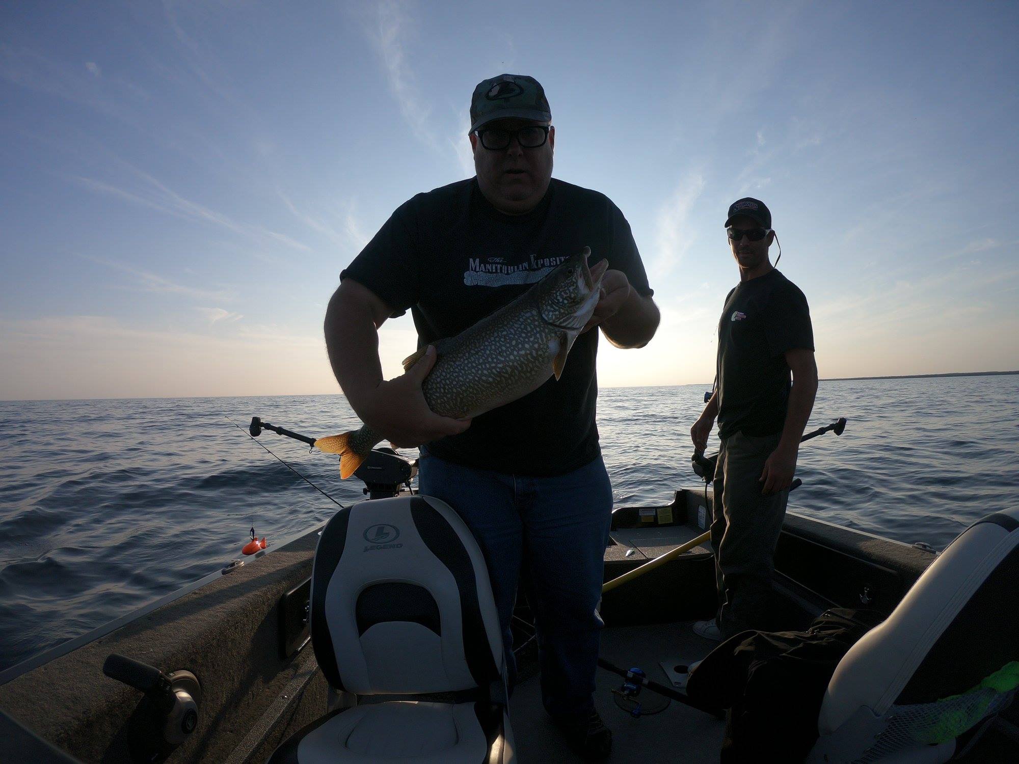
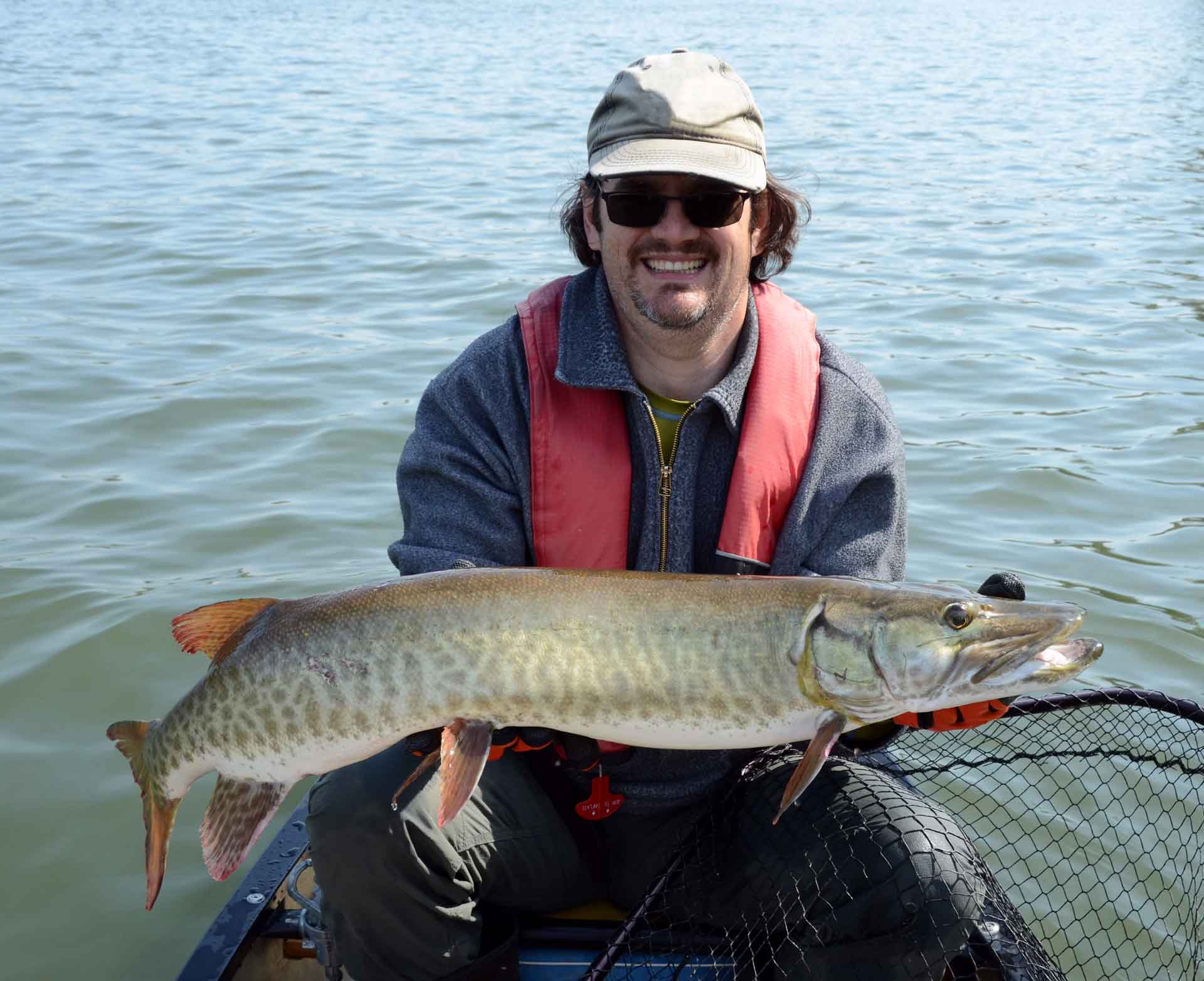
Manitou is famous for its fish, which include bass, perch, whitefish, pike and pickerel, but most notably, lake trout and ling. “It’s a natural lake for lake trout; since before the white man, they’ve always been here,” says Mr. Hayes, adding that, apart from Wolsey Lake (which is attached to the North Channel, hence not technically a lake), “it’s the only real lake for lake trout.”

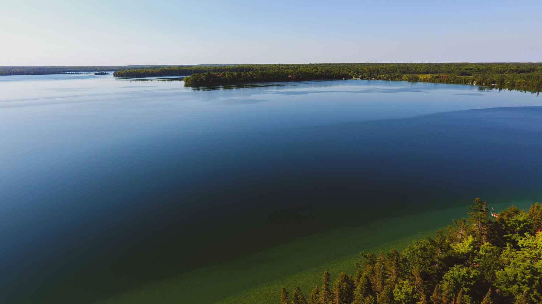
It’s the depth of Manitou that accounts for its lake trout population, but, also, says Mr. Hayes, “its oxygen, and Manitou has a lot of springs.” These factors also explain the presence of ling. “Ling won’t stay anywhere but a clear, deep water lake.”

Clear and deep, that’s Lake Manitou, and clean. Until fairly recently, many people drew drinking water directly from the lake, without filtering.

Carol Sheppard, who operates the Rockville Inn on Green Bay, the northernmost bay on Lake Manitou, and has lived here for many years, says “we used to always get zero/zero readings” on water quality tests, meaning there was absolutely no bacteria or ecoli. The water quality got worse for a while in the 1970s, she says, due to old, substandard septic systems in place at most homes and cottages Now, Manitou is again a remarkably clean lake.

Ms. Sheppard is partly to thank for this. As a councillor of the former Howland Township, she led a drive to get many of the septic systems on the lake inspected through the Ministry of Health and to educate people about water quality.

Her concern began, she says, “when I was on my honeymoon down at Lake Erie. Coming from here, I’d never seen a brown lake before. I had to ask someone why it was that colour.” She says that ever since that wake-up call, she’s been determined to make sure that Lake Manitou retains its uncommon clarity.

And so far, it has. “I’ve scuba dived in this lake, and you can see 10 to 15 feet,” Ms. Sheppard remarks.

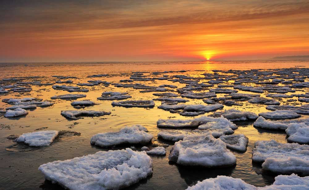
She’s also snowmobiled much of the lake and flown over it as well. In March, Ms. Sheppard says, the view from a plane reveals “a whole bunch of air holes”, spots in the ice surface that are either open or only thinly crusted over, a result, she believes, of either a spring or natural gas. “We have a picture of one hole, where it’s just bubbling,” she says.

One time she and her late husband Ron nearly drove a jeep into an air hole during winter, and another time “one of our neighbours (the late Larry Appleby) had his golden retriever fall in one, but he luckily managed to lasso her with a rope just before she drowned.”

It was Ms. Sheppard’s grandfather, Stan Batman (her maiden name is Batman), who first told her about the air holes. He also talked about crossing Lake Manitou in winter with livestock. “If he’d bought a cattle beast in Mindemoya, he’d bring it across Manitou on his way back to Sheguiandah,” the granddaughter says.

In the early days says of Manitoulin settlement, there was also a regular ferry route from the historic community of Van Zant’s Landing, on the southeast shore of the lake (where Manitoulin Resort is now located) to Lehman’s Landing on the lake’s west side, near the present-day turnoff on the Rockville Road to Camp Mary Anne.

Ms. Sheppard’s great-grandfather, Thomas Batman, operated that ferry. And, in a moment of entwined family lore, it was this predecessor of Ms. Sheppard (nee Batman) who “brought old man Sheppard”, aka Albert Sheppard, the grandfather of her late husband, Ron Sheppard, “across the lake,” a phrase that acts as both a literal description of what happened and an euphemism for “delivered him to his future home.”

Albert Sheppard was a locksmith, and his services, so the story goes, were required in Mindemoya, because the safe at the old Wagg’s Store couldn’t be opened. He went to Wagg’s and did his job, but it was the northwest shore of Lake Manitou, experienced during that ferry ride, that stuck with him. “So he decided to settle here in Rockville,” recounts Ms. Sheppard.

Which is where the ferry operator’s great-granddaughter and locksmith’s grandson made their family home and where Ms. Sheppard and one of her sons live to this day.

Nearby places to stay, eat and play

Rockville is one of many communities, most of them tiny and informal, but formerly bustling and organized, that dot the shores of Lake Manitou.

Apart from Rockville, there’s also Green Bay, Bidwell, Big Lake (just inland from Manitou) and Sandfield. The latter is the most happening community these days, but the others all sported post offices and school houses and churches in their day, and many of those buildings still stand.

If you tour the lake by boat or drive some of the cottage roads, you are also apt to glimpse a style of architecture that seems, if not unique to Lake Manitou, certainly most plentiful here: the so-called cedar pole building. Many cottages and lodges on the lake are constructed in this manner, in which the cedar logs are aligned vertically with the bark left on.

Ms. Sheppard says that most of these buildings, in the northern part of the lake, at any rate, are the work of the late Alfred Spry, who, true to his name, was spry to a ripe old age. So was his wife Lily Spry (nee Snow), who, despite going blind at the age of 27, worked as a midwife and lived to the age of 104.

Ms. Sheppard’s grandfather, Stan Batman, lived to 102.

And they all, presumably, drank water straight out of Lake Manitou!

One could probably do so now, too, but it is recommended that you filter or treat the water. As Mrs. Sheppard notes, “after Walkerton, you can never be too careful.”

But even if you aren’t dipping a cup straight into the lake, Manitou’s crisp, clear waters, teeming with lake trout and bass and perch, and home to numerous pairs of loons, cry out to be experienced up close, ideally by boat or by actually immersing yourself.

Public boat access to Lake Manitou is provided in three locations: at Newby’s Bay (on the Rockville Road southwest of the community of Rockville), at Sandfield, and just beside Manitoulin Resort (just off the Bidwell Road and very close to Manitowaing.)

There is also a wonderful little public beach at the tip of Green Bay where the Bidwell Road meets the lake. The spot is known as the John Dunlop Memorial Park.

Alternatively, you can hike the Cup and Saucer trail, and gaze out over the breath-catching immensity of the lake.

You won’t see it all, even from this promontory, but you’ll get s good sense of its grandeur.

Lake Kagawong

Lake Kagawong

Keen fishermen may find:

About 
Lake Kagawong

Kagawong is a sprawling, unusually shaped lake. I’ve seen it described as an “upside down trident,” but to me it looks most like a Danforth anchor, the long thin bay to the north being the shank, and the two deep bays to the south the flukes.

The lake is 100 feet above Lake Huron, according a long-time cottager on the lake, and unlike the Island’s other large lakes, this one drains into the North Channel. The outlet is the Kagawong River, which plummets over a cliff at famed Bridal Veil Falls, then winds and tumbles past the village into Mudge Bay.

Like Lake Mindemoya, Kagawong has the distinction of having a large island. Kakawaie Island, as it’s called, is a long, thin island in the lake’s large southeast bay. A geologist who cottages on Kagawong believes this island is an esker. It’s privately owned, but uninhabited. It spans 90 acres and boasts a sand beach that people sometimes use for picnics, according to a member of the Dawson family, whose grandparents established Dawson Resort on East Perivale Road, in 1934, to augment their farming business. Deer are often seen swimming from Kakawaie Island to the mainland, the operator of Dawson resort adds.

In 1867, the year of Canada’s formation, the lake was considerably less populated. In Exploring Manitoulin, author Shelley Pearen writes that when the township was surveyed in that confederation year, just three native families lived in the village of Kagawong, one of which had “gardens of potatoes and corn…on the east shore of Lake Kagawong.”

The first European settlers in the area, according to Ms. Pearen, was a French-Canadian named Luke Chatreau, who built a cabin on Lake Kagawong around 1872.

Things have certainly changed in the intervening 150 plus years, but there are still long stretches of Lake Kagawong’s shorelines that remain undeveloped. One area I’d heard about that was particularly interested in seeing is a steep rockface known as Redrock, so named because the sunset occasionally paints its white limestone surface crimson.

Asking when I contacted a friendly cottager and mentioned that I was keen to see these rocks turn red. Would he take me out in the evening, so I could experience this phenomenon? No problem, he said.

I arrived at his place around 8 pm.

We walked down the steep, switch-backing stairs, to the water. This, in itself, surprised me. I hadn’t realized that Kagawong had such precipitous shores. But the shoreline at the camp was nothing compared to the topography on the other; eastern side of the bay.

Redrock. It wasn’t red yet, it was too early, and anyway the sun had dropped behind a cloud but it was steep, I could see that even from a distance.

Enroute, in my friend’s fishing boat, he filled me in on the fauna and aquatic life on the lake. Mink regularly runs along the shore, for instance. A wide variety of fish flourish in its depths, pike, walleye, perch, smallmouth bass (enough of the latter that a popular bass derby is held each August.) Pickerel (Walleye) are now a game species in the lake thanks to the efforts of the Gore Bay Fish and Game Club. A golden eagle is presently nesting on a tree on the “flats” along northeast shore of the lake. He pointed out several mergansers, and at one point a pair of loons flew overhead.

Then we were cruising along below the cliff known as Redrock. From a distance it had looked sheer and smooth, but up close it was full of caves, crags, crumbling ledges, cedars clinging stubbornly to its slopes. “What I tell people is that you’re looking at thousands of years of history here,” my friend says. “And it’s always changing. Mother Nature keeps carving away at it.”

He gazed at the steep, crenellated cliff, and grinned.

“The strangest thing I ever saw here was a baby raccoon, hanging off the cliff with one arm, it must have fallen or something.”

A more unsettling image is that of the deer which, according to Mrs. Dawson, are occasionally seen plummeting off the cliff.

“So, I guess they are bucks fighting for territory,” she mused.

I didn’t see any acrobatic raccoons or falling bucks. Nor any red hue. But it was still beautiful. Farther down there were cottages, holes blasted from the rock to allow water access for boats. (Blasting is not allowed now.)

Then we were heading back across the bay, Redrock behind us, and I’d pretty much given up on the idea of seeing that rockface turn red, when suddenly the sun slipped out from below some clouds, and I turned my head, and there, just as promised, was a brief ruddy glow. The rocks were turning red! I tried to take a picture, but we were too far away. I didn’t have a zoom, it wasn’t going to work.

But I saw it. The rocks turned red.

We chugged back across the bay of Lake Kagawong, just me and my pal, the sun now sunk behind the western shoreline, the clouds above looking bruised and luminous.

And when we glanced back to the east, we suddenly saw a full moon rising over that shore, a huge, pregnant orb, glowing an unearthly orange.

Nearby places to stay, eat and play

Another Lake Kagawong attraction, also on Perivale Road East, is the Perivale Gallery which has become a destination on its own for art lovers. Proprietor Shannon McMullen features primarily Northern Ontario artists (although not exclusively) and her busy gallery is the sole venue to sell the landscape painting of famed Manitoulin artist Ivan Wheale.

Ms. McMullan is pleased that, even though her gallery closes around Thanksgiving each year, it typically remains at or very close to the top of Trip Advisor’s most popular attractions through the cold months.

The Perivale Gallery also offers a series of weekend art classes through the summer, most of them at the nearby Spring Bay Community Hall on Highway 542 in that village. The gallery also has a special two week mid-summer show, ‘In the Spirit of Tom Thomson and the Group of Seven’ that is special and unique in Northern Ontario.

Lake Huron

Lake Huron

Keen fishermen may find:

About 
Lake Huron

Lake, Huron, the second-largest Great Lake, defines Manitoulin Island. After all, if you’re the largest Island in the world in fresh water, you need that fresh water. But, where would you start to write about such a big body of water? Lake Huron is so darn big, 23,000 square miles, with depths up to 750 feet, and its history so rich and varied, it wasn’t like I could really do it justice in a couple of pages.

I decided to focus on the lake as experienced from the south shore of the Island, which is, after all, what people really think about when you say, “Lake Huron.” The North Channel is part of the lake, sure, but it’s a distinct part, a world unto itself; so is Georgian Bay. That limitless sprawl of blue that you see from the south shore, corrugated with big waves and faintly specked with fishing boats, now that’s the true Lake Huron.

So, I packed my wide-angle lens, and set off for Providence Bay. (Actually, I don’t have a wide-angle lens, but you get my point.) Enroute, I thought about Lake Huron, its history, its mystique, its stats. Where to start?

Well, it’s the second largest Great Lake, we all know that, right? It’s also, in my view the greatest of all the Great Lakes.

Sure, Superior is greatest in size, with the most dramatic, precipitous coastline, but it’s a daunting, scary lake, difficult to safely experience unless you’re in a big boat, and even then, you might not be safe. Consider the fairly recent fate of the Edmund Fitzgerald, a shipwreck we all know about thanks to singer songwriter Gordon Lighfoot.

Lake Huron, with its infinite islands and varied shorelines, ranging from long sand beaches in the south, to crazy granite and quartzite in the north, to the limestone flowerpots and bluffs and alvars of Tobermory and Manitoulin, has always struck me as way more enticing and unique than Michigan, Ontario or Erie, but also more hospitable and navigable than its more voluminous sibling to the north.

Huron has no big cities on its shore, unless you count Sarnia. It has dozens of lighthouses, and tens of thousands of islands, including, of course, the world’s largest to be found in fresh water.

The first European to set eyes on Lake Huron was presumably Samuel de Champlain, after navigating the French River to its mouth in 1615 (it’s possible that Etienne Brule got there earlier, but no precise record exists of his travels). Here, Champlain encountered a group of natives who were gathering blueberries; natives, as it happened, from Manitoulin Island.

A few decades later, in 1649, the Huron Nation (from which the lake derives its name,) and the fort established by the French at St. Marie among the Hurons, were routed by the Iroquois in the present-day Midland area in southern Georgian Bay.

Mantioulin’s first Jesuit mission, begun in 1648, was promptly abandoned after these Iroquois raids, and the Island’s Ojibwe and Odawa population scattered far and wide. It wasn’t until the early 1800s that Manitoulin natives returned, and a new mission was established in present-day Wiikwemkoong Unceded Territory.

One of the Island’s more mysterious and sensational events occurred in Lake Huron waters off Wiikwemkoong in 1863. A corrupt fisheries commissioner named William Gibbarb, much loathed by the local first nations people, disappeared while returning to Manitoulin on board a steamer named the Ploughboy; his body was found floating in the lake three days later. No one was ever charged, but people in Wiky have an idea about what might have happened to this day. The story lingers on as “ The Manitoulin Incident” and 20 years ago Wiikwemkoong playwright Alanis King created a play from the story that was presented by the Debajehmujig Theatre Group.

The greatest loss of life on the Great Lakes for its time also occurred in Lake Huron, not far from Manitoulin. In 1882, the poorly designed and overloaded steamer Asia foundered en route to Manitowaning in a storm, killing all but two of its 144 passengers. One of the survivors was Dunk Tinkis of Little Current; the other was a young woman named Christine Morrison. The two teenagers, strangers to one another, but both, uncannily enough, 17, drifted to an island near Pointe Au Baril on a lifeboat, and were discovered the next day by a native couple. There is a monument to the event at Dunk Tinkis’ burial place in the Holy Trinity Cemetery just outside of Little Current.

As I pulled into Providence Bay, parked, and got out to wander around on the beach, it was hard to imagine the sort of storm that might sink a boat the size of the Asia (136 feet). There was a brisk wind blowing this day, but it was out of the north, so the bay was quite calm, and the sun was bright and warm.

The beach at “Prov,” as the community is locally and affectionately known, is certainly one of the Island’s most popular spots, and deservedly so. But having never been the sort of person who likes to laze around on a crescent of sand, possibly exposing himself to skin cancer, I kept my tour short, and then headed for one of my favourite places on all of Manitoulin, the rocky east shore of the bay.

I parked at the marina, and started hiking down this rugged, scenic coast, striding over deep cracks in the fossil-strewn limestone slabs, tiptoeing across wave-smoothed stones, occasionally leaving the tread-marks of my boots in small pockets of sand.

Eventually I reached the light of Providence Point. It’s an unmanned light on a tripod tower. Just in front of it, though, you can see the foundation of the original lighthouse which once stood here.

According to the book Alone at Night, the “Prov” lighthouse was built in 1904 and was manned until 1953. In 1973, it mysteriously burnt to the ground. Some believed it was struck by lightning, but nobody seems to want to name names. The general theory, though, is that it was a local person who had some sort of gripe with the government.

After standing on the foundation of this lighthouse, gone now almost 50 years, I started hiking back to the marina.

Photos of beautiful Lake Huron

The marina was hopping: boats pulling out, boats pulling in. I spoke briefly with a father-daughter team fishing, from Sudbury, who were trailering their boat into the water, setting out to do some salmon fishing. They’d been skunked the last time they went out fishing from Prov but told me they’d had success in the past. I wished them luck, and watched as they struck out onto the bay, rods jutting from stern of the boat. Perhaps they’ll be entering The Manitoulin Expositor Salmon Classic (last Saturday in July through the last Sunday in August) and trying to win some of the $30,000 cash prize money for a championship salmon.

A big, weather-beaten boat was tethered to the end of the pier, out past the slips. I had a hunch what it was but had never seen it up close. I wandered out to get a better look, and sure enough, it was the Blue Fin, the venerable fishing tug operated by the Purvis family in Burnt Island.

Incredibly, this riveted steel boat has been in been in service since 1930, the year that the grandfather of current Purvis patriarch George Purvis had it built.

Out past the end of the pier, you can see another old section of dock, stuck out there like a sad, skeletal island. The pier obviously extended much farther at one time.

I talked to the harbourmaster about this. He showed me a photocopy of an old newspaper article, from the Sudbury Daily Star; dated May 6, 1952. “Providence Bay hit by tidal wave,” was the headline. Although the article didn’t go into details of damage done to the dock, the harbourmaster said it was his understanding that “that was when the pier got broken up. It used to be all one piece.”

Remember what I said about Lake Huron being so much more hospitable than Lake Superior? Maybe I should be taking that back. After all, Providence Bay itself was reputedly named after a ship-wreck. The story goes that some shipwrecked sailors washed up on its sandy shore, and thanked providence for their good fortune. Other  stories tell of the “sailors’ grave,” a small grotto-like area amid tall rocks, now encircled by Providence Bay Park.

I’d seen this natural sculpture before and told myself I should really go and pay my respects before heading home.

Ice Lake

Ice Lake

Keen fishermen may find:

About 
Ice Lake

A shallow, reedy, but surprisingly extensive lake located between Kagawong and Gore Bay. Ice Lake got its name for being the first lake on Manitoulin to freeze each winter and the first to de-ice in the spring.

Compared to such larger, deeper lakes such as Kagawong and Manitou, which don’t ice over until the last week of December or the first of January, Ice Lake firms up well before Christmas, “In recent years it’s been frozen by December 5,” says Bill Baker, who lives at the north end of the lake.

Just because it freezes quickly however, doesn’t mean the ice is safe to travel on. “It’s a lake we don’t use that much in the winter,” remarks Mr. Baker. “There are pockets where it’s not always solid.” He theorizes that gas released by the vegetative bottom is likely accountable for the soft patches.

This hasn’t stopped people from venturing out onto the ice over the years. Mr. Baker remembers seeing “a car out there when I was a kid, towing a couple of skiers.”

Most people are wary of the ice, though. “Old people have referred to teams of horses going through the ice,” says Mr. Baker, adding that his own mother, Ethel Prior talked about two young fellows who drowned in Ice Lake while skating.

The northern and southern portions of the lake are distinct, separated by a peninsula. The northern half is fairly broad and contains two islands (the larger of which, Goat Island, has had a baldheaded eagle nesting on it for the past few years), but extremely shallow throughout, just four feet deep on average; the southern portion is narrower; but twice as deep. It’s a weird shaped lake; the best thing I can liken it to is a dog’s leg.

It was fitting, then, that I brought my pooch along when I decided to do a tour of the lake. It was a breezy day, and I figured he’d be good for a ballast.

I originally planned to put my canoe in at the north end of the lake, where Highway 540 crosses a causeway and there’s a small pull-over spot, but after speaking with Mr. Baker, I learned that the real public launch for the lake is in the southern part.

So instead of following Highway 540 to the tip of the lake, I turned off on Robertson Road. This intersection was once the hub of the community of Ice Lake. While the community was never very big, it still appears on the Turners of Little Current map, and at one time there was a general store here, as well as a post office, which first opened in 1903. Farther down Robertson Road, a stone schoolhouse still stands, engraved with the date 1904 which is the community hall now. If you go the other way from that intersection, north, the roadway is called Beange Road and leads straight to Burt’s Country Meats, a unique organic farm abattoir and retail operation run by a husband and wife who successfully repurposed the family farm over a quarter century ago.

Before I got to the schoolhouse, however, I was arrested by a different stony sight: a farmer’s field humped with half a dozen large, tidy, circular rock piles. I’d never seen so many rock piles, or such symmetrical, aesthetically pleasing ones, in any one place, and I used to live in Rockville.

To reach the public launch, continue past the schoolhouse and then turn right (west) on Douglas Road. When it bends to the south, continue straight to the water.

There’s not much here, just a couple of resident boats (seemingly rentals), some reeds, and a spot to put your boat in the lake. While people have been known to back trailers into the water, most just bring 14-footers that they can slide in by hand and slap a motor on, as the water is quite shallow and the bottom rather soft.

Me, I slid my 16-foot motor-less mode of transport in, told my “ballast” to jump unto the front, and off we went. It was a beautiful evening, but breezy, as I had expected. I decided to head northwest, into the wind, so that coming back would be a, well, breeze.

I aimed for something out in the middle of the lake that appeared to be either a sizable deadhead or an extremely large bird. I t turned out to be an empty 20-pound propane tank, with a small tern perched on top. I have no idea what the tank was there for, presumably marking a rock or hazard of some sort. My dog spooked the tern, and it took off, V-tail and bent wings flashing through the air.

The water was a murky, greenish colour, and at times, even well out from shore, I would look down and realize I was stirring weeds with my paddle tip. At other times, I could easily make out the mucky or pebbly bottom, even through the opaque water. And I was in the deep half of the lake.

Mr. Baker told me that the lake bottom in the shallower, northern end of the lake is actually deeded land. “An American company had the deed, something to do with some mineral in the lake,” he explained, adding that when he was on council for Gordon Township, “it came up for sale for taxes owing.” The municipality decided that nobody should own the bottom of the lake.

Me, I wondered: who would want to own the bottom of this lake? Is there a business possibility in bottling methane gas or something?

The top of the lake, now that was different. Looking around at Ice Lake from my canoe, I found the surface and scenery quite pleasing.

My mutt did too. He particularly liked the fake duck that we found. I’d call it a decoy, except that it was just a grey blob in the vague shape of a duck; it certainly wasn’t a hand carved, intricately painted facsimile. Still, my dog became briefly wound up over the plastic ducky and threatened to tip the canoe.

He also got a bit-wound up over the catamaran that zipped past us at one point, brightly coloured sail puffed in the wind, I paddled as close as I could to snap a picture, and my dog thought that this meant he might have a chance to jump aboard the sailboat. “Lie down,” I ordered, pointlessly. “Sit down,” I begged. “Be a good ballast,” I implored.

Instead the mutt remained, of course, perched on all fours, body straining forward, ears perked up and flapping around crazily in the wind.

This slick-looking catamaran was bearing down on us, big colourful sail puffed professionally in the breeze. Here we were, zigzagging around in a scratched-up canoe. My sail, such as it was, being this recalcitrant canine.


Nearby places to stay, eat and play

Fishing boats were scarce on the lake while I was out there paddling around with my ballast/sail in the bow, but I did encounter one just as we were leaving. They were putting their aluminum boat into Ice Lake just as me and the mutt were taking our Kevlar craft out.

When I asked the fishing boat individuals what there was to get in Ice Lake, he responded: “There’s bass, perch, pike and barbus.”

I thought about that for a minute. I recognized most of the words, but not all. Finally, I ventured: “Um what’s a barbus?” By the time I asked the question I was picturing some kind of exotic, great tasting fish that only exists in the shallow waters of Ice Lake.

Bob, one of the anglers, said “A catfish”, “Oh” I said.

I’ve since looked up “barbus” is my dictionary, and couldn’t find it, but I did find “barbate”. My dictionary says it means “tufted with long hairs,” so maybe “barbus” really is a catfish.

I didn’t stick around long enough to find out if they caught a bass or perch or pike or barbus, but it was interesting to me to find out that people really do come here to fish. And sail. And do other summer things including staying at the lake’s single resort, Evergreen Resort.

Indeed, Ice Lake has something for nearly everyone, young and old. There is a kid’s camp something nearly unique on Manitoulin, called Strawberry Point Christian Camp. It’s access off Robertson Road which is down the east side of the lake from Highway 540.

It struck me as a bit ironic that this lake, named for its propensity to freeze up quickly, is mostly avoided in the winter because of the bad ice, while in the summer months a lot of people evidently enjoy its warm shallow waters.

I know my dog did. It took me forever to coax him from the canoe and convince him it was time to go home.

Big Lake

Big Lake

Keen fishermen may find:

About 
Big Lake

Less than two miles long and mile at its widest, Big Lake is, well, actually quite small. But it’s an attractive lake, its shoreline fringed with leafy hardwoods and scalloped with a couple of small sand beaches.

Drive east of Mindemoya on Highway 542 and you’ll soon see the lake on your right. Lake Manitou is quite close at this point, just a few hundred yards to the north beyond the red barns of the old Dryden farm.

Given its proximity to Manitou, the biggest lake on the Island, the name seems particularly ironic. Did someone name it Big Lake as a joke? Or was there, perhaps, a mistake made here?

The late Marjorie Young, a resident of the lake for many years, suspected it was the latter. “What I’ve always heard is that Manitou was supposed to be Big Lake, and Big Lake was supposed to be Manitou,” she once said.

It seems inconceivable that a surveyor or cartographer could confuse the two, but who knows, bigger blunders have happened. Were it not for a railway planning faux pas, the city of Sudbury probably would have taken root in the deep, level soil of the valley to its north, rather than been plunked on a heap of rock where explosives are required if you want to have a basement.

If the names really were inadvertently switched, it stands to reason that Big Lake must have held a special significance for the local first nations people as the name “manitou”, meaning a spirit or deity, and is not one to be tossed around lightly. Determining whether Big Lake had that sort of importance and mystique for the local Ojibwe is difficult, however; as there hasn’t been a native presence on Big Lake in many years, and no lore seems to have been passed along concerning its role in the lives of earlier Ojibwe.

Today, Big Lake is a quiet but fairly developed lake, with many cottages, a dam at one end, and almost all of it encircled by roads.

As recently as 50 years ago, however, there were few roads and just two modest resorts. “When I first came here (early 1950s) there was just Maple Grove Cottages and Coventry’s Cottages, “recalled Mrs. Young.

At that time, Mrs. Young lived in Ohio, and had come to stay at Maple Grove with some friends. It was here that she met her future husband Kenneth, whose parents Digby and Lena were the owners of the resort. The two married in 1955, and Mrs. Young had lived on Big Lake until her passing.

Maple Grove continues to operate as a resort, but under new owners, a young family translated from South Africa, while Coventry’s is now a private residence. Meanwhile, dozens of cottages, as well as a few homes, have sprouted on the shoreline.

There have been other changes, too. “When I first came here, you could see rock and beach stretching way out, and now the water’s right up against the shore,” remarked Mrs. Young. The reason for the higher water is a dam that was constructed in 1959 at the southwest end of the lake, where a creek flows towards Mindemoya, sometimes flooding the village in the spring.

But while the water level has gone up on Big Lake, the fish population has gone down. “there used to be really good pike fishing in there, but it went downhill from overharvesting,” notes a year-round resident.

The late Bert McKenzie of Tehkummah, recalled at one the time pike literally overspilling the banks of Big Lake. He had worked on the highways, and one spring they had to get out of the trucks and kick the pike off the road. The water had flooded the road, leaving a bunch of spawning pike in the path of the road crew.

During Mr. McKenzie’s life he recalled taking a boat out on Big Lake and then dragging it over to Pine Lake, which is just a couple hundred yards south of Big Lake, to go fishing and duck hunting.

Around that time, there was an eccentric loner who lived on Pine Lake, the old fella came from England and lived like a hermit. The only time the English recluse was seen was when he’d walk out to old Ward’s house to get bread, otherwise he was a hermit who lived off the land at Pine Lake, fishing and hunting, keeping a few cows. He died out under a tree.

After hearing the story, I decided I should probably check out this Pine Lake to see if any contemporary hermits, possibly descendants, were hanging out on its shores.

While in McKenzie’s day you had to cross Big Lake in a boat and then drag it across the “narrows,” as they called the strip of land, you can now drive to Pine Lake on the Big Lake Dam road, which made my mission considerably easier.

I turned off on this dirt road, briefly checked out the dam, which provides a nice view of the lake, and continued on, passing a bunch of cottages, many of them rustic log buildings.

One in particular caught my attention, because of the sign above its door, which read: “Big Lake Yacht Club.” I stopped my vehicle, jumped out, and wandered down to meet the yacht club owners.

The sign, they explained, was created for a float that a group of playful Big Lake cottagers contributed to the Mindemoya Homecoming parade over 35 years ago. It subsequently adorned other floats that participated in the Providence Bay parade.

At the “narrows” leading to Pine Lake, the Cooper family had helpfully built a “bridge” out of wooden pallets to span the swampy ground between the cottage road and the lake. I walked across the bridge and stood on the shore of small, shallow Pine Lake. I didn’t see many pines (probably logged out a century ago), nor did I see any hermit dwellings. But it did look like a good place to hunt for ducks.

Having found Pine Lake, my next mission was to find the public beach on Big Lake which I had been told about. I’d forgotten the name of the sideroad he mentioned, though, so after driving back out to Highway 542 and heading east, I just started turning off onto any road that seemed to lead to Big Lake.

I did see a sand beach, but the landowner politely told me the public one was on the other side of the lake.

Pike were plentiful in the old times, and at one time you could catch musky (planted ones) in Big Lake.

Nearby places to stay, eat and play

While pike are scarce, bass still frequent the lake in decent numbers. According to the year-round resident I befriended, one of his neighbours on Big Lake recently hooked a 9-pound smallmouth.

The lake is quite shallow, with weed beds here and there, even in the very middle. Estimates are that greatest depth is a mere 20 feet. (And that’s since the dam was created to bring the level up.)

I asked about the public beach, and was told me the way to reach it is via Myles Side Road. I thanked him and jumped back in my car.

It was a roundabout way to get there. You have a to drive a few miles away from the lake on Highway 542., then double back towards it on Myles Sideroad.

But it was worth it. The beach was devoid of swimmers when I visited. It also wasn’t very big, just a tiny crescent of sand, a few reeds growing at its edges, and a picnic table whose legs were leaning on a wicked angle, as if it had been partially flattened by a tornado.

Yet it struck me as all the more appealing for these very reasons. It was out-of-the-way, rarely used, private. Private yet public (the property is owned and maintained by Central Manitoulin.)

I didn’t go for a swim, as the waves were pounding in, and the sun had disappeared behind some clouds. But I did appreciate the view from this pretty, obscure, unadvertised spot.

Maybe it’s not a mistake it got named Big Lake after all.

There is a boat launch just off Highway 542 where the road skirts the lake’s north end. It’s located at the west (Mindemoya) stretch of lakefront highway.

Bass Lake

Bass Lake

Keen fishermen may find:

About 
Bass Lake

There’s more to Bass Lake than bass. The lake boasts a surprising variety of species, as well as a unique mix of terrain and tradition.

Located just west of the village of Sheguiandah, Bass Lake indeed has bass, both large mouth and small mouth. But it also has pike, pickerel, perch, blue gill, and most remarkably: muskellunge. It is, in fact, Manitoulin’s only inland lake to support the coveted game fish, famous for its feistiness and size.

The north shore of the lake is checkered with farms, some still operated by the same families who settled here well over a century ago. Broad green fields roll lazily back from the shoreline towards a limestone bluff, and tractors, in the summer months, chug slowly across them, cutting the first hay of the summer.

The south shore, by contrast, is densely wooded, mostly uninhabited, and punctuated, in two places, by striking outcroppings of white quartzite. These peaks, along with a similar outcropping in the village of Sheguiandah, where an ancient quarry was discovered in the 1950s, represent the only examples of this stark granitic landscape to be found on Manitoulin.

Most of the south shore is owned by Sheguiandah First Nation, members of whom continue to utilize the land in the same manner as their ancestors. “There is still some medicine that we get from there,” notes Noman Aguonie, “and we have a sugar bush that has been used for generations.” In the spring, First Nation families boil sap in a cast iron pot suspended over a fire.

The sugar bush is also noteworthy for harbouring a monster maple that was deemed the largest on Manitoulin in the early 1990s when the late Grant Garrett and the Manitoulin Nature Club held a biggest tree contest.

If there was a biggest fish contest, Bass Lake would probably figure as well: Mike Sprack of Manitowaning once caught a 36-pound muskie here, and about 25 years ago, Kirby Burnett reeled in a 28-pounder while fishing with his cousin Amy Burnett.

Mr. Burnett’s behemoth stretched four feet in length, a third the length of the 12-foot rowboat he was fishing from. To land it, Mr. Burnett says he “hit it over the head with the paddle.”

The Burnett family goes back five generations on Bass Lake. Kirby’s uncle Blake Burnett still farms the property that was settled by his great-grandparents in 1875.

The farmer doesn’t fish much himself, being generally busy with his beef cattle operation.

Yes, Bass Lake itself might look tame and peaceful, but the surrounding hills remain fairly wild. Mr. Burnett has seen many bears and once, several years ago now, a pair of moose.

For anyone who travels Northern Ontario, a moose is not an unusual sight, of course, but it’s highly unusual for Manitoulin. “Those were the first ones I ever saw anywhere on the Island,” Mr. Burnett notes.

Muskie are unusual for the Island too, but they thrive here in Bass Lake. Mr. Sprack has spent many pleasurable evenings on Bass Lake. Many, many evenings.

“Through the latter part of the ‘70s and all of the ‘80s, I would spend four to five nights a week at Bass Lake,” he says. “It’s a beautiful little lake and puts out a lot of muskie for its size. It’s deceptive, looking at it.”

Just a mile and a quarter long, Bass Lake doesn’t look like it would support many muskie, but it reaches depths of 40-feet-plus, according to Mr. Sprack, and “it’s a basin lake, with no shoals. Basically, you can run around it all day and not hit any rocks.

Muskie have frequented the lake for decades. Cliff Lewis, an old-timer with whom Mr. Sprack spoke at one time, “told me that they’d been here in this lake for as long as he could remember, and he fished in the 1930s.

Mr. Sprack concedes that fingerlings were stocked in the 1970s, but he describes it as a “reintroduction, a way to strengthen the gene pool. I find it hard to believe that they would have stocked muskie prior to the 1930s.”

His assumption is that the muskie “migrated up the creek (Bass Lake Creek, which runs from the lake to Sheguiandah Bay) before it was damned.”

Now, in summer months anyway, the creek is not much more than a trickle, but conveying muskie up from the big water wasn’t its only function in the old days. It once powered three mills, a grist mill, a sawmill and a woolen mill.

“The grist mill was at the headwaters of the creek, where it leaves Bass Lake,” a local historian says, “It was torn down (in 1958) when they were working on Highway 6.

The late Alec Murray, who lived just west of the creek outlet on Bass Lake, and whose family operated Manitoulin Gardens, a fresh produce and flower business, for many years, said it’s a real shame that the mill was torn down. “It was three storeys, with a log frame. It could’ve been a real tourist attraction.

Tourists should still be attracted to Bass Lake, though, Anglers, especially, will enjoy testing its waters, for muskie, of course, but also for bass or perch or pickerel, or for pike, the muskie’s cousin.

Just make sure you know the difference. Mr. Sprack notes that muskie and pike are often confused, and since there is a minimum size requirement for muskie, 32 inches, this can be a problem because a person might land a smaller fish they believe is a pike, when it’s really a muskie.

The Sudbury chapter of Muskie Canada has recently posted an identification sign at the Bass Lake public boat launch, located at the end of Russell Street, near the intersection of Highway 6 and the Townline Road.

It gets a bit complicated, since pike and muskellunge can cross-breed, but Mr. Sprack stresses that the “hybrid is still considered a muskie, and it’s pretty easy to tell the difference: pike have white spots, but neither muskie nor hybrid muskie do.

If fishing isn’t your scene, there are other ways to experience Bass Lake, notably an excellent hiking trails: the “Lewis Twin Peaks Trail”, leaves from a pullover spot on the west side of Highway 6, just south of the bridge over Bass Lake Creek.

Named for the access it provides to the two quartzite peaks that loom above the lake’s southeast shore (as opposed to the creepy, short-lived David Lynch TV series of the same name) this two-kilometre trail is well worth experiencing.

Another, admittedly lazier, option is to simply drive along the Townline Road. Doing so, you’ll see the lake spreading out to the south, its surface shimmering in the sun, a fishing boat or two (or, more rarely, 10) relieved against the rippled water.

Nearby places to stay, eat and play

There are interesting buildings to see too, such as the Quonset hut (now a residence) that used to be Sheguiandah hockey arena (and home of the Sheg Bears, a team that apparently won a few trophies in its day), and the old Howland municipal building, which used to be a schoolhouse.

The late John Dunlop, who lived on the south side of nearby Pike Lake, used to drive a horse and cutter across the lake in winter to reach the school, and members of the Atkinson clan were known to skate across on occasion.

While driving, or hiking, or fishing around Bass Lake, expect more than the obvious.

Bass Creek, where it runs out of the lake that gives it its name and down to Sheguiandah Bay, was completely rehabilitated as a walleye/ pickerel spawning ground a few years ago by the Little Current Fish and Game Club and the Island wide environment organization, Manitoulin Streams.

Rocks were placed “just so” in the water to slow down the current and to make the way easier for spawning fish to fight their way up stream. The creek was designed for pickerel but other spawning fishy species find the improvements useful too in their reproductive lives.

Significant tourist attractions just downstream are the reproduction Batman’s Mill (on historic grist mill recreated and a real photo-op for visitors) and nearby Bass Creek is a raised viewing platform that provides a fisheye view up and down the stream with all of its underwater improvements within view. In the spring, you can also watch the spawning pickerel/ walleye making use of these man-made improvements as they rush to reproduce.