South Bay

South Bay

Keen fishermen may find:

About 
South Bay

South Bay is the large bay with a fairly narrow opening to the “Big Water” and so it is to Lake Huron what Lake Wolsey is to the North Channel: each “lakelike bays”.

Visitors to Manitoulin arriving via the MS Chi Cheemaun at the ferry docks at South Baymouth can look straight up the bay, at least before those with vehicles are summoned to the car deck. They can look up the bay but it’s long enough that the northern end, the isthmus dividing the rest of Manitoulin from Wiikwemkoong Unceded Territory, isn’t visible on the horizon.

In fact, the lower, southern of Wiikwemkoong’s two giant peninsulas is defined by South Bay on its west side and the community at the lower end of this part of Wikkwemkoong is called South Bay.

Visitors aboard the Chi Cheemaun and anglers fishing the plentiful waters of South Bay can see homes and cabins along the Wiikwemkoong side and farms and summer holiday camps on the municipal side that takes in part of both Tehkummah and Assiginack Townships, both of these municipalities’ named for important Wiikwemkoong figures who figure in the First Nation’s history. (They are the only ones of Manitoulin’s municipalities to be named for prominent local Indigenous figures when Manitoulin was surveyed for European settlement after the 1862 Manitoulin Treaty.)

South Baymouth, Manitoulin’s ferry town, is the sole town on the large bay, on either side, and the story of how it came by this name is an interesting one.

The community’s name had never been formalized since it was founded in the 1870s by commercial fishing families.

It was variously called South Bay (and so caused some confusion with the community of the same name that is part of Wiikwemkoong Unceded Territory,) South Baymouth and South Bay Mouth (which is an accurate description of the place.)

To formalize things, there was a local vote on the issue in the 1960s and the two-word moniker won out: South Baymouth is perhaps not as accurate a description but it does roll nicely off the tongue.

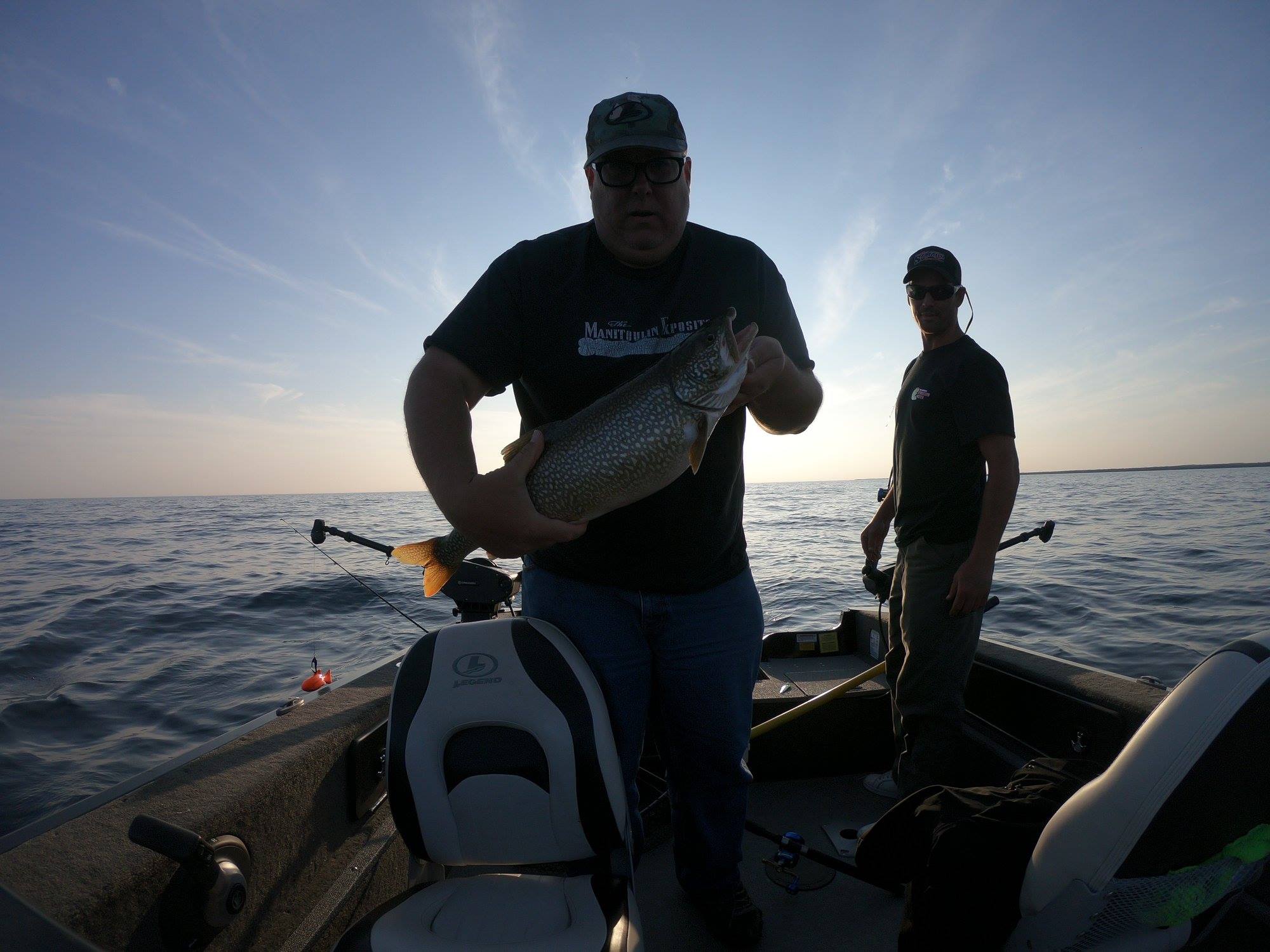
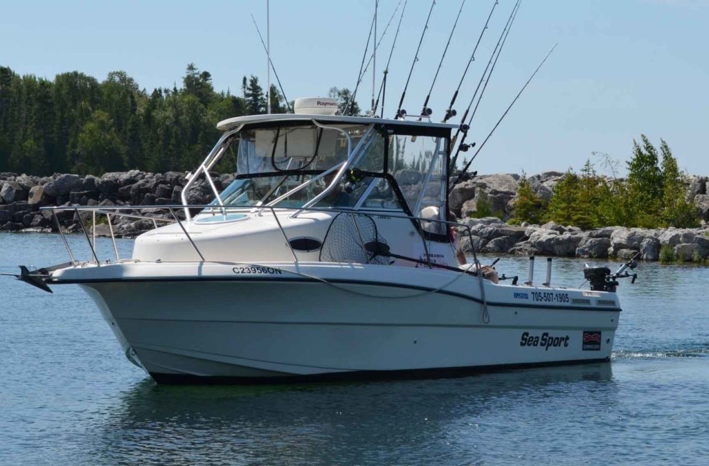
South Baymouth pays homage to the early commercial fisherman and it is still a popular place from which to set out into Lake Huron in search of the fruits of the deep but these days the “fishing fleet” is largely comprised of sturdy boats from which anglers fish deep, using downrigging techniques, to bring their line and bait to the depths where their next meal dwells.

There is a fine small craft harbour just to the south of the ferry dock with, pump out and marine fuel available, in addition to a handy dockside laundromat and sport fishing charter businesses operating from the marina.

The Manitoulin Expositor Salmon Classic is a major attraction for the South Baymouth sports fishing community from the last Saturday in July to noon on the fourth Sunday in August and details for this event can be found on www.fishmanitoulin.com.

The commercial fishing legacy also lives on and often one of the Purvis Fisheries fish tugs can be seen passing in or out of the gap at South Baymouth on its way to set or lift nets.

South Baymouth itself is a colourful town with motel and housekeeping cottage options for staying a while in addition to the South Bay Resort campgrounds.

There are galleries, lots of dining options, local fudge and souvenir shops in this proud little town whose museum, just at the waterfront, is called the Red School House Museum and is (partly) located in the last of Manitoulin’s one room schools that has been preserved as a 1940s – 1950s era working school.

There is a modern exhibit building located on part of what was the schoolyard where visitors can learn of Tehkummah Township’s farming, fishing and military heritage.

A new attraction is the ‘flags of our town’ that adorn a wide length of garden fencing on Highway 6 in the village, just across from Carl Brown’s Store. The people who live there (and produce a significant garden) did some research and found that South Baymouth is home, many of them seasonally, to people whose origins are in the 30 or so countries whose flags they carefully reproduced for this display.

The Old Ontario Department of Lands and Forests (now the Ministry of Natural Resources and Forestry) staffed a busy Great Lakes research station on South Bay, just outside the village, until about 30 years ago when it was deemed surplus to needs and the numerous research buildings and laboratories were torn down and the staff relocated.

Most people involved in the commercial and sports fishing industries in Northern Lake Huron and Georgian Bay believe this was not a useful change; that the research done there was (and still would be) vital to the balance of interests in this Great Lake.

All that remains is the research station’s dock on South Bay, often used by a Purvis Fisheries fishing tug.

Nearby places to stay, eat and play

On the Wiikwemkoong side of South Bay, landmarks are a century-old church, Our Lady of Grace Catholic Church, lovingly built of dressed stone by local stonemasons. Just across the South Bay Road from the church is an ever-flowing spring that delivers cool, clear water (just like the song says) which is also imminently drinkable.

The proud community of South Bay also sports a timber frame community hall and many farms.

In watery South Bay, anglers’ fish for perch, bass, whitefish, salmon, lake trout, rainbow trout and pike.

There is a boat launch at the end of Cowan’s Road, which runs off Highway 6 some eight kilometres south of Manitowaning and right beside Black Rock Lodge.

As previously noted, the boat launch at South Baymouth’s small craft harbour offers access to both South Bay and Lake Huron.

Rogers Creek flows into South Bay flows on its western shore not too far north of South Baymouth and is well known as a pike fishing hot spot, both in its bay and in the stream.

Further north, in Assiginack township and just south of Manitowaning, the fertile farming region known as Clover Valley also has South Bay as a focus and there are several cottage communities on the bay there.

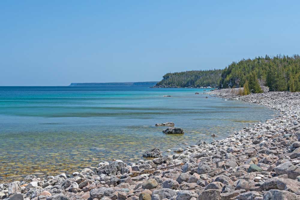
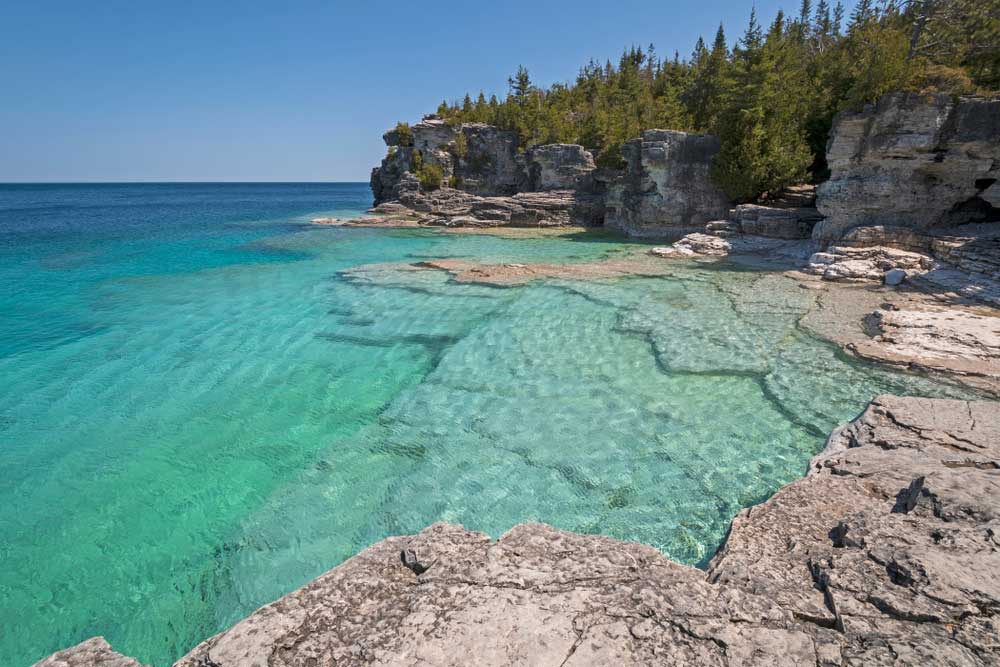
South Bay is part of Lake Huron but (usually) without the wind and storms, but not entirely as this deep bay sometimes hosts its own significant weather events, separate and distinct from Lake Huron.

If you do nothing else at or on South Bay, the village of South Baymouth, where the ferry docks and then leaves to return to Tobermory on her trans-Georgian Bay crossing excursions (from the first Friday in May until the Sunday after the Thanksgiving weekend) is a wonderful place to visit and   ferry watch. The spectacle of Ontario’s most prominent ferry coming into and leaving port is unique in Ontario.

There is a delightful park, perfect for ferry watching, just beside and south of the small craft harbour, that comes complete with modern children’s playground, two heritage range lights (they resemble lighthouses) and a great elevated boardwalk with benches and picnic shelters, all accessible via a wonderful hump-backed bridge that looks directly at the Chi Cheemaun’s shipping channel in vast Lake Huron.

Lake Huron

Lake Huron

Keen fishermen may find:

About 
Lake Huron

Lake, Huron, the second-largest Great Lake, defines Manitoulin Island. After all, if you’re the largest Island in the world in fresh water, you need that fresh water. But, where would you start to write about such a big body of water? Lake Huron is so darn big, 23,000 square miles, with depths up to 750 feet, and its history so rich and varied, it wasn’t like I could really do it justice in a couple of pages.

I decided to focus on the lake as experienced from the south shore of the Island, which is, after all, what people really think about when you say, “Lake Huron.” The North Channel is part of the lake, sure, but it’s a distinct part, a world unto itself; so is Georgian Bay. That limitless sprawl of blue that you see from the south shore, corrugated with big waves and faintly specked with fishing boats, now that’s the true Lake Huron.

So, I packed my wide-angle lens, and set off for Providence Bay. (Actually, I don’t have a wide-angle lens, but you get my point.) Enroute, I thought about Lake Huron, its history, its mystique, its stats. Where to start?

Well, it’s the second largest Great Lake, we all know that, right? It’s also, in my view the greatest of all the Great Lakes.

Sure, Superior is greatest in size, with the most dramatic, precipitous coastline, but it’s a daunting, scary lake, difficult to safely experience unless you’re in a big boat, and even then, you might not be safe. Consider the fairly recent fate of the Edmund Fitzgerald, a shipwreck we all know about thanks to singer songwriter Gordon Lighfoot.

Lake Huron, with its infinite islands and varied shorelines, ranging from long sand beaches in the south, to crazy granite and quartzite in the north, to the limestone flowerpots and bluffs and alvars of Tobermory and Manitoulin, has always struck me as way more enticing and unique than Michigan, Ontario or Erie, but also more hospitable and navigable than its more voluminous sibling to the north.

Huron has no big cities on its shore, unless you count Sarnia. It has dozens of lighthouses, and tens of thousands of islands, including, of course, the world’s largest to be found in fresh water.

The first European to set eyes on Lake Huron was presumably Samuel de Champlain, after navigating the French River to its mouth in 1615 (it’s possible that Etienne Brule got there earlier, but no precise record exists of his travels). Here, Champlain encountered a group of natives who were gathering blueberries; natives, as it happened, from Manitoulin Island.

A few decades later, in 1649, the Huron Nation (from which the lake derives its name,) and the fort established by the French at St. Marie among the Hurons, were routed by the Iroquois in the present-day Midland area in southern Georgian Bay.

Mantioulin’s first Jesuit mission, begun in 1648, was promptly abandoned after these Iroquois raids, and the Island’s Ojibwe and Odawa population scattered far and wide. It wasn’t until the early 1800s that Manitoulin natives returned, and a new mission was established in present-day Wiikwemkoong Unceded Territory.

One of the Island’s more mysterious and sensational events occurred in Lake Huron waters off Wiikwemkoong in 1863. A corrupt fisheries commissioner named William Gibbarb, much loathed by the local first nations people, disappeared while returning to Manitoulin on board a steamer named the Ploughboy; his body was found floating in the lake three days later. No one was ever charged, but people in Wiky have an idea about what might have happened to this day. The story lingers on as “ The Manitoulin Incident” and 20 years ago Wiikwemkoong playwright Alanis King created a play from the story that was presented by the Debajehmujig Theatre Group.

The greatest loss of life on the Great Lakes for its time also occurred in Lake Huron, not far from Manitoulin. In 1882, the poorly designed and overloaded steamer Asia foundered en route to Manitowaning in a storm, killing all but two of its 144 passengers. One of the survivors was Dunk Tinkis of Little Current; the other was a young woman named Christine Morrison. The two teenagers, strangers to one another, but both, uncannily enough, 17, drifted to an island near Pointe Au Baril on a lifeboat, and were discovered the next day by a native couple. There is a monument to the event at Dunk Tinkis’ burial place in the Holy Trinity Cemetery just outside of Little Current.

As I pulled into Providence Bay, parked, and got out to wander around on the beach, it was hard to imagine the sort of storm that might sink a boat the size of the Asia (136 feet). There was a brisk wind blowing this day, but it was out of the north, so the bay was quite calm, and the sun was bright and warm.

The beach at “Prov,” as the community is locally and affectionately known, is certainly one of the Island’s most popular spots, and deservedly so. But having never been the sort of person who likes to laze around on a crescent of sand, possibly exposing himself to skin cancer, I kept my tour short, and then headed for one of my favourite places on all of Manitoulin, the rocky east shore of the bay.

I parked at the marina, and started hiking down this rugged, scenic coast, striding over deep cracks in the fossil-strewn limestone slabs, tiptoeing across wave-smoothed stones, occasionally leaving the tread-marks of my boots in small pockets of sand.

Eventually I reached the light of Providence Point. It’s an unmanned light on a tripod tower. Just in front of it, though, you can see the foundation of the original lighthouse which once stood here.

According to the book Alone at Night, the “Prov” lighthouse was built in 1904 and was manned until 1953. In 1973, it mysteriously burnt to the ground. Some believed it was struck by lightning, but nobody seems to want to name names. The general theory, though, is that it was a local person who had some sort of gripe with the government.

After standing on the foundation of this lighthouse, gone now almost 50 years, I started hiking back to the marina.

Photos of beautiful Lake Huron

The marina was hopping: boats pulling out, boats pulling in. I spoke briefly with a father-daughter team fishing, from Sudbury, who were trailering their boat into the water, setting out to do some salmon fishing. They’d been skunked the last time they went out fishing from Prov but told me they’d had success in the past. I wished them luck, and watched as they struck out onto the bay, rods jutting from stern of the boat. Perhaps they’ll be entering The Manitoulin Expositor Salmon Classic (last Saturday in July through the last Sunday in August) and trying to win some of the $30,000 cash prize money for a championship salmon.

A big, weather-beaten boat was tethered to the end of the pier, out past the slips. I had a hunch what it was but had never seen it up close. I wandered out to get a better look, and sure enough, it was the Blue Fin, the venerable fishing tug operated by the Purvis family in Burnt Island.

Incredibly, this riveted steel boat has been in been in service since 1930, the year that the grandfather of current Purvis patriarch George Purvis had it built.

Out past the end of the pier, you can see another old section of dock, stuck out there like a sad, skeletal island. The pier obviously extended much farther at one time.

I talked to the harbourmaster about this. He showed me a photocopy of an old newspaper article, from the Sudbury Daily Star; dated May 6, 1952. “Providence Bay hit by tidal wave,” was the headline. Although the article didn’t go into details of damage done to the dock, the harbourmaster said it was his understanding that “that was when the pier got broken up. It used to be all one piece.”

Remember what I said about Lake Huron being so much more hospitable than Lake Superior? Maybe I should be taking that back. After all, Providence Bay itself was reputedly named after a ship-wreck. The story goes that some shipwrecked sailors washed up on its sandy shore, and thanked providence for their good fortune. Other  stories tell of the “sailors’ grave,” a small grotto-like area amid tall rocks, now encircled by Providence Bay Park.

I’d seen this natural sculpture before and told myself I should really go and pay my respects before heading home.