Conservancy has spent decades helping you experience Manitoulin’s nature

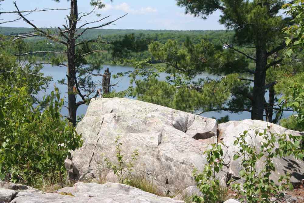
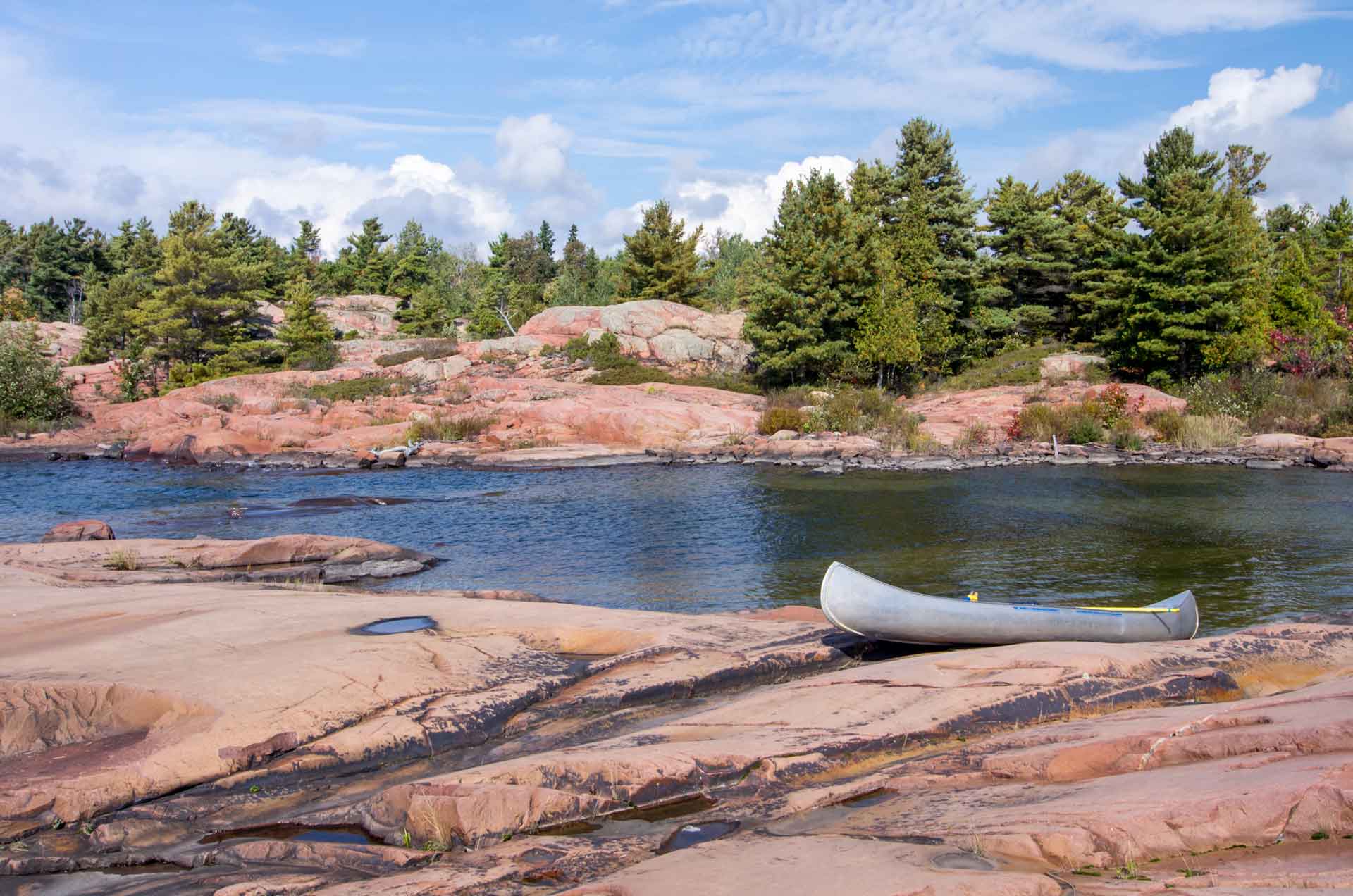
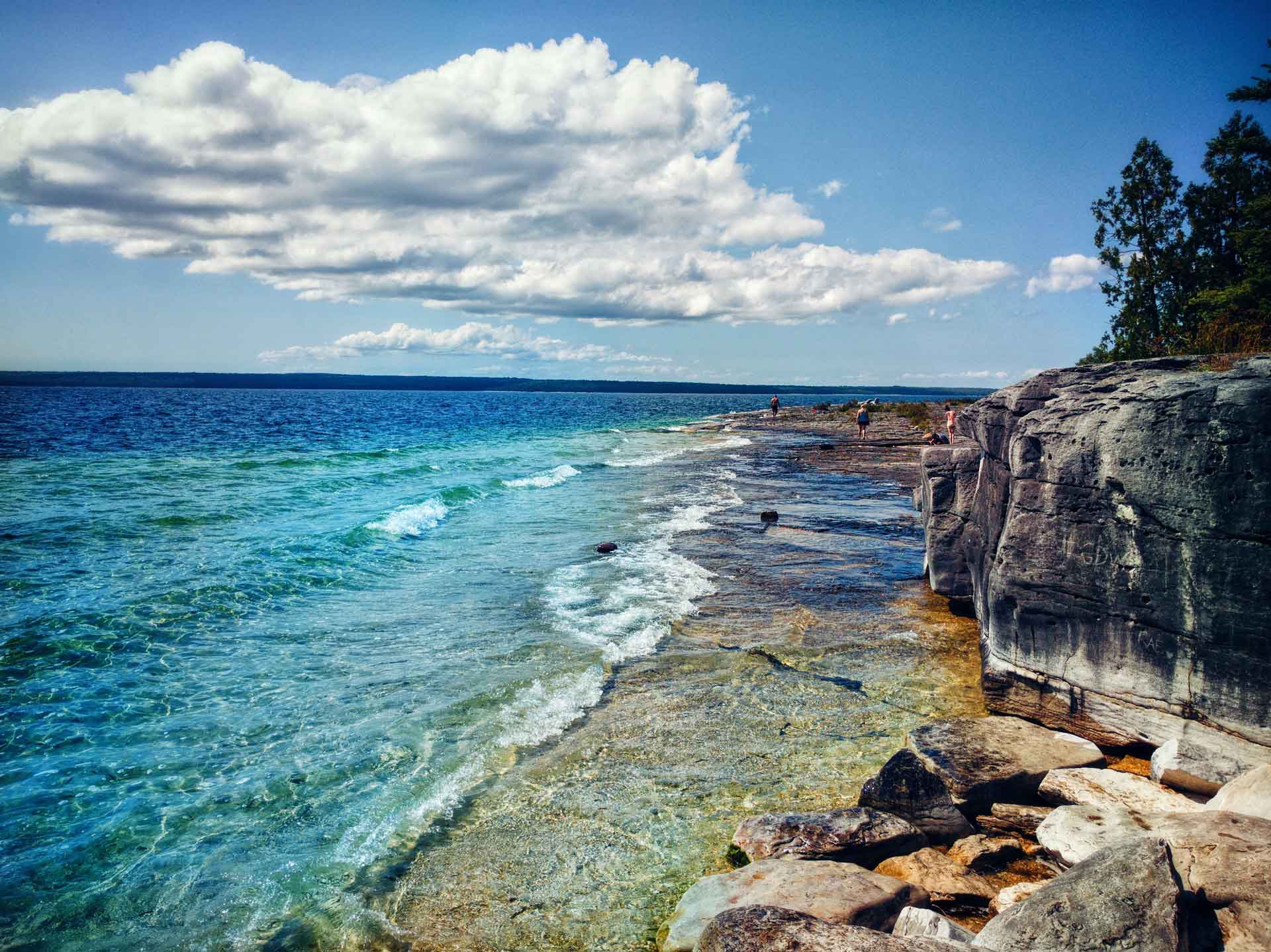
Rocky lookouts along Manitoulin trails afford the hiker magnificent vistas.

by Warren Schlote

Nature has drawn many people to Manitoulin Island for generations. But this place’s abundance of pristine lakes, forests and rocky lookouts is no accident—groups like Escarpment Biosphere Conservancy (EBC) have spent decades of time and millions of dollars preserving the Island’s greatest natural treasures.

More than 25 years since it began in 1996, EBC now protects 4,905 acres of land on Manitoulin Island (7,400.3 acres if you include its land reserves in the LaCloche mountains, just minutes north of Manitoulin). That’s especially significant because the vast majority of Manitoulin’s land is privately owned.

EBC executive director Bob Barnett spends the better part of an hour with this reporter, leafing through his property records. His list of land purchases runs in chronological order from the mid-’90s to the present day. 

Every property has a story, and as Mr. Barnett scans the list, expressions like “wow,” “exciting” and “oh my goodness” frequently escape his lips.

“This work is a never-ending source of joy to me. The people that have donated money or their land, you can tell they’re living their lives properly and they’re just a joy to work with,” says Mr. Barnett.

Although EBC is headquartered in Toronto, its connection to Manitoulin Island runs deep.

Manitoulin falls within the geography of the Niagara Escarpment, a landform that stretches from upstate New York and right across southern Ontario, before re-appearing on Manitoulin Island and Cockburn Island and arcing back southward. It ends as far southwest as Milwaukee.

But many see the escarpment as only stretching from Niagara Falls to the Bruce Peninsula, something Mr. Barnett and his colleagues have struggled with. In 1996, they were volunteering with the Bruce Trail Conservancy (which looks after the legendary 900-kilometre hiking trail that connects Tobermory to Niagara-on-the-Lake).

The trail group focused on the land along the Bruce Trail, but Mr. Barnett and his colleagues dreamed bigger, seeing the importance of the Niagara Escarpment ecosystem as a whole. Even Ontario’s official Niagara Escarpment Plan only covers the eastern edge of the Bruce Peninsula.

But why is the escarpment so special? Since 1990, it’s been designated as a UNESCO Biosphere Reserve, one of only 19 in Canada. Its special qualities include the longest stretch of mostly forested land in southern Ontario, the greatest diversity of geographic landforms in southern Ontario, the highest level of species diversity among all of Canada’s biospheres, and being an important habitat source for about 70 species at risk.

That biosphere designation also ends at Tobermory, but for Mr. Barnett and the founders of EBC, it was only natural, if not urgent, to include the Island in their conservation efforts.

“Right from the get-go, we knew Manitoulin Island was important,” he says. The group’s history of land acquisitions bears out that importance.

**

EBC’s first project on Manitoulin Island was the famed Cup and Saucer, a hiking trail that has become one of Manitoulin’s premier attractions. Mr. Barnett’s group bought 300 acres of it in 1999, then added 47 more acres in 2000. Those were the third and fourth nature reserves EBC had ever purchased.

Escarpment Biosphere Conservancy now protects 7,400.3 acres of land on and near Manitoulin Island.

In recent years, EBC has added improved signage to the trail and a massive parking lot off of Highway 540. Despite the massive new parking facilities, the Cup and Saucer is so popular that it occasionally overflows with hikers’ cars on the busiest days of the summer.

The popularity of the Cup and Saucer highlights EBC’s philosophy toward conservation. 

EBC lands often contain rare habitats or species at risk, both of which could be harmed with any human activity. But despite that, Mr. Barnett says it’s important to allow people to access protected areas.

“We put a big focus on trying to demonstrate how much value nature is adding to our lives,” he says. “Nature is providing quite a wide range of services to humans. We want to improve those nature services and share knowledge with people about how important nature services are.”  

Those nature services can include things like wetlands absorbing floodwater or trees removing carbon dioxide from the air. A 2009 report for the Ontario Ministry of Natural Resources said ecosystem services have a value of about $84.4 billion per year in southern Ontario alone!

Prioritizing public access sets EBC apart from some conservation organizations. The Nature Conservancy of Canada (NCC) owns far more land on Manitoulin and Cockburn Islands than EBC, but Mr. Barnett says he doesn’t often hear of that group encouraging the public to use its lands.

“EBC is the major driving force to improving access and getting more nature conserved up there,” he says. “That’s not a criticism by any means; I appreciate that (NCC) wants to help keep nature natural but … we put a big focus on trying to demonstrate how much value nature is adding to our lives.”

The EBC website carries a listing of all its properties on Manitoulin Island, alongside photos and descriptions of the geography, flora and fauna that make each site special. Trying to imagine what a rare savannah landscape would look like in Northern Ontario is one thing; it’s another to venture to EBC’s Bidwell Bog and experience it in person.

Manitoulin Island is very much part of the Niagara Escarpment.

“The provincial government has pretty much stalled when it comes to building provincial parks,” he says. “When it comes down to it, there’s only two groups that are working actively to create nature reserves on Manitoulin: us and the Nature Conservancy of Canada.”

There are challenges to this mission. Land costs are ever-increasing, making it harder for small organizations like EBC to afford purchasing their most sought-after lands. This pressure persists, even though the Canadian government has launched programs to encourage land preservation.

Of course, no conservation work would be possible without local champions. One of the best-known conservationists on Manitoulin Island is Dr. Roy Jeffery, a physician who has offered major help toward purchasing, maintaining and enhancing EBC’s properties, particularly its trail systems.

Dr. Jeffery’s name comes up several times as Mr. Barnett lists the 73 properties on Manitoulin that EBC either owns or stewards. Dr. Jeffery offered to match donations on EBC’s massive fundraising effort toward buying Heaven’s Gate, a 2,140-acre property in the LaCloche Mountains north of Manitoulin.

“He’s been so instrumental in a lot of our work on the Island,” Mr. Barnett says. “Dr. Jeffery and his family are very generous. Heaven’s Gate wouldn’t have been possible without them.”

One of EBC’s reserves near Manitowaning is on land donated by Dr. Jeffery and his wife Kathy, with that reserve appropriately carrying the Jeffery name. It’s near Fossil Hill and McLean’s Park on New England Road.

Mr. Barnett, as always, says he’s gazing toward the future. In early 2023, he says he has three properties that EBC is actively working on acquiring. “There might be a fourth,” he says, and a few moments later, “maybe a fifth.”

In his usual fashion, he declines to go on-record with the details of these latest projects, keeping up the suspense as a “wait-and-see” for now.

He says he wants to increase EBC’s holdings along Highway 6, making it easier for ferry-bound traffic to pause and experience nature as they cross the Island.

Venture into the Bidwell Bog to experience an interesting landscape.

There’s also a worldwide push on, thanks to a FedNor grant, to promote Manitoulin Island internationally as an excellent tourist destination. Dr. Jeffery, EBC board member Ted Cowan and project manager Sean O’Hare are getting advertisements in European and Scandinavian countries to boost interest in the Island’s trails.

All that extra interest means Manitoulin’s trails and nature reserves will be in tip-top shape this year, ready for even more seasonal visitors. 

Every EBC property offers something a little different, and it will take you several Manitoulin Island trips to experience them all. That leaves just one question.

Which one will you visit first? 

The consuming passions of Doug Smith

The consuming passions of Doug Smith

Manitoulin Transport founder finds Gore Bay the best place to be

Nestled between two high, prominent ridges of the Niagara Escarpment on Manitoulin’s northwestern coast and approached down gently sweeping hills, the town of Gore Bay and its namesake V-shaped inlet slowly reveal their enduring allure on these sheltered shores of the North Channel of Lake Huron.

  Incorporated in 1890, Gore Bay’s development had proceeded quickly after the Treaty of 1862 opened the Island to settlement. Homes, stores, hotels, a blacksmith, liveries, sawmills and receiving docks for the steamships that brought passengers, mail and supplies and took lumber and fish to southern markets were established – at the turn of the twentieth century, the growing settlement was a boomtown of industry.

  Enterprise built this town. When Fred Smith arrived here in 1898 at the age of 23, leaving his parents and siblings behind in eastern Ontario, Gore Bay was prospering and the young entrepreneur saw it as full of opportunity. Fred immediately started a creamery on the waterfront with local businessmen, and Fred’s brother William arrived a year later, at age 15, to help out. After the great fire of 1908, the brothers took over a general store that became Smith Brothers’ General Merchants, for decades selling everything from groceries and bulk supplies to clothing, hats and footwear for the whole family, right on the main street. 

  It was a series of prescient business acquisitions, from the Merchants’ Dock Company and the creamery to the general store in the 1920s that propelled Fred and William’s retail business into wholesale by the 1950s. Wholesaling became the means of expansion for Fred’s son, R.W. ‘Bill’ Smith, in the 1920s and for Bill’s son, Douglas, who joined his father’s business in 1955 after becoming disillusioned with a budding banking career in Toronto. By 1960, Doug Smith had founded Manitoulin Transport, now the most extensive transportation network in North America, still headquartered in Gore Bay sixty years on.

  “When I started Manitoulin Transport, the head of some big accounting firm told me I didn’t have a chance,” smiles the tall, slender and soft-spoken businessman sitting across the table in a wooly plaid shirt. “It was a struggle, sure.” 

 “When I started Manitoulin Transport, the head of some big accounting firm told me I didn’t have a chance,”

The company continuously had to adapt in very challenging environments for transportation. When their wholesale grocery trade began to flourish in the 50s – customers included every commercial outlet on the Island and in Killarney, Espanola, Whitefish Falls and Cockburn Island –   they “had to” slash their competition. National Grocers, a big supplier that brought produce to the Island as well as groceries was cutting into the Smiths’ business. 

  To compete, Doug Smith bought a Ford F-900 truck in 1957, custom built and insulated to transport perishables – the first of many transport innovations pioneered by him —  and began driving down to Toronto’s Ontario Food Terminal, heading back north overnight with produce fresher than National Grocers’. Upon delivery in Gore Bay, the truck would be loaded with fresh-killed frozen turkeys from the Manitoulin Turkey Co-Operative and driven to Toronto’s Royal York Hotel and Eaton’s department store restaurants. After the acquisition of local Hill’s Transport got them a couple of trucks and a Class A license for the Toronto-Manitoulin Island run in 1960, the new company, Manitoulin Transport, was born.

  The myriad rules imposed by the Ontario Highway Transport Board that regulated the trucking industry until 1988 required endless applications, hearings and witnesses to prove the ‘necessity and convenience’ of each route. “When trucking was de-regulated, the competition was so fierce, many companies couldn’t survive and chose to sell,” says Mr. Smith. “We chose to expand: we acquired more terminals and partnered with more brokers and owner-operators, lessening the competition for our services.” 

  Manitoulin Transport is now within the Manitoulin Group of Companies – whose CEO is Doug Smith’s son, Gord – encompassing global transportation services worldwide from supply chain management, warehousing, forwarding, customs brokerage, crating and packaging to time-critical deliveries. Two hundred and fifty employees work in the sprawling Head Office in Gore Bay, 700 tractors (those familiar red trucks with the iconic Manitoulin logo) and 1500 trailers operate out of more than eighty terminals in Canada, with partners and brokers in the U.S., Asia and Europe. In 2008, Doug Smith was invested into the Order of Canada, this country’s highest civilian honour, in recognition of his work as a pioneer and innovator in Canada’s trucking industry.

Two hundred and fifty employees work in the sprawling Head Office in Gore Bay, 700 tractors (those familiar red trucks with the iconic Manitoulin logo) and 1500 trailers operate out of more than eighty terminals in Canada, with partners and brokers in the U.S., Asia and Europe.

Nowadays, Doug Smith has other interests: in addition to his lifelong passion for advancing the family business, the founder of Manitoulin Transport has an abiding love for his hometown of Gore Bay and a keen interest in its wellbeing. At 86 years of age, Doug Smith has not given a thought to retirement, perhaps harkening back to his grandfather Fred’s words: “Keep going til you’re ninety and success will be yours!” He maintains his office at headquarters in town where today he is engaged in reviewing the town’s plans for new docks in the marina and some Swing Bridge replacement ideas sent by a friend; Maureen Dumond, his executive administrative assistant for the last twenty-five years, is his right hand.

  The zeal that has driven Doug Smith’s business success also informs his ideas about Gore Bay. “We want the town to survive,” he says. It’s been a long haul from the boom days of lumbering and fishing, milling and shipping, to the Island’s present-day tourism-driven economy. The priorities of the town have changed. “Tourism is a good direction for the Island; small towns have been suffering, tourism is the only thing we’ve got left.” 

  So, Mr. Smith, who was born and raised here and was only ever away for a couple of years, started to partner with town council on improvement projects. “I love it here,” he says. “It’s a beautiful place, there’s hunting, fishing, and I know most of the people in town.” An avid boater “since age five,” he’s particularly partial to the waterfront and anchors his boat in the marina. “We motored our boat down to Florida one year and I looked around and thought: the North Channel is so much better.”  

  Ron Lane, former mayor of Gore Bay (2010-2018), remembers partnering with Doug Smith on town projects during his eight-year tenure. “We had a close working relationship,” he says. “We’d talk about the town together; we’d find ways to fund ideas for improvements; we talked about how the town should look good.” 

  The first partnership rebuilt the marina’s old shower house. The new breakwall that juts into the bay at a cost of $1.4 million was next, and the Community Hall renovation project that transformed the imposing limestone building into a more accessible public space that is also able better to accommodate the Gore Bay Theatre’s award-winning annual presentations. The Arena, built after WWII, needed refurbishing. By the time of the town’s 125th anniversary in 2015, many of the town’s historical exteriors had been restored, the main street and the waterfront spruced up. The town’s prized boardwalk was rebuilt and extended; two walking trails were established on the East Bluff with spectacular views of the town across the bay. 

 “I love it here,” he says. “It’s a beautiful place, there’s hunting, fishing, and I know most of the people in town.” An avid boater “since age five,” he’s particularly partial to the waterfront and anchors his boat in the marina. “We motored our boat down to Florida one year and I looked around and thought: the North Channel is so much better.”  

“Doug never wants credit,” says the former mayor. “The only time he gave in was allowing his name to appear on a plaque at the breakwall. His support has helped tremendously to beautify the town; it’s not just about beauty but also about having a working town with attractions and facilities for residents, visitors and the young families who move here to work at Manitoulin Transport, too, our biggest employer.”

  The Smith Family Foundation supports the communities of Manitoulin and Northern Ontario with donations to the Gore Bay health centre, the Fish and Game Club, to charitable organizations and for a future fitness centre in the town. More recently, there are discussions about new park space on the waterfront, new tennis courts, expansion of the marina and last year a splash pad and playground were installed by the boardwalk. 

  “Doug is a numbers guy,” adds Mr. Lane. “He thinks long-term in his projects – twenty, fifty years from now – planning for the future, how to keep the town viable, a great place to live. He looks at what services are lacking; he’s a philanthropist with a sense of importance about Gore Bay. We’re very lucky to have him.”

  “I first played in a band in 1947,” says Mr. Smith, musician. “It was at the annual Sailors’ Ball for workers on the Great Lakes. A band from Wiky was going to play, but there was a big storm, they didn’t make it so I played in the replacement band. I was fourteen.” Doug Smith, on clarinet, and Bob Wiseman, on trumpet, started the Manitoulin Swing Band in 1948 and played dances until 1965: “1948 to 1965 we had sheet music, after 1965 the sheet music wore out and the band had to learn to play by ear.”

  Recently, the Swing Band, with additional players, has performed locally, such as at last summer’s opening of Doug Smith’s newly acquired and refurbished resort, stunningly positioned below the East Bluff. The old lodge, a classic of its era but sadly neglected, had been up for sale since 2016. “I wanted to maintain the resort that I’d known since I was a child,” explains the clearly sentimental buyer, who has renamed it the Inn at Gore Bay. 

  If a beautiful old town property is at risk of losing its longtime character, its old-fashioned appeal, Mr. Smith might very well decide to buy it, out of respect. 

  www.gorebay.ca; also on Facebook 

  ‘The Early Years of Gore Bay,’ by John McQuarrie, is available at Gore Bay’s two pharmacies and at the Expositor Bookstore. 

  www.manitoulintransport.com 

   ‘Manitoulin: A Canadian Trucking Trademark,’ by Josephine Griffith, a detailed history of the Smith family businesses and of early regional transportation, is available in the Gore Bay library.

Article by

Isobel Harry

Isobel Harry

Isobel Harry is a photographer and writer who has also worked extensively in the field of human rights advocacy. Her photos have been widely exhibited and she has published articles in many magazines; as programmes director and executive director for PEN Canada for twenty years, she worked on behalf of the right to freedom of expression internationally. Now living on Manitoulin Island, Isobel works as a freelance writer and photographer and is a frequent contributor to the weekly Manitoulin Expositor newspaper and the annual This is Manitoulin magazine. Her interests lie at the intersection of arts, culture and human rights.

M’Chigeeng: Ojibwe Cultural Foundation Honours Traditions Old and New

M’Chigeeng:

Ojibwe Cultural Foundation Honours Traditions Old and New

  Fascinating and important encounters await visitors to M’Chigeeng: the First Nation is a vigorously forward-thinking community that honours its traditions while forging educational, cultural and health and wellbeing institutions to serve its community with standard-setting schools, cultural spaces, social services and businesses.

  To experience M’Chigeeng is to learn the ancient history of the First Peoples of the Great Lakes Region of Northern Ontario, the traditional crafts still practiced today, contemporary artistic expression and the grace and welcome of the summer powwow – all within a growing commercial hub of restaurants, gas stations and shopping choices nestled among the Lakeview and Kenjgewin Teg schools (including a new trades school), the health centre and the impressive cultural institution that is the Ojibwe Cultural Foundation (OCF).

  At the crossroads of Highways 540 and 551, in the heart of the community, the Ojibwe Cultural Foundation’s evocative circular building houses the Museum, a beautifully curated space that displays ancient scrolls, porcupine quill boxes, ash and sweetgrass baskets, jingle dress regalia, pottery and antler carvings, pieces of historical significance and spiritual meaning. The Healing Lodge is a tranquil, circular wood-lined chamber with seating around a fire; a carved wooden tray holds the sacred plants of sweetgrass, sage, tobacco and cedar for smudging ceremonies and healing circles.

 “We have a mandate to represent the culture, and the Museum presents culturally authentic interpretations of Anishininaabek history, cultural practices and beliefs,” says Anong Migwans-Beam, OCF’s executive director

The Ojibwe Cultural Foundation began life in 1974 as an educational and cultural resource centre in a tiny wood frame building. Through the efforts of Mary Lou Fox, James Debassige and others who led the fundraising, the spacious new building was constructed and opened in 1999. Sophie Corbiere, finance officer, started working with the OCF as a summer student “in ’77 or ’78,” she says. “We brought people together around the culture, and ceremonies.”

  “Each director has brought different strategies into the OCF, but bringing back traditional teachings is what they have in common, and what works. Alan Corbiere brought people in to learn about history with important presentations. Anong [Migwans-Beam] brings her art experience, and shares the culture on a regular basis.”

  “We have a mandate to represent the culture, and the Museum presents culturally authentic interpretations of Anishininaabek history, cultural practices and beliefs,” says Anong Migwans-Beam, OCF’s executive director and an accomplished artist and educator. “The OCF represents the culture through language, art, stories, food, crafts and books.” The gift shop offers intriguing art, jewelry, posters and t-shirts for sale.

  The OCF is building an extensive archeological collection, originally placed there at the request of the United Chiefs and Councils of Mnidoo Mnising (UCCMM), moved from storage in Sudbury, and recently received Canadian Heritage funding for a geothermal heating and cooling system for the growing archive. A teaching kitchen for traditional foods is another project on the horizon . 

  The children’s Ojibwe language immersion school is run by M’Chigeeng’s Kenjegwin Teg Educational Institute and hosted at the OCF. “It’s nice to hear kids learning the language,” says Ms Migwans-Beam, “and the ceremonies, to hear them singing and drumming.”

The OCF is building an extensive archeological collection, originally placed there at the request of the United Chiefs and Councils of Mnidoo Mnising (UCCMM), moved from storage in Sudbury, and recently received Canadian Heritage funding for a geothermal heating and cooling system for the growing archive. A teaching kitchen for traditional foods is another project on the horizon . 

Consulting on cultural or clan teachings and traditional foods and medicines, Leona Nahwegahbow is the Elder in Residence, available to meet with anyone who asks. She speaks with visiting university students, with the immersion school students and she gets “translation requests from all over.” Ms Nahwegahbow attends when requested in the Healing Lodge.

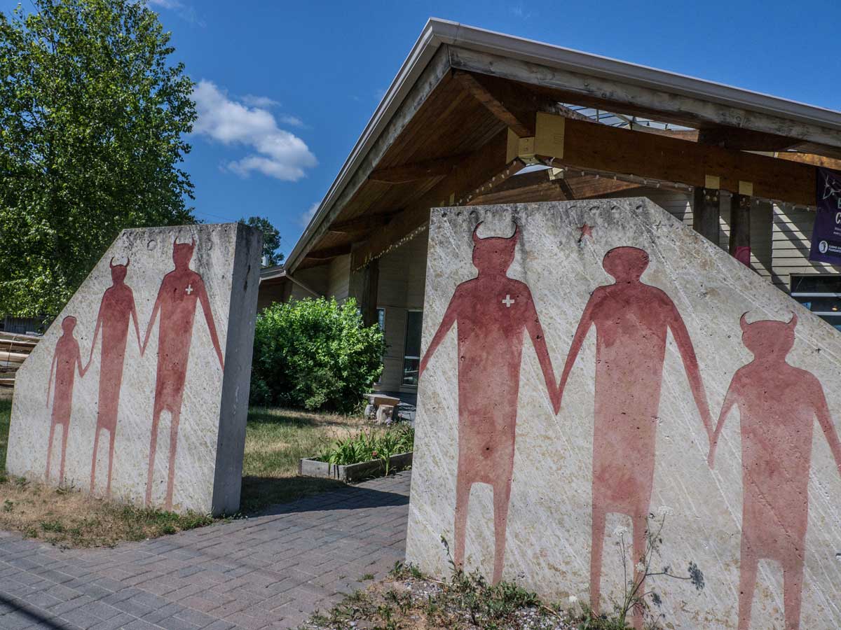
  A small studio houses M’Chigeeng’s Ojibwe-language radio station, GIMAA Radio, host to CHYF-FM, 88.9 on your radio dial.  “The radio station was founded by my dad,” explains Ms Migwans-Beam, whose late father, Carl Beam, became the first artist of Indigenous ancestry to have his work purchased by the National Gallery of Canada as contemporary art; his much-photographed ‘Bringing the Family Together’ painting is incised into the stone gates that  adorn the OCF’s front entrance.  

  Steve Radulovic is the new Director of GIMAA Radio, with a vision for “implementing more live radio, bringing in more people to engage our audiences.” Previously, programs were pre-recorded then played on air. 

  “One of our largest groups of listeners are learners of Anishinaabemowin, so we will have a bit of English, a bit of Ojibwe, to learn vocabulary. The radio is great too for those who just need to hear the language spoken more.” OCF’s sound archives are being digitized to provide a wealth of information, ideas and history for GIMAA Radio podcasts in future. While the station only has an 8km broadcast range, programs are available online at gimaaradio.com and there’s a Facebook page. 

  During the summer, the OCF holds weekly public events: fish pie and scone making, storytelling, sweet grass picking and introductory art studio sessions, such as in etching and ceramics.   “It’s a traditional open studio. We’re open to everyone,” says Ms Migwans-Beam, “even those who just come to observe. It’s a place where contemporary ideas and traditional crafts come together.” 

  Surrounded by her beads, quills and tools, Darlene Bebonang has been making and beading deerhide moccasins, gloves, dresses and vests and teaching the craft for 25 years.  She took her first crafting course at OCF “in ’94-’95,” she says. “I was a student then, now I’m a teacher.” Aspiring beaders are taught by Ms Bebonang in OCF’s studio.

“One of our largest groups of listeners are learners of Anishinaabemowin, so we will have a bit of English, a bit of Ojibwe, to learn vocabulary. The radio is great too for those who just need to hear the language spoken more.”

There’s much more to explore in M’Chigeeng: Aboriginal Experiences at the Great Spirit Circle Trail across from Lillian’s Crafts and Lillian’s Museum’s collection of quill boxes and baskets made by renowned weavers and artists. Many art practitioners exhibit at the OCF and others in their studios and galleries. Neon Raven Art Gallery is a treasure trove of art by Ann Beam, Carl Beam and Anong Migwans-Beam. At the crossroads is the working studio of Blake Debassige and up the hill is Blair Debassige’s Nimkee Gallery. Further east is Weengushk Film Institute, a film and television training centre dedicated to Indigenous youth founded by filmmaker Shirley Cheechoo, currently Chancellor of Brock University. Weengushk is organizing an Indiginous film festival at several Island venues this July 13-15.

  For refreshment there’s Maggie’s Café, Bear Spirit Café, Seasons Restaurant and Abby’s Sunday Brunch; there are several snack bars and convenience stores, a large hardware store, and coming soon, a large grocery store. The quiet tree-lined sand beach behind Lillian’s, with a day pass and a picnic, beckons with an expansive view over West Bay and there is a beautiful Niagara Escarpment hiking trail behind the ball park. The West Bay beach, a community place, is just beside the street leading to Manitoulin Secondary School from the main intersection.

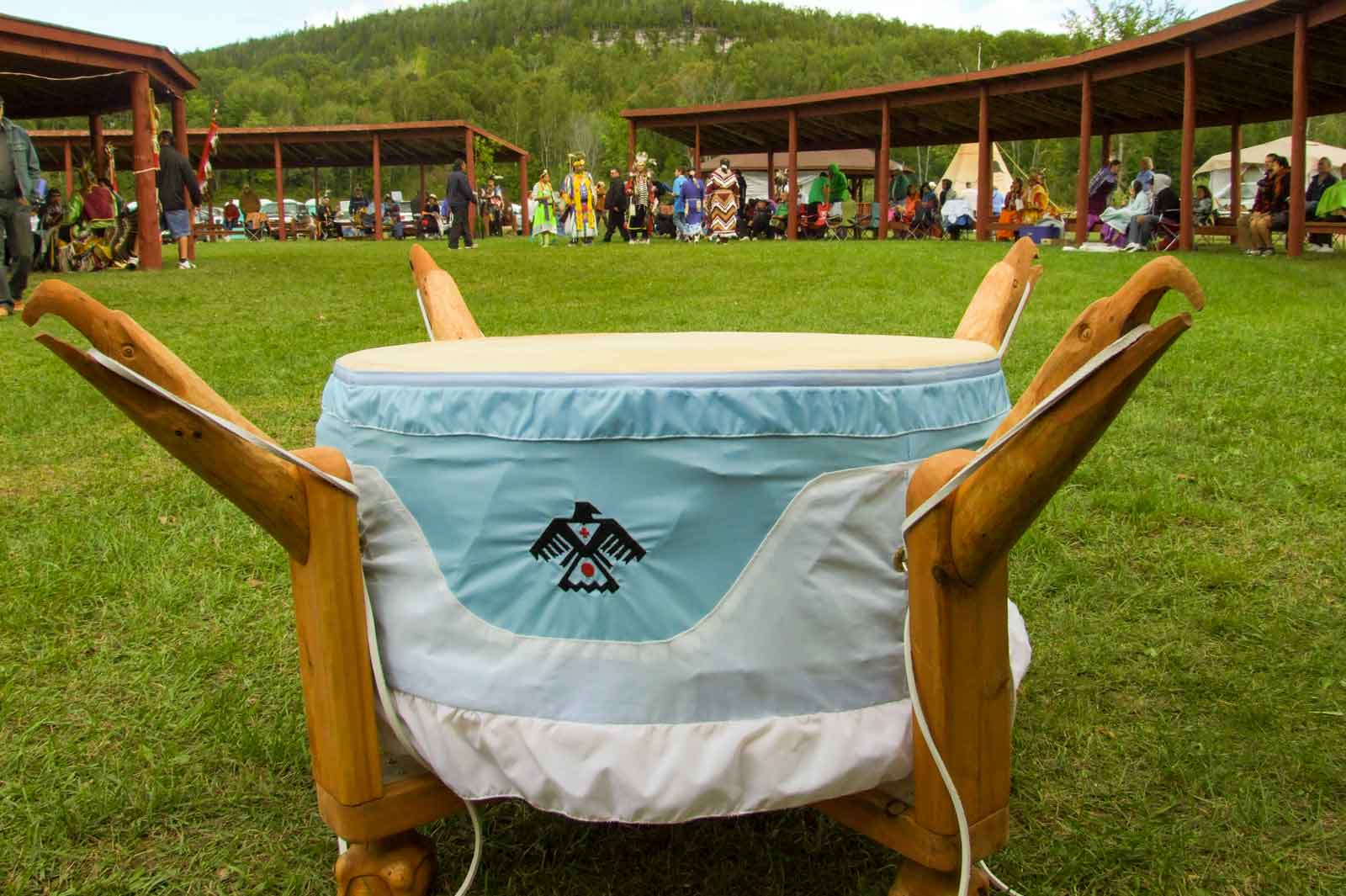
  The annual powwow is on the Labour Day weekend, officially ending the Island’s powwow season in grand style. It’s a cultural feast of dance and drum, food, crafts, colour, sound and community spirit, a welcoming celebration of the timeless and vital culture of M’Chigeeng First Nation.

  Ojibwe Cultural Foundation, 15 Hwy 551, M’Chigeeng. Telephone 705- 377-4902. https://ojibweculture.ca and on Facebook.

M’Chigeeng First Nation: www.mchigeeng.ca

Article by

Isobel Harry

Isobel Harry

Isobel Harry is a photographer and writer who has also worked extensively in the field of human rights advocacy. Her photos have been widely exhibited and she has published articles in many magazines; as programmes director and executive director for PEN Canada for twenty years, she worked on behalf of the right to freedom of expression internationally. Now living on Manitoulin Island, Isobel works as a freelance writer and photographer and is a frequent contributor to the weekly Manitoulin Expositor newspaper and the annual This is Manitoulin magazine. Her interests lie at the intersection of arts, culture and human rights.

Saving the Cup and Saucer

Saving the Cup and Saucer

Community Resilience and Ingenuity at Work

Almost everyone who knows Manitoulin Island, residents and visitors, has trekked the Cup and Saucer Trail, one of the Island’s most well-known natural attractions, its twelve kilometres of woodland paths leading to 70 vertical metres (230 feet) of Niagara Escarpment cliffs and spectacular views which were visited by over 20,000 hikers last year.

But hearts sank on May 22, 2017 on reading The Manitoulin Expositor’s online headline announcing the unimaginable: “Cup and Saucer trails closed for now; future of the attraction in jeopardy.”

Minds boggled. Not only is the C and S famous, it is beloved. Previously, the trail had been made available through the efforts of the Manitoulin Tourism Association and the donation of the use of part of their properties by Don Eadie Construction Ltd., Randy Noble, Meredith Chandler and the Escarpment Biosphere Conservancy (EBC).

A company that had hosted the entrance and the parking lot announced “with a heavy heart” that they where going to repurpose that property and it would no longer be suitable as the Cup and Sauce trailhead.

While readers were still processing the grim announcement, they heard the very next day from the Town of Northeastern Manitoulin and the Islands’ (NEMI) Mayor Al MacNevin, in whose jurisdiction lies the Cup and Saucer. Via press release, the mayor declared: “Council is going to take immediate action to find a solution to this problem … We intend to work closely with our community partners and the parties directly involved to see if we can broker a solution, or find an alternative trail entrance and parking area.”

“An emergency meeting was held by the mayor and council of the Town of Northeastern Manitoulin and the Islands Tuesday night in which a partnership was formed between the municipality and the Escarpment Biosphere Conservancy (EBC) to create a new access to the Cup and Saucer hiking trails.”

Just one day later, on May 24, the newspaper reported: “An emergency meeting was held by the mayor and council of the Town of Northeastern Manitoulin and the Islands Tuesday night in which a partnership was formed between the municipality and the Escarpment Biosphere Conservancy (EBC) to create a new access to the Cup and Saucer hiking trails.”

“We hope to have the trail re-opened by early summer,” Mayor MacNevin concluded.
The Town of NEMI and the Escarpment Biosphere Conservancy – which owns 300 acres of land at the Cup and Saucer, including most of the cup, a large portion of the saucer and most of the adventure trails – immediately began putting into effect a contingency plan they’d drafted together in earlier discussions.

Dave Williamson, NEMI’s Chief Administrative Officer, remembers well that May long weekend: “We found out about the closure of the trail entrance on the Friday, and immediately contacted the other landowners, Randy Noble and Meredith Chandler, who assured us of their continuing support for the trails on their properties; we contacted EBC’s Bob Barnett and I met with Roy Jeffery [EBC’s Manitoulin trails steward] on Sunday. The MTO (Ontario’s Ministry of Transportation) was contacted for temporary approval of a trail entrance off Highway 540, on EBC property.”

Dr. Jeffery’s first concern was to acknowledge the traditional lands on which the Cup and Saucer is situated, and to that end, Norman McGraw and other Elders from Aundeck Omni Kaning and Elders from M’Chigeeng First Nations were invited to carry out a ceremony to ask permission of the spirits of the land to create a new trail.

Bob Barnett, EBC’s director: “When emails started coming in the day the trail was closed, it was laudable that NEMI was able to jump in and get things moving right away. I called Roy and we agreed to just get it done.” 

Dr. Jeffery’s first concern was to acknowledge the traditional lands on which the Cup and Saucer is situated, and to that end, Norman McGraw and other Elders from Aundeck Omni Kaning and Elders from M’Chigeeng First Nations were invited to carry out a ceremony to ask permission of the spirits of the land to create a new trail.

“It’s a very beautiful site,” says Dr. Jeffery, “that goes through several ecological zones.”
When the news of the trail closure hit, “Facebook groups and all kinds of people emailed wanting to help out. The new trail was created by volunteers and EBC members who did intense sessions to create ways up steep embankments; we replaced ladders with stairs, widened the trail, mitigating dangers to the ecology,” Mr. Barnett recalls.

Dave Williamson: “Public Works from the Northeast Town then installed culverts and removed trees for the parking lot while EBC volunteers blazed a new trail to connect with the old. In about a week and a half we had re-opened access to the trail.”

The collective sigh of relief was heard Island-wide and far beyond.

With interest in the Cup and Saucer intensifying, parking is deemed adequate for now, says NEMI’s CAO: “The first parking lot, for 35-40 cars, has been enlarged with a second that accommodates a further 40-50 cars, so there’s more parking than before. The MTO has installed more ‘No Stopping’ signs as people will no longer be allowed to park on the highway.”

 “We have secured the land as public domain, available to the public in perpetuity,” Mr Williamson noted.

The new entrance is located about 3 km west of the Highway 540-Bidwell Road intersection (or about 4 km east of the M’Chigeeng boundary on Highway 540).

  “The EBC,” says Roy Jeffery, “is interested in conservation. We need a management plan for maintenance and safety so we’re seeking funds for that. A plan will identify groups that can help maintain the trail, fundraise, and so on.”

  “What we need now are more indications of how to get around and stay safe while keeping Nature the preeminent experience,” says Bob Barnett.

  At the beginning of 2018, NEMI received support from the MTO for a permanent entrance permit, and a FEDNOR application was approved that covers 43 percent of NEMI’s initial costs for the parking area and signage. “We now have federal support for the trail,” says Dave Williamson.   

  “People come to Manitoulin for the opportunity to enjoy and experience Nature first-hand – it’s part of what makes us a destination. We have a certain feel over here, you can reconnect with nature, the vistas, the beauty. We value the lifestyle here – low key, relaxed – that’s the environment we have. We connect with the land.

  “We have secured the land as public domain, available to the public in perpetuity,” Mr Williamson noted.

  www.townofnemi.on.ca

The Escarpment Biosphere Conservancy’s ‘Hiking Trails of Manitoulin’ map highlights their twelve Island trails and twelve more that are maintained by municipal, First Nations and private owners. It’s available from May onwards on the ferry and in many Island businesses or by contacting the EBC: http://escarpment.ca. To donate to the Cup and Saucer Trail, visit https://www.canadahelps.org/en/charities/escarpment-biosphere-conservancy-inc/p2p/save-the-cup-and-saucer/

Article by

Isobel Harry

Isobel Harry

Isobel Harry is a photographer and writer who has also worked extensively in the field of human rights advocacy. Her photos have been widely exhibited and she has published articles in many magazines; as programmes director and executive director for PEN Canada for twenty years, she worked on behalf of the right to freedom of expression internationally. Now living on Manitoulin Island, Isobel works as a freelance writer and photographer and is a frequent contributor to the weekly Manitoulin Expositor newspaper and the annual This is Manitoulin magazine. Her interests lie at the intersection of arts, culture and human rights.

A Magical Place

A Magical Place

In so very many ways, the duality and intermixing of Manitoulin’s parallel cultures–First Nations people and the descendents of nineteenth century farming pioneers–define Manitoulin and make the world’s largest island in fresh water undeniably unique.

You’re a visitor who has decided to explore Manitoulin Island and you decide to journey from southern Ontario, up the Bruce Peninsula to Tobermory and make the ferry trip across Georgian Bay part of your holiday plan.

The ferry is named the M.S. Chi-Cheemaun, or “Big Canoe” in the Ojibwe language.

When the ship was being built in Collingwood between 1972 and 1974 to go into service in our waters, the Ontario government had a naming contest and the name “Chi-Cheemaun”, submitted by a resident of the Cape Croker First Nation on the Bruce Peninsula, was chosen the winner.

You ride the Big Canoe across the deep waters of Georgian Bay and you, your car, truck, bicycle or motorcycle disembark at the community of Sagidawong, the Ojibwe name for the modern town of South Baymouth, where the English name is merely a direct translation of the name that First Nations people had called this land feature for thousands of years. North on Highway 6, you’ll come to the town of Manitowaning, while a left turn onto Highway 542 will take you to the busy commercial hub of Mindemoya. These are examples of communities that have retained their traditional Ojibwe names (there are many more) and signals to tourist visitors that, on Manitoulin Island, the cultures here are inextricably linked. Take Manitowaning which is, in spite of its name and that of its surrounding municipality (Assiginack), one of Manitoulin’s commercial centres where the older homes and businesses were built and founded by pioneers of Irish, Scots and English heritage.

The ferry is named the M.S. Chi-Cheemaun, or “Big Canoe” in the Ojibwe language.

This having been said, Manitowaning is also the home base of De-ba-jeh-mu-jig Theatre group, an internationally-acclaimed professional First Nations theatre troupe that operates out of its Creation Centre in the community’s downtown.

Summertime offerings at the theatre, when the actors are in residence, can be accessed at www.debaj.ca and by scanning the Manitoulin Island newspaper, The Manitoulin Expositor (where you can also learn what’s happening at Manitoulin’s other theatre, the Gore Bay Theatre during July. www.gorebay.ca) But the presence of the First Native theatre, in Manitowaning which is, in turn, within Manitoulin Island, is one of those “wheels within wheels” experiences you’ll discover to your delight throughout your Manitoulin visit.

When you take Cardwell Street out of Manitowaning, the roadway that is the only land link to the enormous double peninsula that is the Wiikwemkoong Unceded Territory, you’ll pass by two institutions that are important to Manitoulin but each of which represent Manitoulin’s unique cultural duality. The Assiginack Curling Club and the clubhouse for the Rainbow Ridge Golf Course are both located where Clover Valley Road intersects with Cardwell Street and give the impression of sharing a common parking lot because of their proximity to one another.

The Rainbow Ridge Golf Course, however, is owned and operated as a public course by the Wiikwemkoong Unceded Territory while the Assiginack Curling Club is operated by a community board for the benefit of the local folks for whom the game is a winter passion.

More wheels within wheels as the two recreational facilities, both hosting sports with Scottish origins, exist side by side where they each welcome the broad community to play their respective games and yet each is operated by one of Manitoulin’s cultural communities.

While these last are unique examples of cultural cooperation, they do serve to underscore the fact that, when you are on Manitoulin, you are living within a mosaic that has been carefully crafted by municipal and First Nation neighbours over the past 150 years.

When you take Cardwell Street out of Manitowaning, the roadway that is the only land link to the enormous double peninsula that is the Wiikwemkoong Unceded Territory, you’ll pass by two institutions that are important to Manitoulin but each of which represent Manitoulin’s unique cultural duality.

Not that the going has been always easy, for it has not. But common sense here has taught the people of Manitoulin, whether their ancestors were the long-time First Nation inhabitants of the place or the descendants of the pioneer settlers, how to live, work and play together and to respect one another’s traditions and this is something of which everyone can be justly proud.
People celebrate their own, local heritage too and you are invited to join them as a visitor.

Every First Nation community, for example, hosts at least one cultural festival, usually referred to as a powwow. The one over Civic Holiday weekend in Wiikwemkoong is the largest and oldest and spans four days. It is also a competitive event and is a stop on a North American powwow circuit where dancers compete for prize money. It’s a big, major event and, historically, is the oldest powwow in Central Canada. (Visionary people from Wiikwemkoong revived the tradition in 1961 and all of Ontario’s First Nations powwows have evolved from this pivotal event more than a half-century ago.)

The rest of the First Nations communities celebrate “Traditional” powwow events which are non-competitive and are held to celebrate and showcase each community’s own traditions as homecoming events and as a series of major summertime festivals. All of them welcome tourist visitors and all of them have traditional crafts and food for sale by local vendors. 

But the sharing of culture on Manitoulin is nearly inexhaustible: dedicated volunteer groups in virtually all of Manitoulin’s municipalities have created local museums to maintain aspects of their particular heritage.

The rest of the First Nations communities celebrate “Traditional” powwow events which are non-competitive and are held to celebrate and showcase each community’s own traditions as homecoming events and as a series of major summertime festivals.

In South Baymouth, where the ferry docks, the museum originated in the community’s one-room school (it’s located just before the ferry terminal) which has since seen other buildings added within the old schoolyard to house more artifacts and displays.

In Mindemoya, the feature is a covered bridge that leads to a display of pioneer farm implements. In Gore Bay, the old jail is the basis for a museum that has expanded to include art gallery and studio space at its original site and now on the waterfront as well. In Meldrum Bay, whose origins were as a pioneer fishing village, the museum reflects this as it is located in an historic net-mending building and there are other equally unique places that reflect local culture in Sheguiandah and Manitowaning.

Art abounds and there are privately run galleries in Wiikwemkoong, M’Chigeeng, Little Current, at 10 Mile Point along Highway 6, in Gore Bay, on Lake Kagawong at Perivale, on the shores of Dominion Bay, in Kagawong village and in many other locations.

The variety of work they display is enormous, of high quality and showcases Manitoulin’s dual cultures.

Manitoulin Island is culturally diverse but at the same time it is all one place.

There is much to see and learn on Magical Manitoulin. We look forward to sharing these experiences with you.

Manitoulin Island – Land of Legends

Manitoulin Island:
Land of Legends

Manitoulin is a place that, while it’s north, isn’t quite in Northern Ontario, so it’s not too far from your home.

 Manitoulin has always been a sort of middle earth: neither north nor south; the sort of place where dreams and legends abound.

 On Manitoulin, you can relax and dream of the past or the future.

 And, long before European settlement of the largest freshwater island in the world, the original people told legends of how each place came to be.

 Here is a sampling of Manitoulin lore:

 Manitoulin is a place where legends live on. Wherever you go on this vast and beautiful island, you can feel the mystical aura of the place and its people. Visit Manitoulin’s communities and you’ll always be drawn back for more.

 Every place has a story to tell, it’s just up to you to discover it. To start off, here are the original meanings of some of the village names of the Island. No doubt you’ll agree it is a shame some of these beautiful, lilting Ojibwe names were Anglicized.

Manitoulin is a place where legends live on. Wherever you go on this vast and beautiful island, you can feel the mystical aura of the place and its people. Visit Manitoulin’s communities and you’ll always be drawn back for more.

To begin, the name Manitoulin has sort of a legend of its own. The Ojibwe and Odawa people saw Manitoulin as the home of the Great Spirit. They believe that nature and its forces are represented in the spirit world by “manitous”. Superior to all the other manitous is the Great Spirit, known around these parts as Gitchi Manitou. And because of the Gitchi Manitou’s greatness it was only fitting that this spirit would live separate and apart from all other spirits.

 No other place seemed quite as appropriate to serve as the home of Gitchi Manitou than a great island lying in the north end of Lake Huron. So the Gitchi Manitou has made the world’s largest freshwater island its home ever since, lending part of its name to address its home…the Manitoulin Island.

 Translated literally the name “Manitoulin” means God’s Island, and a lot of tourists and locals alike would agree with that assessment.

 The Ojibwe name Manitowaning can be translated to mean “den of the Great Spirit”, the home base of the Gitchi Manitou. Another legend has it that the Great Spirit makes use of a secret underground cave linking South Bay and Manitowaning Bay, to travel from one to the other.

 Sagidawong means simply, the outlet in English. This little island village blossoms during the summer months when thousands of tourists flock to Manitoulin via the island’s southern link to the mainland, the Chi-Cheemaun ferry. Sagidawong has been replaced with the much more easily pronounced, if not hum-drum name of South Baymouth.

Translated literally the name “Manitoulin” means God’s Island, and a lot of tourists and locals alike would agree with that assessment.

“Home of the stork”, “place of the grindstone”, and “bay of grey slate” are all translations for the name Sheguiandah. Sheguiandah actually refers to two communities; Sheguiandah First Nation and the tiny village of Sheguiandah. Evidence of human habitation, probably attracted by the excellent quality of the silica deposit at this location dates back well over 9,000 years making it one of the oldest sites of prehistoric civilization in North America.

 Further north is Manitoulin’s largest metropolis, a town of 1500. Waiebijiwang literally means “where the waters flow” in the Ojibwe language. Early French voyagers must have had the same idea when they christened the settlement “Le Petit Courant”. On early maps the community was labeled Shaftsbury.

 Metchiging, meaning “place of the fish harpoon”, had taken on the somewhat less romantic name of West Bay but has since reclaimed its name as M’Chigeeng. The geographic centre of Manitoulin, M’Chigeeng is home to Manitoulin Secondary School, the island’s high school. Over the years artistic talent in the community has flourished, led, in part, by the efforts of the Ojibwe Cultural Foundation.

 The next step on Highway 540 is a place that has retained its Ojibwe name, Kagawong, home of the beautiful Bridal Veil Falls. It translates to mean, “where mists rise from the falling water”.

 Gore Bay, a town of 800, was given the Indian name of Pushkwdinong. Translating to mean “the barren hill”, the name is no longer appropriate as Gore Bay is a noted place of beauty on the Island.

 Not forgetting the largest unceded Indian reserve in North America, Wikwemikong, with a population of over 3000 means “bay of the beaver”.

Tehkummah, is instantly recognizable as the name of a great chief, Louis Tekoma. The name means “rays of light flashing in the sky”…probably referring to lightning.

Its west end counterpart, a small reserve called Sheshegwaning, has an unsettling name that means “place of the rattle snakes”. The name is more than a little misleading considering the Mississauga rattler is no longer found there.

 The beautiful little hamlet of Providence Bay, home of the legend of the burning boat, and the sailer’s grave, has an Ojibwe name, Bebikodawangog, that aptly means, “where sand curves around the water”. Providence Bay boasts the largest sand beach on the Island.

 Spring Bay, a close neighbour to Providence Bay, means “cold water” in its Ojibwe name, Takibiwikwet.

 Not to be left out, Mindemoya has a name that serves as a legend in its own right. Mindemoya translate to mean “the old woman”, and refers to a legend regarding the island in Lake Mindemoya.

 Tehkummah, is instantly recognizable as the name of a great chief, Louis Tekoma. The name means “rays of light flashing in the sky”…probably referring to lightning.

There are countless other magical places on this Island with long forgotten, enchanting names. Give it a whirl and see what other legends you can discover.

The Burning Boat

Legends of Manitoulin:

The Burning Boat

When a full red moon rises over the shores of Providence Bay, a phantom ship is engulfed by hot red tongues of burning flames.

What could the mysterious ghost-like ship be? Are the secret whispers of a thousand stories of centuries gone by heard amongst the glowing embers of the ship’s gutted frame? Or is the burning boat simply an illusion of the moonlight dancing upon the rippling waters of Providence Bay?

No one really knows. And it has been a good many years since the legend of this blazing vessel has been told amongst the townspeople of the tiny hamlet of Providence Bay. The legend has all but been forgotten.

And it has been a good many years since the legend of this blazing vessel has been told amongst the townspeople of the tiny hamlet of Providence Bay. The legend has all but been forgotten.

Nearly fifty years ago tourists and locals alike used to line the shores of Providence Bay, directly in front of the Cornish’s camping park, now Providence Bay Tent & Trailer Park, to try and catch a glimpse of this flaming enigma. Sometimes numbers would equal thirty or forty, and all would scan the bay until three or four in the morning, looking for the legendary ship.

And many times their search would be successful. Many a tourist has left Manitoulin with the never to be forgotten memory of a fiery red ball of flames floating on the waters just off where the lighthouse used to stand. And some have even captured the spectacle on film.

Legend has it that the boat bursts into sight in a huge ball of fire and then, for a time, the flames recede to allow the observer to see the outline of the gutted ship.

Many a tourist has left Manitoulin with the never to be forgotten memory of a fiery red ball of flames floating on the waters just off where the lighthouse used to stand. And some have even captured the spectacle on film.

But sceptics claim that the boat can only be seen at night, because without the reflection for the huge red moon, the illusion is not possible. Sightings at dusk, they answer, a simply the result of a brilliant sunset playing the same tricks upon the waves.

Another theory tries to explain the hazy, smoky image of the burning boat. It has been said that the ship’s flaming outline is almost like hot gasses or heated air flickering for a moment and then erupting into flames.

Bring your blankets and lawn chairs and wait until the fiery apparition appears. It may be a night you will never forget.

Whatever it is, the puzzling legend of the burning boat will forever spark the curiosity of all those who know the tale.

But by no means take anyone’s word for it. See for yourself. Mark your calendar for the full moon during your Manitoulin vacation. It would be the perfect opportunity to watch a legend in progress. Bring your blankets and lawn chairs and wait until the fiery apparition appears. It may be a night you will never forget.

Exploring Manitoulin Island

Exploring Manitoulin

To find comparisons that will register with the imagination and accommodate the extreme disproportions of geological time is no easy task.

However, imagine if you will, a walk from Little Current to the Bidwell Road, about 20 kilometres. If we let this distance represent all the time since the formation of the universe (Big Bang approx. 15,000 million years ago), every step would represent 400,000 years. Our earth and sun would come into existence almost 2/3 of the way through our walk. Half a kilometer away from the Bidwell, the age of dinosaurs begins and they become extinct about 100 meters from the turnoff. The whole human history from the time of Christ to the present would be the last 3 millimeters of highway before we finish our walk.

If time on such a grand scale stuns us momentarily, we have only to look at Manitoulin Island and vicinity to see, touch, and walk upon the stones that witnessed the ancient seas and sunsets.

“And God said, let the waters under heaven and earth be gathered together in one place, and let the dry land appear, and it was so” Genesis 1.9

Half a kilometer away from the Bidwell, the age of dinosaurs begins and they become extinct about 100 meters from the turnoff. 

There was no oxygen in the atmosphere, no life on land and only the most primitive Cyano-bacteria forming in the tidal pools around 2300-2100 million years ago. During this time a thick sequence of sedimentary rock was deposited in the Sudbury-Manitoulin area. Mountain building (tectonic activity) deformed and metamorphosed (changed) these rocks. Erosion gradually wore down the huge mountains. The LaCloche Mountains of Willisville and Killarney are what remain of this ancient chain.

Between 480 and 410 million years ago, these same mountains were islands in a shallow, warm subtropical sea that covered much of North America and Manitoulin Island.

By this time, the seas teemed with life. Early types of shellfish and seaweed were the dominant species, along with the trilobite, the forerunner of todays horseshoe crab. Along with these organisms, the first reef corals were establishing colonies such as the formations at Fossil Hill south of Manitowaning. Together these creatures lived and died, their bodies building up the layer upon layer of slimy ooze that became beautiful Manitoulin Island.

Between 480 and 410 million years ago, these same mountains were islands in a shallow, warm subtropical sea that covered much of North America and Manitoulin Island.

Thus, the abundant limestone that a visitor sees virtually everywhere was deposited on the bottom of this ancient sea. Abundant fossils of the earliest marine life can be seen in the rock cuts just before and after the bridge entering Little Current. The round discolourations (on average the size of baseballs) in these rocks are fossilized sponges and the fossils that people often mistake for spinal columns, similar to those found in canned salmon, are actually the stalks of crinoids, a forerunner of todays seaweeds.

Each year, hundreds of geology students from all over North America come to marvel at the fossil formations that can be found in this area. One reason for this pilgrimage is that unlike sedimentary rock of this age found in other areas, Manitoulins Ordivician and Silurian sediments have not undergone any extensive deformations that would otherwise destroy the fossils. A first time visitor will be surprised to learn that the numerous large boulders one can see on the flats just outside of Little Current on the way to Espanola were deposited by mile and a half high glaciers which covered this area as little as 8,000 years ago.

A first time visitor will be surprised to learn that the numerous large boulders one can see on the flats just outside of Little Current on the way to Espanola were deposited by mile and a half high glaciers which covered this area as little as 8,000 years ago.

Shortly after, the glaciers began to rapidly recede. This area became sub-artic in climate and with the wooly mammoths that roamed the marginal barren lands came early Paleolithic hunters. In quarries near Sheguiandah the flint chips that remained after making stone tools are scattered everywhere.

The area has a truly amazing history.

Bikes on Board! MICA Initiatives take Island Cycling to Higher Heights

Bikes on Board!

MICA Initiatives take Island Cycling to Higher Heights

There’s a joyous upsurge in enthusiasm for bicycling on Manitoulin– the numbers are in and they show an increasing appetite for this healthy, enjoyable sport, year after year. For starters, the Island’s many natural charms and nostalgic appeal, tranquil back roads and welcoming inhabitants all but guarantee a stress-free vacation on wheels with as many or as few local activities as desired.

It was the Manitoulin Cycling Advocates’ (MICA) inaugural Passage Ride in 2012 that first brought eighty bicyclists on a free ferry ride to Manitoulin from Tobermory (sponsored by the Owen Sound Transportation Company), kick-starting the annual event that saw 250 riders disembark last year for two days of fully supported riding, food, music and fresh air infusions.For MICA’s president, Maja Mielonen, and vice-president Guy Nielen, the continual increase in bicycle riders on the Island provides the motivation to up the ante not only with new additions to their cycling adventure offerings but with their ongoing successful lobbying of the powers that be for better cycling infrastructure on the Island, all the while networking with tourism boards and regional bike trail organizations, attending Tourism Northern Ontario’s summit and promoting the Island at the Toronto International Bicycle Show in March. These two powerhouses of the pedal, along with MICA’s board and members, sponsor businesses and organizations are the wind behind all those bikes touring the highways and byways of the Island.


“In 2017,” says Ms Mielonen, “there was a 6.1% increase in cycle passengers on the ferry, in contrast to the .2% increase in general ferry passengers. Five thousand eight hundred and thirty-four bicycles were counted on the ferry, including walk-ons and bikes on cars. And in June, of course, the Passage Ride was sold out.”

Manitoulin Cycling Map

Purchase your Manitoulin Cycling Routes and Road map from the Manitoulin Island Cycling Advocates.

MICA’s annual signature event on June 2 and 3 this year includes free passage on the Chi-Cheemaun for participants and their bikes, free luggage shuttle to their choice of accommodations (pre-booked by participants) in which to hang their helmets for two nights, a dinner and dance on Saturday night and a musical community lunch on Sunday. The Passage Ride is supported both days with mechanical breakdown assistance and aid stations strategically positioned along three different routes.

Initiated in 2017, MICA’s ‘Cycle Adventures’ offer longer (five-day) touring packages in June and September on long or short routes, with four nights in a lakeside lodge or cottage, four breakfasts, lunches and dinners, free ferry passage and lots more. Last June, two intrepid cyclists booked the first package and in September, there were ten riders eager to explore Manitoulin’s spectacular scenery and amenities.

MICA’s working partners now include the Tourism Ontario Product Development Team, Northeastern Ontario Tourism and other arms of government (notably the Ministries of Transportation (MTO), and of Tourism, Culture and Sport, in the development of safe cycling routes and programs on the Island. 

Thanks to MICA’s multi-pronged vision and strategy to increase cycling, Manitoulin is part of the Georgian Bay Cycling Route – a thousand-mile signed route that encircles the Georgian Bay, winds through the Island to Sudbury before turning south again – itself a part of the Great Lakes Waterfront Trail which ultimately will connect to Sault Ste-Marie via the Lake Huron North Channel Route, opening more and more of Northeastern Ontario to safe cycle travel.

MICA’s working partners now include the Tourism Ontario Product Development Team, Northeastern Ontario Tourism and other arms of government (notably the Ministries of Transportation (MTO), and of Tourism, Culture and Sport, in the development of safe cycling routes and programs on the Island.

MICA’s tireless lobbying efforts at the highest levels resulted in getting Ontario’s Ministry of Transportation (MTO) to begin adding bicycle-friendly paved shoulders on the Island’s highways, starting with the stretch between South Baymouth, the ferry’s port, up Highway 6 to Ten Mile Point; the next stretch, from there to Little Current, will be completed in 2018, as will the northward route from Little Current to Espanola, connecting north and south with paved shoulders for the first time, starting from Mar on the Bruce Peninsula. Also due to MICA, paved shoulders were incorporated into the upgrading of Highway 551 between M’Chigeeng First Nation and the town of Mindemoya in 2016.

These are huge victories, as those who rode the Island’s previous shoulder-less incarnations will attest.

Sometimes the powers that be act in mysterious ways, too, as MICA discovered after lobbying for over three years with the support of Aundeck Omni Kaning First Nation (AOK) to get the MTO to pave the shoulders of Highway 540 in the resurfacing work being done last year from Little Current to Honora, passing through AOK. No response. The resurfacing started and when it was finished, lo and behold, there were paved shoulders the whole way! MICA’s work with AOK culminated in much-improved ease of access and safety for bicyclists in that community who travel to school, shopping or jobs in Little Current, close by yet too far to travel daily without public transportation.

The “surprise” shoulder paving of Highway 540 is like a beacon of hope to MICA for the future of bike infrastructure improvements on Manitoulin, as it was followed shortly after with a letter from the MTO to Michael Mantha, MPP for Algoma-Manitoulin, also a strong supporter of MICA’s mission.  It outlines support for infrastructure projects related to “promoting cycling and cycling safety in the province” such as improvements to various roads that are part of the Georgian Bay Cycling Route, including those on the Island. More interestingly, there is an acknowledgement by the MTO of “the role that Highway 540 plays in supporting cycling in the community” in their decision (albeit announced after the fact) to add shoulders to that summer’s paving west of Little Current to Honora and, when work on the highway improvements recommences, the hope is that the paved shoulders will continue on to M’Chigeeng, and Kagawong and Gore Bay.

While the letter does not explicitly mention adding paved shoulders in further resurfacing projects, Guy Nielen says, “We’re hopeful that the bike route that has been initiated on Hwy 540 will continue in the next phase of highway rehabilitation.” MICA’s board plans to discuss “further efforts” as the next MTO project unrolls between Honora and Kagawong this summer.

And so, Island cyclists, MICA’s got your backs, powered by fierce commitment and resourcefulness to ensure safe, accessible and pleasurable pedalling now and into the future.

www.manitoulincycling.com   manitoulincycling@yahoo.ca   Also on Facebook and Twitter.

Article by

Isobel Harry

Isobel Harry

Isobel Harry is a photographer and writer who has also worked extensively in the field of human rights advocacy. Her photos have been widely exhibited and she has published articles in many magazines; as programmes director and executive director for PEN Canada for twenty years, she worked on behalf of the right to freedom of expression internationally. Now living on Manitoulin Island, Isobel works as a freelance writer and photographer and is a frequent contributor to the weekly Manitoulin Expositor newspaper and the annual This is Manitoulin magazine. Her interests lie at the intersection of arts, culture and human rights.

Sheguiandah National Historic Site: Twice the Age of the Pyramids of Egypt

Sheguiandah National Historic Site:

Twice the Age of the Pyramids of Egypt

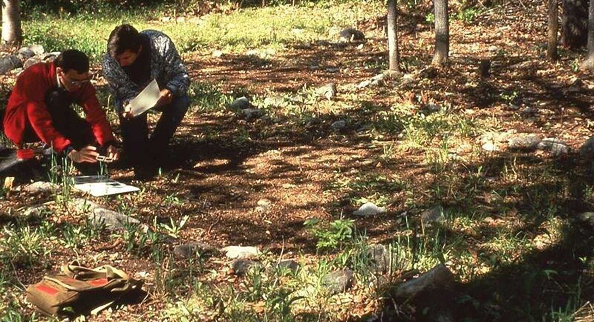
When Thomas E. Lee, an archaeologist with the National Museum of Canada, found ancient stone implements in an Island farm field in 1951, they led him and his team to a nearby ridge of quartzite, part of the Precambrian geological formation over two billion years old that was poking out of the top of the younger rocks.

At the top of a hill in Sheguiandah, a picturesque hamlet on Highway 6 south of Little Current, Lee uncovered a stunning archeological find: a large, prehistoric quarry filled with innumerable stone tools, spearheads and scrapers that Lee claimed proved the existence of the oldest recorded humans in the Americas, some 25,000 years ago. His findings, developed before the use of carbon-dating, contradicted the ‘standard’ view – that humans came to North America after the last Ice Age, about 10,000 years ago – and were not substantiated, fueling a decades-long controversy that is still debated today.

In 1954, the hill, quartzite quarry, and the habitation area that encompasses the village of Sheguiandah were designated a National Historic Site of Canada. For over forty years after Lee’s initial digs, the site lay dormant, the land privately owned and occasionally quarried in a different location.

“The heritage value of the remains found in Sheguiandah,” reads the Canadian Register of Historic Places, “resides in a series of successive cultural occupations of early inhabitants in what is now Ontario, beginning circa 11,000 B.C.E. with the Paleo-Indian Period during the recession of glacial Lake Algonquin.

“The site also contains artifacts from the Archaic Period (1000-500 B.C.E.) as well as Point Peninsula Culture stone tools associated with the Middle Woodland Period (0 – 500 C.E.).”

These were the findings of Patrick J. Julig of Laurentian University and Peter L. Storck of the Royal Ontario Museum who led a team of specialists to re-open the quarry site in 1991. They found strong evidence that the glacial till in which Lee had found artifacts and which dated the site to 25-30,000 years ago was in a fact a much younger beach of a receding glacial lake and the effects of wind and erosion in mixing the soil had caused some artifacts to be lodged in lower, older soil strata.  Julig and Storck dated the site at 9,500 carbon-dated years, after the last Ice Age, now the standard view among archaeologists.

A Geo-Archeologist, Patrick Julig has been a professor of Anthropology at Laurentian University in Sudbury since 1990, now part-time, and had been doing research on Manitoulin since 1985. He and his wife Helen bought a hobby farm in Sheguiandah in 2002, semi-retiring to the Island in 2005 – just up the road from the site of one of most exciting archeological finds of Dr. Julig’s long career.

“The new dig was a collaboration among local municipalities and First Nations; we were working with First Nations Chiefs from the beginning. The Chiefs of Sheguiandah and Aundeck Omni Kaning were involved in discussions about collaborative ventures for tourism; communication is ongoing. The First Nations did their own studies about a possible cultural or interpretive centre and there’s support from the major landowners and the Town of NEMI. Sheguiandah First Nation wants to honour their ancestors by allowing others to learn from the site.”

Also close to the archeological site on Highway 6 is the Centennial Museum of Sheguiandah, a small but significant repository of artifacts found in the nearby excavations, ancient fossils and settler implements and buildings, offering fascinating glimpses of life in this culturally diverse area from prehistory to modern days. Last fall the Museum unveiled an engaging interactive exhibit dedicated to the National Historic Site of Sheguiandah with the backing of the Town of NEMI and grants from the Northern Ontario Heritage Fund and Canadian Heritage’s Canada Cultural Spaces Fund. At last, an easy-to-navigate, fun way to learn the amazing history, geology and archeology of this important place.

Dr. Julig is chair of the Museum’s Advisory Committee and designed the content of the exhibit into the clearly delineated archaeological periods of the site that are represented by descriptive panels and accompanied by the artifacts of those periods found by Lee in the 1950s and by Julig and Storck in the 90s. Museum Curator Lisa Hallaert was keen on activities for kids, so there’s a sandbox ‘dig’ with a screen for sifting out ‘artifacts’ like shells, stones and beads and an iPad station with a custom-designed archeological game featuring Dr. Julig as a cartoon character.

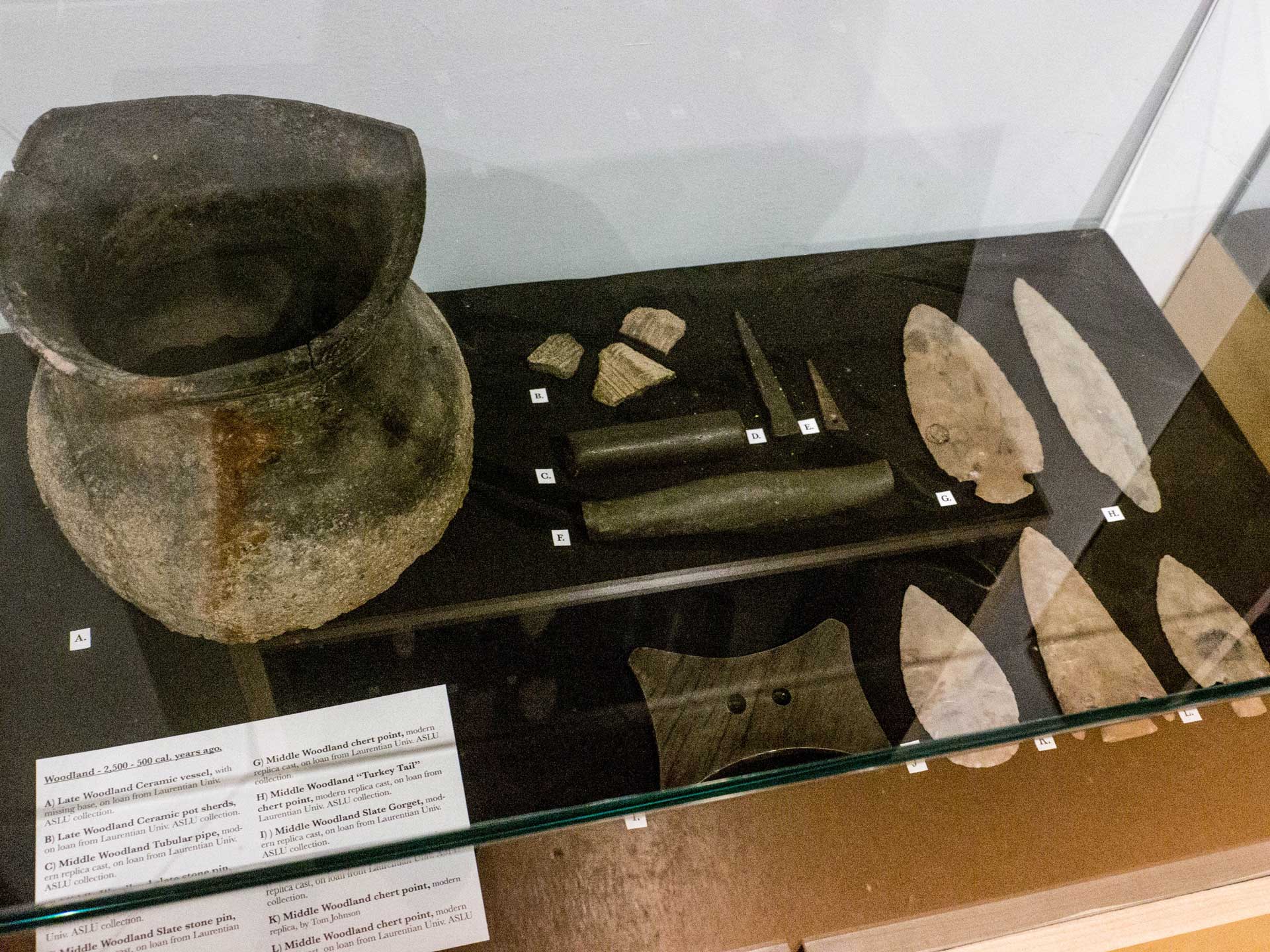
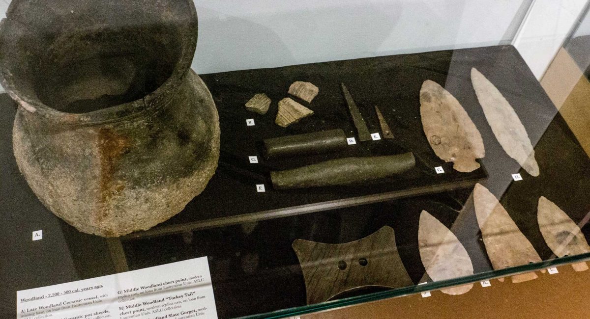
Among the educational panels of photos, maps and absorbing information on the site’s history, Patrick Julig indicates a display case of artifacts from the Middle Woodland Period and points to a clay pipe. “You see that in this era, people started to smoke tobacco and they made clay pipes. The Middle Woodland is characterized by the making of pottery and copper beads. Before clay, containers were made of skin or birch bark.” A beautiful clay pot from a similar site is shown as an example of artisan work from 2,500 BCE.

“Each cultural period is an evolution into the next,” adds Dr. Julig. “Paleo-Indians used long, thin, pointy spear points for thrusting at game. The quartzite knoll in Sheguiandah was their tools workshop for centuries, and we have the evidence of their scrapers and spear points, and of heavier ‘cores’ used to chip into a spear point or to flake into scrapers or knives. The spear points of different periods also indicate different ways of throwing spears, and in the Archaic Period they were fast and accurate, using ‘atlatls’ (spear throwers) and spear points with notches.”

A welcome development of the Centennial Museum project to bring the site into the light of day is the plan to allow guided tours to the prehistoric quarry in future, pending funding and consultation with those involved. “We need a boardwalk first, and gravel paths,” says Patrick Julig. The site is fragile and vulnerable to disturbance and is protected from any encroachment by the Ontario Heritage Act and the National Historic Site designation.

To Patrick Julig, almost thirty years after the publication of his team’s findings, the Sheguiandah Archeological Site remains a place of awe: “Sheguiandah is twice the age of the Pyramids of Egypt and of Stonehenge. You can see the different ancient water levels that are clearly visible and indicate the distinctive eras, the 450 million-year-old Ordovician beach conglomerate called Mystic Ridge, the artifacts that have been lying around for thousands of years and the dug pits, now bogs, at the very top,” says the archeologist. “Because quartzite is more acidic than Manitoulin’s more usual alkaline soil, there are blueberries up there.”

Until it’s possible to tour the famous site, the Centennial Museum’s interactive exhibit will whet the appetite for the archeological wonder that is Sheguiandah.

The Centennial  Museum of Sheguiandah, 10862 Highway 6, Sheguiandah.  Tel: 705-368-2367 Open May to October.